West Bengal: An Overview
In terms of population, West Bengal ranks as the fourth most populated state in India with an estimated population of 102,552,787 in 2024.
Districts of West Bengal
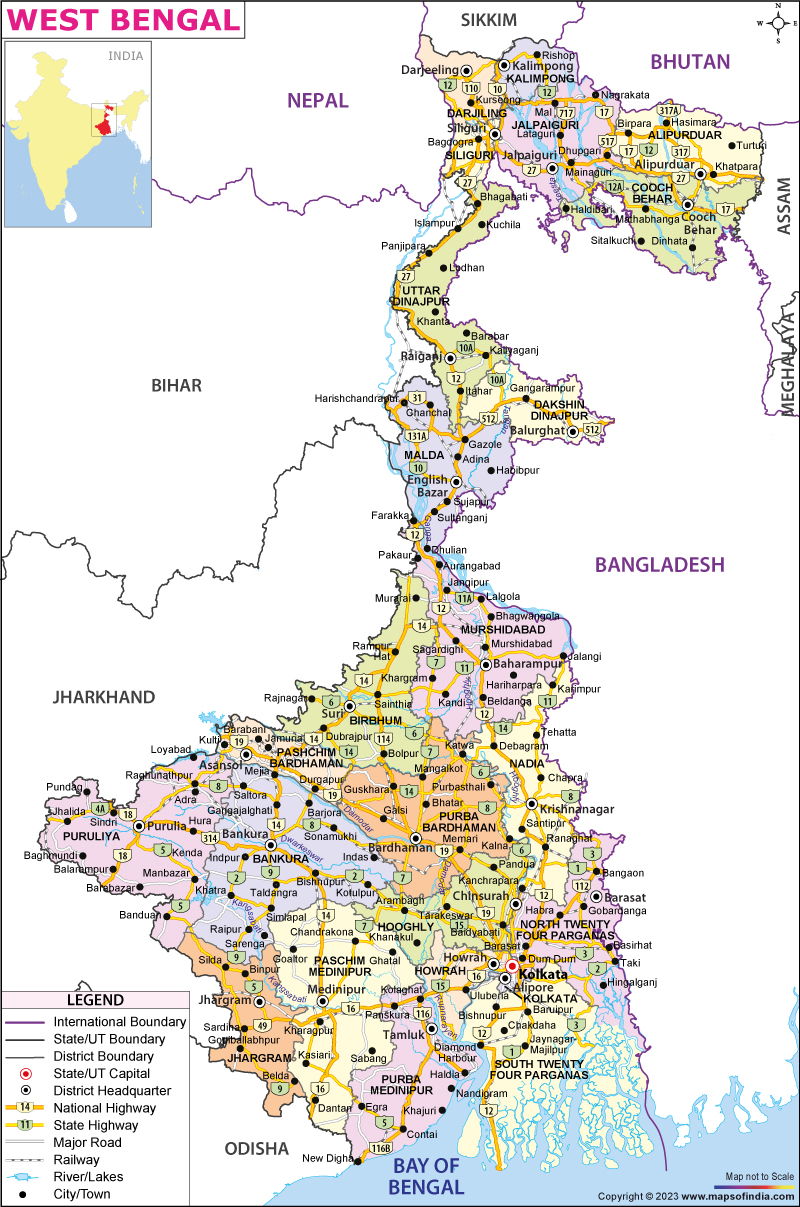
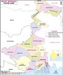
As of 1 November 2023, West Bengal is divided into 23 districts:
Alipurduar, Bankura, Birbhum, Purba Bardhaman, Cooch Behar, Dakshin Dinajpur, Darjeeling, Hooghly, Howrah, Jalpaiguri, Jhargram, Kalimpong, Kolkata, Malda, Murshidabad, Nadia, North 24 Parganas, Paschim Bardhaman, Paschim Medinipur, Purba Medinipur, Purulia, South 24 Parganas, and Uttar Dinajpur.
Divisions of West Bengal
There are five administrative divisions in the state: Presidency, Jalpaiguri, Malda, Medinipur and Burdwan.
Area of West Bengal
The state covers a total area of 34,267 m2 or 88,752 km².
Population of West Bengal
According to the 2011 census, the population of the state is 91,276,115. The estimated population in 2024 is 102,552,787.
Tourist Attractions in West Bengal
The state is known for the Sundarbans, a UNESCO World Heritage Site. Major cities include Kolkata, Siliguri, Asansol, Durgapur, Kharagpur, Darjeeling and Malda.
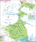
The state has diverse geographical features, including the Himalayan Mountain Range in the north, the Gangetic Plain in the south, and the Sundarbans delta in the southwest.
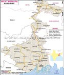
West Bengal shares borders with the Indian states of Jharkhand, Odisha, Sikkim, Bihar, and Assam. It also borders Bangladesh to the east, and Nepal and Bhutan to the north.
Economy
West Bengal has a diversified economy, with agriculture, manufacturing, mining, and services contributing significantly to its GDP. It is the sixth-largest contributor to India's GDP.
Education in West Bengal
The state has a strong education system, with several renowned universities and institutes, including the University of Calcutta, Jadavpur University, Indian Statistical Institute, and Visva-Bharati University.
Government of West Bengal
The current Governor of West Bengal is C.V. Ananda Bose, appointed by the President of India. The Chief Minister is Smt. Mamata Banerjee, representing the Trinamool Congress party. The Legislative Assembly has 294 seats.
Geography of West Bengal
The state has diverse geographical features which include towering summits of the Himalayan Mountain Range, flat terrain, rivers, and sea. The state shares its boundaries with the Himalayas in the north and the Bay of Bengal to the south. To the west, it is bordered by the states of Jharkhand and Bihar. To the east, it is bordered by Bangladesh. To the northeast, it is bordered by Assam, Sikkim and Bhutan. The territory of Nepal lies to the northwest. The state of Odisha is situated to the southwest of the state.
Landforms
The state is made up of the following varieties of landforms:
- Darjeeling Himalayan hill region
- Terai region
- North Bengal plains
- Rarh region
- Coastal plain
- Sunderbans
- Western plateau and high lands
- Ganges delta
Agro-climatic regions
The state can be divided into the following agro-climatic regions:
- The shoreline alluvial areas in the south
- The Teesta and Terai alluvial areas of North Bengal
- The mountainous areas in the north
- The Vindhya alluvial area in the middle
- The red, laterectic, and severely rolling areas to the west
- The Gangetic alluvial area in the west.
West Bengal State Information | |
|---|---|
| Capital | Kolkata |
| Date of formation | 26/01/50 |
| Governor | C. V. Ananda Bose |
| Chief Minister | Mamata Banerjee |
| Tourist attractions | Victoria Memorial, Vidyasagar Setu, Shantiniketan, Darjeeling |
| Festivals | Durga Puja, Rabindra Jayanti |
| Major dance and music forms | Jatra theatre; Baul; Rabindrasangeet |
| Arts and crafts | Terracotta Bankura horses; Kalighat style of painting; hand-woven Baluchari Silk textiles |
| Languages | Bengali, Hindi, Urdu |
| Size | 88,752 sq. km |
| Population (Census 2011) | 91276115 |
| Rivers | Hooghly, Teesta, Torsa, Subarnarekha, Joldhara |
| Forests and wildlife sanctuaries | Sunderbans Tiger Reserve, Jaldapara WS |
| State animal | Fishing cat |
| State bird | White-throated kingfisher |
| State flower | Shephali |
| State tree | Devil tree or chatian |
| Major crops | Rice, maize, oil seeds, sugarcane |
| Factoids | Bengali literature developed early thanks to the cultural awakening brought about by the Brahmo Samaj. |
| Rabindranath Tagore, the first Asian to win the Nobel Prize for Literature, was from Bengal. | |
| No. of District | 23 |
Blogs about West Bengal

Diwali Celebrations in Different Regions of India : Diwali, the ancient Indian festival, has been celebrated for ages in various parts of the country with great enthusiasm and fun. With many religious significances associated with the festival, there are multiple ways of celebrating this festival too in different regions of India. In most parts of India, Diwali is celebrated for five days. • First Day, Dhanteras: Worshipping of Lord Yama and buying of metal objects • Second Day, Choti Diwali, Roop Chaturdashi, Narak Chaturdasi • Third Day,…

Hollywood Films Shot in India : What has become more prominent than the story in a film? The locales - exotic and exquisite. The need to have a foreign location has become so pivotal that sometimes the makers shoot the entire film abroad, at times just for the sake of it. Likewise, there are so many Hollywood production houses who chose to shoot in India since it is exotic to them. However, the only difference is, their stories are often apt…

Mobile Games Addiction, A Threat to Life of Teenagers : Participation in active sports is essential for kids for their overall development. Outdoor games provide various mental and physical health benefits, it is a vital cog for every growing child. Sports enhance social skills, creativity and imagination as well. Therefore, conscious parents always encourage their children to play outdoor games, in order to remain physically fit and mentally alert. Digital change At present things have changed, with the advent of the digital entertainment media. In…

Cyclone Alert: Odisha And Bengal Brace to Fight Cyclone Amphan : Cyclone storm Amphan over central parts of the South Bay of Bengal is turning into a severe weather menace as per the Indian Meteorological Department (IMD) bulletin on Monday morning. The severe effects of the storm have reached West Bengal and Odisha in India and Bangladesh. Cyclone Amphan wrecks parts of WB, Kolkata airport waterlogged The devastating cyclone storm Amphan made landfall near Sundarbans between Digha (West Bengal) and Hatiya Islands (Bangladesh) on Wednesday afternoon.…

PM Set to Announce Lockdown Extension; States Roll Out Lockdown Till April 30 : Despite the lockdown, the nationwide COVID-19 cases continue to rise. Prime Minister Narendra Modi has not made any announcement on the extension of the three-week lockdown yet. Still, he has advocated the lockdown policy in his meeting with chief ministers via video conference on Saturday. PM likely to extend lockdown Seeing the seriousness of the situation, the nationwide lockdown amid novel coronavirus is expected to be extended until the end of April. PM Modi during…
Last Updated on : February 05, 2025
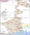
West Bengal Route Maps
Famous Personalities of West Bengal
|
|
