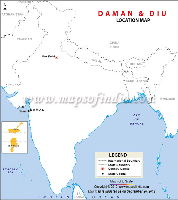
Daman and Diu is a Union Territory in India and are essentially small enclaves located in Western India. Daman is a small city on the mouth of the Daman Ganga River bounded on all sides by the state of Gujarat, while Diu is a small island off the coast of Gujarat.
Daman and Diu are situated on the Arabian Sea and were part of Portuguese India for 450 years and became part of India on December 19th 1961 by military conquest, though Portugal did not recognize this until 1974. The population of Daman and Diu is 242,911 (2011 census) and the Union Territory covers an area of 112 km sq.
Districts and Administration of Daman and Diu: Daman and Diu are divided into two districts for administration purposes, the Daman District and the Diu District. The administration of Daman and Diu is the responsibility of a Deputy Commissioner, who is an officer from the Indian Administrative Service. A Superintendent of Police, an officer from the Indian Police Service is responsible for the law and order management of Damn and Diu.
Tourism in Daman and Diu: Being a Portuguese colony for over 400 years the city is rich in Portuguese style architecture which lends the place a rare charm. Daman and Diu is dotted with beautiful Portuguese style churches and sunny beaches, which are one of its most important tourist draws. Rich in culture and offering numerous options for fun and adventure, lately Daman and Diu has emerged as a popular destination for corporate meets, conferences, seminars and training sessions.
Last Updated on : January 14, 2026
