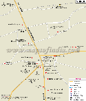
Places to See
Some of the places of interest in the Akola city are as follows:
Narnala Fort: Also known as the "Shahpur Fort", it is is a popular attraction in the city of Akola. The name Narnala is derived from the Rajput Ruler Narnal Singh or Narnal Swami. The visitors can also explore the Teliagarh Fort and the Jafaragarh Fort near the Narnala Fort
Narnala Wildlife Sanctuary: Located at a distance of a few kilometres from the Akola district, it is a dense forest which surrounds the Narnala Fort. It is a home to a good variety of flora and fauna and also houses species of animals like porcupines, wild boars and serpents.
Shegaon: It is a famous pilgrimage place of 'Gajanan Maharaj'. The Gajanan Maharaj Sansthan is the largest temple trust in the region and is also known as 'Pandharpur of Vidarbha'.
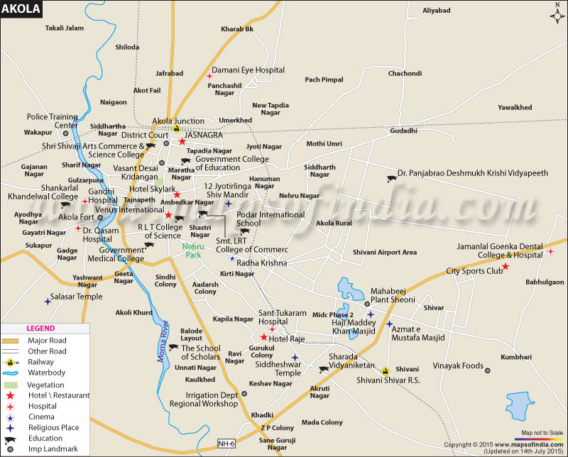
Akola Fort: Also known as Asadgad, it is a popular tourist attraction in the city. Built in 1697 by Asad Khan, it was unfortunately destroyed by the British. There is a temple in the fort dedicated to Lord Shiva. Another spiritual place, known as the Rajeshwari temple, is also visited by many devotees.
Ashok Vatika: It is a prominent place of worship for the Buddhists and the Dalits of the city. It houses statues of Siddharth Gautam Buddha, Mahatma Jyotirao Phule and Dr. B R Ambedkar.
Nehru Park: It is an amusement and water park in the city. There is a 3D Planetarium in the park which is also the first of its kind in the country. The park has many rides and a stadium with a sitting capacity of 350.
There are many temples and a few mosques in the city as well. Some of the temples in the city are:
- Shri Rani Sati Dham - A Devi (Mata) temple, near Collector office
- Shri Laxminarayan Mandir, Toshniwal layout
- Shri Khatu Shyam Mandir Tulshiyan, Layout Geeta Nagar National Highway No.6
- Jain Temple at City Market Place
- Shree Sidhivinayak Temple Jathar peth Nr Prasad Colony
There are also a few mosques in the city:
- Mominpura Masjid Mominpura
- Jama Masjid Inamdar Pura
- Chaand Hafiz Masjid
- Masjid Turaab Ali Nawab Pura
How to Reach
Aurangabad airport and the Nagpur airport are the nearest airports to the city. Akola railway station is the main station of the city which connects it to many other cities like Bikaner, Ahmedabad, Indore, Bhopal, Nagpur and many more. Maharashtra state transport runs intercity buses from Akola to other cities; and the Akola Municipal Transport (AMT) provides the local public transport services in the city.
WBST140515
Last Updated on : January 14, 2026
| Find Distance from Akola to other Indian Cities | |||
