
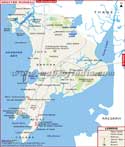
The city was formed after including an area of 95 villages of Raigad and Thane district. The total area included from the villages to form the city was 343.70 sq km. The Government of Maharashtra approved the proposal of the city in August 1979. Navi Mumbai has been developed as an environment-friendly city comprising beautiful landscapes with gardens and parks. Efforts have been made to preserve the mountain terrains, lakes and green spaces which cover almost half of the total area.
According to the provisional reports by Census of India 2011, the population of the city is a little more than one million. The average literacy rate of the city is about 91%. The sex ratio is 831 per 1000 males. The infrastructure development is already in place and the city gets adequate supply of electricity from several sources. Banks, restaurants, multiplexes, malls and other major shops; all required utilities are available in the city. There are plans to create the Navi Mumbai Special Economic Zone (SEZ) which can provide commercial growth and employment to the people of the city. It is attracting companies and start-ups to set up their base in the city.
There are total seven nodes in the city where auto rickshaws are the preferred mode of transport. There are four suburban stations in Navi Mumbai-Nerul, Vashi, Belapur and Panvel (which is also the busiest stations among all). Navi Mumbai Municipal Transport (NMMT) and Brihanmumbai Electric Supply and Transport (BEST) ply their buses all over the city and also in Mumbai, Kalyan-Dombivli-Badlapur, Thane, Bhayandar and other areas. Chatrapati Shivaji International Airport in Mumbai is at a distance of 30 km from Navi Mumbai. There is a proposal to build an International Airport in the city in the Panvel area. The construction of the airport will be a Public Partner partnership (PPP) venture. Under this venture, the private sector partner will have a 74% share in equity while the Government of Maharashtra (via CIDCO) and the Airports Authority of India (AAI) will hold 13% share each.
Even though Navi Mumbai is not a very old city but it has become a unique project due to the pattern of its development, social, housing and physical infrastructure, sustainable planning and balanced financial methods. At present, the city is well-equipped with all infrastructural facilities that are required to make it a Super City.
WBST230315
Last Updated on : May 12, 2026