The origin of Kolhapur goes down in Hindu mythology and it is believed that Kolhapur was the home of Kolhasur, a demon who was killed by Goddess Mahalakshmi to deliver the local people of their misery. The city was named Kolhapur as per the demon's last wish to have the city named after him. Religiously Kolhapur was an important Buddhist destination in the 6th century BC and also finds mention in the Devi Gita. Historically Kolhapur was also where an intense conflict took place between the Western Chalukyas and the Chola Kings, Rajadhiraja Chola and his son Rajendra Chola 2. It was after the Battle of Koppam in 1052 that Rajendra Chola 2 annexed Kolhapur and constructed a Jayasthamba (victory pillar) in the city.
Kolhapur City Map |
|
||||||||||||
 | ||||||||||||
|
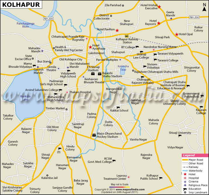
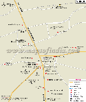
| *Kolhapur city map showing major roads, hotels, hospitals and other places of interest. | Disclaimer |
| Major Cities of Maharashtra |
 |
 |
 |
 |
| Mumbai City Map | Pune City Map | Nashik City Map | Nagpur City Map |
 |
 |
 |
 |
| Ahmednagar City Map | Aurangabad City Map | Mahabaleshwar City Map | Shirdi City Map |
| other cities of Maharashtra >> | |||
Kolhapur is a city located in south west Maharashtra besides the River Panchganga and is the headquarters of the Kolhapur district. The city is also famous for the temple of Goddess Mahalakshmi, a Hindu Goddess.
The origin of Kolhapur goes down in Hindu mythology and it is believed that Kolhapur was the home of Kolhasur, a demon who was killed by Goddess Mahalakshmi to deliver the local people of their misery. The city was named Kolhapur as per the demon's last wish to have the city named after him. Religiously Kolhapur was an important Buddhist destination in the 6th century BC and also finds mention in the Devi Gita. Historically Kolhapur was also where an intense conflict took place between the Western Chalukyas and the Chola Kings, Rajadhiraja Chola and his son Rajendra Chola 2. It was after the Battle of Koppam in 1052 that Rajendra Chola 2 annexed Kolhapur and constructed a Jayasthamba (victory pillar) in the city.
The origin of Kolhapur goes down in Hindu mythology and it is believed that Kolhapur was the home of Kolhasur, a demon who was killed by Goddess Mahalakshmi to deliver the local people of their misery. The city was named Kolhapur as per the demon's last wish to have the city named after him. Religiously Kolhapur was an important Buddhist destination in the 6th century BC and also finds mention in the Devi Gita. Historically Kolhapur was also where an intense conflict took place between the Western Chalukyas and the Chola Kings, Rajadhiraja Chola and his son Rajendra Chola 2. It was after the Battle of Koppam in 1052 that Rajendra Chola 2 annexed Kolhapur and constructed a Jayasthamba (victory pillar) in the city.