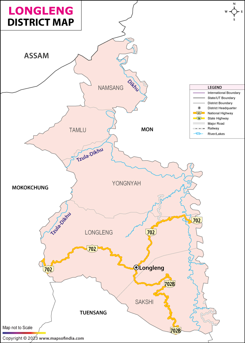
One of the important districts of Nagaland, Longleng was formed by the division of the Tuensang District. The Longleng District of Nagaland is bordered by the Mokokchung District, Mon District and the Tuesang District.
The Longleng District in Nagaland covers an area of 885 Square Kilometers and has a total population of 1,58,300. Located at an altitude of 1,066 Meters, the district of Longleng has its head-quarters at the Longleng Town.
Blessed with enchanting natural beauty, the Longleng district is visited by thousands of tourists and travelers every year. The total area of Longleng includes 15 villages and few towns. One major college and several schools form the educational structure of the district. The district has some government hospitals and some private medical centers as well.
Last Updated on February 19, 2026
