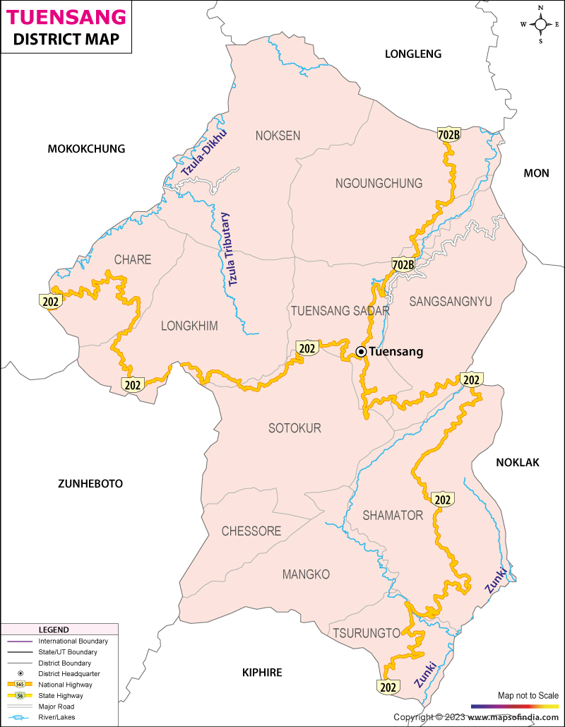
Tuensang lies in the eastern side of the state of Nagaland. The state is bordered by the districts of Nagaland and has 180 kilometers of international border running between the district and the country of Myanmar. The district derives its name from the village that is sited in the vicinity of the headquarters of the district. Five different tribes inhabit the picturesque land, interspersed with gorges, ridges, hills and valleys.
Tuensang district of Nagaland is bound by Mon district in the north and the east. The district of Mokokchung lies in the West along with Zunheboto district. Phek District of Nagaland borders Tuensang in the south. The international boundary with Myanmar is located on the eastern side.
The district of Tuensang encompasses an area of 4228 square kilometers. The district is between the geographical coordinates of 94 degrees 45 minutes East longitude and 26 degrees 15 minutes North latitude. Tuensang town is the district headquarters and the seat of administration in the district. 234 villages fall within the boundaries of the district of Tuensang. According to the Census conducted in the year 2001, the population of the district stands at 4, 14,801 with a population density of 98 persons per square meters. With the aid of the government, the district has achieved 71 percent literacy.
The tribes of Sangtam, Khiamniungan, Phom, Chang, Yimchunger and Sumi inhabit the district of Tuensang. The different customs and practices of the tribes are representative of their tradition. One of the important districts of Nagaland, Tuensang lies at a distance of 269 kilometers from the capital city of Kohima from where regular buses ply to the district of Tuensang via Mokokchung and Wokha.
Last Updated on January 14, 2026
