In order to ensure the better and smooth functioning of a state, it is divided into districts. Each district is appointed a district manager responsible for managing the district.
MapsofIndia brings you the information and maps of the districts in the state of Nagaland. These include Dimapur District Map, Kohima District Map, Mokokchung District Map, Mon District Map, Phek District Map, Tuensang District Map, Wokha District Map and Zunheboto District Map.
Nagaland is a state in the North - Eastern part of India. The state earlier having 8 districts is now divided into 11 districts.
- Kohima District:
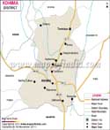
Kohima is the capital city of Nagaland. Dimarpur and Phek districts of Nagaland were earlier parts of Kohima district. The Kohima district shares border with Wokha to the North, Zunheboto and Phek to the East, Dimarpur to the West and Manipur to the South. - Dimarpur District:
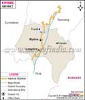
It is referred to as the Gateway of Nagaland and Manipur. The district is surrounded by Kohima district on the south and east, Karbi Anglong district of Assam on the West, the Karbi Anglong and Golaghat District of Assam in the west and the north. - Kiphire District: Carved out of Tuensang District, Kiphire is the 9th district of Nagaland.
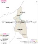
- Longleng: Earlier a part of Tuensang district, Longleng is the 10th district of Nagaland.
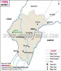
- Peren: The 11th district of Nagaland, Peren District is carved out of Kohima District of Nagaland.
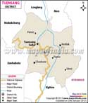
Tuensang is one of the districts at Nagaland. This district is situated in the eastern part of the state. It has got its name from a village located near the headquarters of the district.
The district of Longleng is bounded by Mon in the north, Tuensang in the south and Mokokchung in the west.
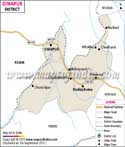
Kohima is the district in which the capital city of the state is located. This district is located in the southern part of the state at a height of 1444 meter above the level of the sea.
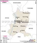
Zunheboto is one of the Nagaland districts. It is bordered by Wokha towards the west and Mokokchung towards the east.
This place is located in central region of Nagaland. This place is well known for the Sumis.
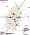
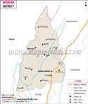
Mokokchung district is well reputed as the dwelling place of the ethnic group called the Ao Nagas.
Dimapur is one of the districts in Nagaland. It is bordered by Anglong towards the west and Kohima towards the east and the south.
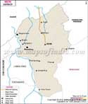
Mon is closely associated with the Konyak Nagas, while Wokha is also well known for housing the ancient ethnic group of Lothas.
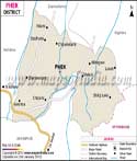
Phek district of Nagaland is located in the south-eastern region of the state. The name 'Phek' has been coined from the word ' Phekrekedze', which means 'watchtower'.
All the above districts of Nagaland have their unique socio-cultural identities, which are quite different from each other.
List of Districts in Nagaland
| Sr. No. | District | District HQ | Population (2011) | Growth | Sex Ratio | Literacy | Area (km2) | Density (/km2) |
|---|---|---|---|---|---|---|---|---|
| 1 | Dimapur | Dimapur | 378811 | 0.00% | 919 | 84.79 | 926 | 410 |
| 2 | Kiphire | Kiphire | 74004 | 0.00% | 956 | 69.54 | 1255 | 66 |
| 3 | Kohima | Kohima | 267988 | 0.00% | 928 | 85.23 | 1041 | 213 |
| 4 | Longleng | Longleng | 50484 | 0.00% | 905 | 72.17 | 885 | 89 |
| 5 | Mokokchung | Mokokchung | 194622 | 0.00% | 925 | 91.62 | 1615 | 120 |
| 6 | Mon | Mon | 250260 | 0.00% | 899 | 56.99 | 1786 | 145 |
| 7 | Peren | Peren | 95219 | 0.00% | 915 | 77.95 | 2300 | 55 |
| 8 | Phek | Phek | 163418 | 0.00% | 951 | 78.05 | 2026 | 81 |
| 9 | Tuensang | Tuensang | 196596 | 0.00% | 929 | 73.08 | 4228 | 98 |
| 10 | Wokha | Wokha | 166343 | 0.00% | 968 | 87.69 | 1628 | 120 |
| 11 | Zunheboto | Zunheboto | 140757 | 0.00% | 976 | 85.26 | 1255 | 112 |
Last Updated on : June 24, 2026