Most of Uttaranchal falls in the southern slopes of the Himalayas, but it also has some areas in the plains. The plain areas are called the Terai. About 64% of the state is forested.
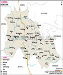
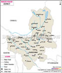
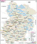
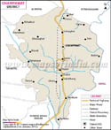
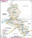
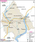
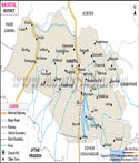
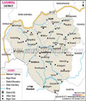
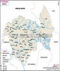
The state has two divisions of Garhwal and Kumaon, and is further divided into thirteen districts. The districts which fall in Garhwal division are Dehradun, Haridwar, Chamoli, Rudraprayag, Tehri Garhwal, Uttarkashi, and Pauri Garhwal. These districts have some of the highest Himalayan peaks located here. The districts which are a part of Kumaon division are Almora, Nainital, Pithoragarh, Udham Singh Nagar, Bageshwar, and Champawat. Most of the tourist hill towns in the state are located in the Kumaon Division.
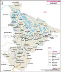
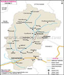
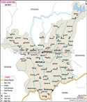
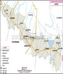
Uttarkashi district, in the Himalayas, is the home of the source of two most important rivers in the country-the Ganges and the Yamuna. The Hindu pilgrim points of Char Dham fall in this district. Udham Singh Nagar district lies in the Terai plains. The famous Jim Corbett Tiger reserve is located in the Nainital district. The world Heritage Nanda Devi Park is located in Chamoli district.
The state capital is at Dehradun. Other important towns and district headquarters are Nainital, Haridwar, and Almora. Dehradun is an important rail connection for the entire state as it lies on the route of the Northern Railway line. For the Kumaon division, Kathgodam town is the last terminus of the broad gauge line for the North eastern railways.
The state has airports in Dehradun in Dehradun district and Pant Nagar in Udham Singh Nagar District.
List of Districts in Uttarakhand
| Sr. No. | District | District HQ | Population (2011) | Growth | Sex Ratio | Literacy | Area (km2) | Density (/km2) |
|---|---|---|---|---|---|---|---|---|
| 1 | Almora | Almora | 622506 | -1.28% | 1139 | 80.47 | 3090 | 198 |
| 2 | Bageshwar | Bageshwar | 259898 | 4.18% | 1090 | 80.01 | 2310 | 116 |
| 3 | Chamoli | Gopeshwar | 391605 | 5.74% | 1019 | 82.65 | 7692 | 49 |
| 4 | Champawat | Champawat | 259648 | 15.63% | 980 | 79.83 | 1781 | 147 |
| 5 | Dehradun | Dehradun | 1696694 | 32.33% | 902 | 84.25 | 3088 | 550 |
| 6 | Haridwar | Haridwar | 1890422 | 30.63% | 880 | 73.43 | 2360 | 817 |
| 7 | Nainital | Nainital | 954605 | 25.13% | 934 | 83.88 | 3853 | 225 |
| 8 | Pauri Garhwal | Pauri | 687271 | -1.41% | 1103 | 82.02 | 5438 | 129 |
| 9 | Pithoragarh | Pithoragarh | 483439 | 4.58% | 1020 | 82.25 | 7110 | 69 |
| 10 | Rudraprayag | Rudraprayag | 242285 | 6.53% | 1114 | 81.3 | 1896 | 119 |
| 11 | Tehri Garhwal | New Tehri | 618931 | 2.35% | 1077 | 76.36 | 4085 | 169 |
| 12 | Udham Singh Nagar | Rudrapur | 1648902 | 33.45% | 920 | 73.1 | 2912 | 648 |
| 13 | Uttarkashi | Uttarkashi | 330086 | 11.89% | 958 | 75.81 | 7951 | 41 |
Last Updated on : May 08, 2026