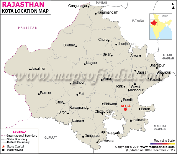
Information regarding Kota Location includes the exact position of this popular city in the map of Rajasthan. Kota is situated on the eastern corner of the Chambal river passes through Rajasthan. From the perspective of Rajasthan state in India, Kota lies on its south.
Chambal river plays an important role in the locational contours of Kota in Rajasthan. Due to its close proximity with the river, Kota has successfully established a number of dams like that of Jawahar Sagar, Gandhi Sagar, Kota Barrage, Rana Pratap Sagar, among others. All of these dams provide fruitful support to the agriculture infrastructure of Kota as a whole.
Placed at a distance of 270 km from Udaipur and 242 km from Jodhpur, Kota can be arrived at through regualar bus services that ply from the two previous cities of Rajasthan. Due to easy accessibility, Kota is visited by large number of tourists round the year.
As a prominent location of Rajasthan, Kota boasts of several notable industrial zones such as the precision instrument unit, the nearby atomic power plant and fertilizer plant which is considered as the biggest one in Asia.
Enjoying the advantages of a convenient positioning, Kota Location enhances the commercial and tourism viability of the city.
Last Updated on November 13, 2025
