
 |
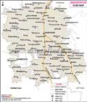
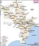
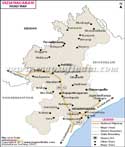
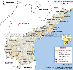
The state has seen a tremendous growth story, which could not have been possible without its well-laid road network. All the districts, cities, towns and many villages in Andhra Pradesh are conveniently connected via well-maintained roads. In addition, this road network also takes you to other neighbouring states like Tamil Nadu, Orissa and other through local roads and national highways.
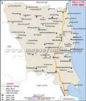
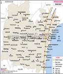
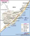
A well-designed Andhra Pradesh road map makes it easy for you to understand the great reach of these roads across and around the state. If you are planning to visit the state any time soon, you should consider checking a good Andhra Pradesh road map to make you acquainted with roads in various cities in the state.
In fact, the growth rate of vehicle ownership is the largest in this state as compared to that in the country. The road network of Andhra Pradesh includes national highways numbered NH 18, 16, 205, 202, 214, 214A, 221, 219, 234, 222, 43, 4, 63, 9, 5 and 7.
Roads act as the lifelines for a state or city because they facilitate the transport of people and various essential and not essential commodities from one place to other. You can use the clickable road map of Andhra Pradesh given above to help you travel; without any hassle s and hesitations.
Last Updated on : May 11, 2026