
 |
 |
 |
 |
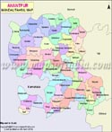
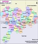
| Anantpur Tehsil Map | Chittoor Tehsil Map | East Godavari Tehsil Map | Guntur Tehsil Map |
 |
 |
 |
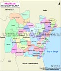 |
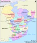
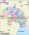
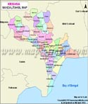
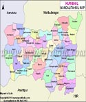
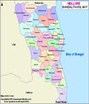
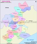
| Krishna Tehsil Map | Kurnool Tehsil Map | Nellore Tehsil Map | Prakasam Tehsil Map |
 |
 |
 |
 |
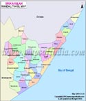
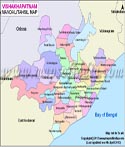
| Srikakulam Tehsil Map | Vishakhapatnam Tehsil Map | Vizianagaram Tehsil Map | West Godavari Tehsil Map |
 |
|||
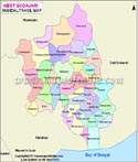
| YSR Tehsil Map |
A tehsil is an administrative division in India and denotes a sub-district. In some states, they are also known as talukas or mandals. Tehsil is generally a land area that serves as the administrative centre to a city or a town and includes towns and sometimes villages. Within a tehsil's jurisdiction, the tehsil offices exercise some fiscal and administrative power over the municipalities and the villages. A tehsil officer is known as Tahsildar or at times Talukdar. At times, tehsils are also known as "blocks".
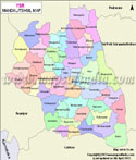
Tehsils can be found in every state of India; Andhra Pradesh being one of them. The above map gives you an insight into the tehsils of the state. You can also see the state boundary with adjoining states like Maharashtra, Chhattisgarh, Telangana and Odisha. The major tehsils of Andhra Pradesh are categorised into 13 districts that are marked in different colours. Clicking on each district, you will get a detailed map of the tehsils located in the region. Apart from that, you can also directly check out the district-wise tehsil maps as links for the same are provided below the main map. To have a look at the maps of the tehsils, you just need to click on the desired map. WBST180615 WBVDA
Last Updated on : May 11, 2026