| Rajghat Dam Facts | |
|---|---|
| Dam Name | Rajghat Dam |
| State Name | Uttar Pradesh and Madhya Pradesh |
| Type of dam | Earthen / Masonry |
| Operated by | Water Resources Department of Madhya Pradesh |
| Nearest City | Lalitpur, Chanderi |
| Impounds | Betwa River |
| District Name | Ashok Nagar, Lalitpur |
| Catchment Area | 472 km2 |
| Lat / Long | 24.762834,78.233894 |
| Total Capacity | 96 million m3 |
| Purpose | Irrigation, Water storage and Electric Power Generation. |
| Construction began | In 1975 |
| Opening date | In 2006 |
| Height | 73.3 meters |
| Length | 573.29 meters |
| Power Generation Capacity | 45 MW (3x15 MW) |
| Spillway Gates | 18 |
| Spillway Type | Ogee |
| Creates | Rajghat Reservoir |
| Project | Rajghat dam and Hydroelectric Project |
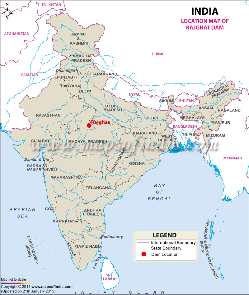
Location of Rajghat Dam
Rajghat - Entry Fee, Timing, Address, Official Website | |
|---|---|
| Address | Mahatma Gandhi Marg, Ring Road, New Delhi, Delhi - 110006 |
| Entry Fee : | No entry fee |
| Timings : | Visiting Hours - 6:00 AM - 7:00 PM |
| Official Website | www.varanasi.org.in/ramnagar-fort |
| Photography allowed or not | Allowed |
| Nearest railway station | New Delhi Train Station |
Last Updated on : February 19, 2026
