






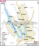
About
Nestled within the far northeast reaches of Himachal Pradesh lies Kinnaur, a remote expanse shaped by towering mountains. Known locally as the "Land of God," this area bridges lush sub-Himalayan slopes and the arid uplands resembling Tibet's plateaus. Flowing continuously through these formations, the Sutlej River has etched wide ravines over countless millennia. Magnitude defines this place - not through exaggeration, but in sheer physical presence spread across every ridge and slope.
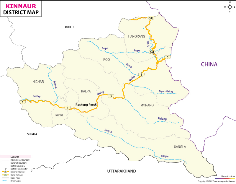
Three primary valleys shape Kinnaur: green Sangla, steep Sutlej, then barren Hangrang. Facing the holy summits of Kinnaur Kailash stands Reckong Peo, a working hub amid thin air and silence. Because elevation governs daily patterns, routines unfold slowly. Along roadways carved near sky level, visitors move past hamlets known for tart fruit, carved sanctuaries, traditions unchanged by time - here, old beliefs blend without conflict.
History & Culture
Deep within the Himalayas, Kinnaur's past winds through myth, monarchy, and mountain trails. Celestial musicians called Kinners - half-divine beings - appear in epics such as the Mahabharata and Puranas, said to dwell near Mount Kailash. Long before modern borders, this land belonged to Kamru, an early kingdom that evolved into Bushahr, a dominant hill state.
Carved into steep mountain edges, the well-known Hindustan-Tibet Road emerged under British direction. Centuries earlier, Kinnaur's communities had strong economic and social ties with western Tibet. After the Independence of India, Kinnaur became part of the Mahasu district. It became an independent district on May 1, 1960.
Kinnaur is located at the palace where the Indian lowlands meet the high Tibetan plateau. The district carries a mixed cultural trait shaped by both Hindu and Vajrayana Buddhist traditions. Apart from this the areas like Hangrang have strong adherence to the Tibetan Buddhist practices. These spiritual threads run through daily life, not as separate strands but woven together over time. Found in each settlement is a main deity, enshrined within intricately built wooden temples. From these sacred spaces, guidance flows - not only for rituals but also for settling disputes and shaping village rules - delivered through chosen individuals believed to speak for the gods.
Honesty and warmth are the defining features of the mountain community. The Kinnauri language spoken in the district can be traced back to the Tibetan Burman linguistic roots. The clothes worn in the district have a history linked to them. The headwear known as Pang is worn by both genders. It is a green band that serves as a marker of identity for the people.
Festivals pulse through Kinnauri culture like breath - each one shaping rhythm and meaning. Circle dances called Kayang move to the sound of deep brass horns, paired with steady drumbeats that echo across valleys. In January, during Sazo, people honor the moment when deities leave earth for the heavens above.
Built to endure both snow-heavy winters and deep-rooted traditions, Kinnaur’s houses rise through time-tested methods. Thick logs of deodar cedar stack carefully with flat river stones, joined only by precise fitting - no metal fasteners used at any stage. Known locally as Kath-Kuni, this method forms walls that absorb tremors instead of cracking under them. Temples stand among dwellings, their frames allowing movement when the earth shifts beneath. Carved panels wrap upper levels, etched with serpents, blooming lotuses, shapes drawn from old symbols. Inside these quiet halls, voices pass down stories older than stone. Stability emerges not just from material but from rhythm between craft and land.
Economy
High-value farming in cold climates shapes much of Kinnaur’s economy, while large-scale renewable power production turns difficult terrain into profitable ventures. Though rugged mountains limit access, they also create ideal conditions for both crops and electricity. Because steep valleys trap water flow, hydro projects thrive alongside apple orchards.
Public Sector
Hydropower in Kinnaur thrives because government initiatives shape much of its energy footprint across northern India. Flowing fast from glaciers, the Sutlej River powers multiple run-of-the-river plants tucked into steep valleys. Projects like the 1,500 MW Nathpa Jhakri dam stand alongside the 1,000 MW Karcham Wangtoo facility - both backed by state-led or joint funding models.
Services Sector
Incomes from apple farming, along with tourism focused on nature, have fueled growth in Kinnaur’s service industries. Because banks now reach even isolated areas, growers can buy equipment like tractors or units for keeping produce cool. Trucks move constantly through steep terrain, carrying apples to cities nationwide, thanks to expanding transport networks. Instead of leaving their villages, many young people run guesthouses, lodges, or outdoor stays using family buildings repurposed for travelers. Growth in these roles offers steady work rooted in local resources rather than outside jobs.
Tourism
High in the Himalayas, Kinnaur pulls travelers who crave raw landscapes - adventurers find trails here, pilgrims discover quiet sanctuaries, while those chasing stillness wander through Asia’s loftiest reachable passes and striking river folds.
Nako Village
Upward still along the Hangrang Valley, vegetation fades abruptly into alpine barrenness. At more than 3,600 meters elevation rests Nako - a solitary cluster of stone homes shaped by wind and isolation. Encircling a calm, elliptical lake lies its heart, mirroring jagged peaks draped in year-round snow. Movement through narrow lanes evokes another era - or perhaps a quiet corner of western Tibet. There, tucked beside prayer flags, stands an 11th-century monastery housing fragile clay figures and painted walls. Pilgrims on long footpaths, alongside far-traveled visitors, arrive simply to stand before them.
Sangla Valley Baspa Valley
Beautiful views draw many travelers to the Sangla Valley, known across the Himalayas for lush fields and thick woods of cedar. Following the bright waters of the Baspa River, it cuts through mountains capped year-round with snow. Nestled within stands Kamru Fort, once central to royal rule under the Bushahr dynasty - its tall wooden structure rising like an old watchful guard. Wooden homes cluster near Chitkul at the far edge, where India meets Tibet, and roads run out. The air feels untouched there, clean and sharp, while stories echo among slopes shaped by centuries.
Kalpa
High up on a sharp incline just beyond Reckong Peo lies Kalpa, a quiet mountain settlement tucked among dense stands of pine nut trees and wide apple groves. Though small, its position gives unobstructed sightlines toward the full stretch of the Kinnaur Kailash range - an imposing summit rising 6,050 meters into the sky. As sunlight shifts, so does the hue of the peak, transforming steadily from dawn to dusk. Perched beyond contemporary concrete structures, Kalpa holds rows of homes built from timber and stone, enduring years of thick snowfall without falter.
Sarahan: The Gateway to Kinnaur
Perched near where Shimla meets Kinnaur, Sarahan holds strong links to how most travelers first enter the region. Standing tall, there is the Bhimakali Temple, admired for its grand structure shaped by old Himalayan building methods using layered wood and stone. Craftsmanship shows clearly in carved details, while the design itself resists shaking during quakes. This place opens understanding of the Kinnauri heritage long before reaching the inner mountain zones.
Demographics
Kinnaur district carries the mark of a remote, close-knit tribal society nestled high in the mountains. Backed by 2011 government records, its full headcount reaches just 84,121 people - placing it among India’s most lightly inhabited regions. Of these inhabitants, men make up 46,249 individuals, whereas women number 37,872. For every thousand males, only 819 females appear, a gap shaped largely by waves of transient male workers linked to defense units, highway crews, and dam construction sites.
Despite being mountainous, Kinnaur district reports a literacy rate of 80.00%, clearly above India’s national figure - evidence of sustained educational investment. Males show higher attainment: 87.27% can read and write, compared to females at 70.96%. Since the late twentieth century, government-run schools and residential learning centers have reached isolated settlements across deep valleys.
In the district, Kinnauri pulses through everyday talk - a Tibeto-Burman tongue woven into routine moments. Though Hindi runs through government work, market exchanges, and schools, English finds a steady footing in offices that handle visitors.
What stands out in Kinnaur’s social fabric is how mountain seclusion forged distinct patterns of kinship and collective life. Because brothers once took one wife, farmlands stayed intact across decades of rugged subsistence farming. Though schooling and roads have nearly ended such unions, their legacy lingers in daily routines - women now steer budgets, run orchards, shape decisions. Instead of fading into history, old customs quietly evolved into fairness woven through homes and fields. When snow looms, people gather not just to reap apples but to lift whole houses built with interlocked wood beams. Through the Khel, a web of duty binds neighbors long before storms hit.
Administration
Kinnaur comes under the Shimla division for administrative purposes. The deputy commissioner is responsible for the daily governance and the law enforcement along with the Superintendent of Police. Public services advance despite rugged geography, shaped by joint efforts at the district level. Borders receive attention not only for security but also due to regional complexity. Routine administration adapts constantly, responding to isolation and weather challenges alike.
Splitting the region helps manage travel challenges caused by steep valleys - Kinnaur has three administrative units, along with five tehsils for local oversight. Centered around Reckong Peo, Kalpa Sub-Division serves as the core hub for regional governance. Housing the district's primary offices, it functions as the base for judicial operations. Medical services of key importance are located within this area. Administration here supports broader oversight across the region.
Perched high among rugged ridges, Kinnaur's countryside consists of 241 villages. Roughly 65 of them function as permanent revenue villages, grouped into multiple gram panchayats. Governance unfolds through the grassroots Panchayati Raj model - each community votes for its own council, headed by an elected leader known as Sarpanch or Pradhan. Owing to scattered homesteads clinging to sharp inclines and divided by roaring river gorges, local self-rule becomes vital here.
| Official Name | Kinnaur |
| Location | Himachal Pradesh |
| Area | 6401 sq. km |
| Population | 84121 |
| Language | Hindi, Pahari |
FAQs
Q1: How many village panchayats are there in Kinnaru district?
There are 73 village panchayats in the district.
Q2: What is the population of the district?
84121 people live in the district according to the 2011 census.
Q3: What is the district most famous for?
The district is known for the premium quality apples, the Sanga valley, and the Kailash range. The diverse culture of the district, characterized by Hindu and Buddhist traditions, further adds to the richness.
Last Updated on : July 10, 2026
