






About
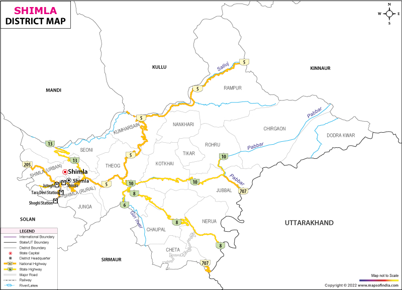
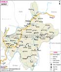
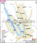
Nestled where the Himalayas curve westward, this stretch of land breathes rhythm through villages and valleys alike. High slopes rise beside quiet temples while wooden balconies peek above misty tree lines. A nickname born centuries ago stuck - locals still call it Queen of the Hills even though crowns have never been worn here. Back then, strangers from Britain climbed up seeking softer heat, escaping lowland droughts that cracked earth each June. Cool winds greeted them first, followed by forests so dense sunlight barely touched the soil. Buildings went up slowly at first, then quickly once others heard about views stretching beyond belief. Stretching over 5,131 square kilometers, this area sits right at the heart of Himachal Pradesh. Northward, it touches both Mandi and Kullu. On the east, Kinnaur forms a natural border. Southeast brings in the neighboring state of Uttarakhand into view. From the south all the way to the southwest, Solan and Sirmaur form adjoining borders.
History & Culture
Shimla District's past comes alive through native mountain customs meeting sudden shifts under British rule. Long ago, this land broke into tiny kingdoms called the "Simla Hill States." Among them stood Bushahr, Jubbal, Keonthal, and Balsan - each ruled by its own chief or Rana. Power shifting like that made local rulers look far beyond their borders. Instead of standing alone, they reached out to a foreign trading group - the British East India Company. From there, conflict grew, lasting two years starting in 1814.Out there beyond the fighting, land once held by Gurkhas shifted hands. Following defeat under British force at Sugauli, regions slipped away through treaty terms. Among them was a small village called Shyamala, taken from a regional form of Kali. Because it stayed fresh and free of illness, colonial officials started building homes there for warmer months. Come 1864, Viceroy John Lawrence made it official - Shimla became the summer seat of power for British India. Up into these cool mountain heights moved the full machinery of imperial rule, staying through much of each year.In this area, old traditions tie closely to the wider Mahasu landscape. Community life stands firm, built on shared trust and spiritual practice. People honor their devtas with quiet respect passed down through generations. Expression thrives in everyday acts - songs sung at gatherings, stories told under eaves, rhythms tapped out on packed earth. Native dance moves appear when festivals arrive, bodies swaying in bright wool cloaks stitched by hand. The sound of drums carries far across hillsides where elders nod along.
Festivals define the social calendar of the district:
A yearly celebration takes place in June up on the Ridge. Local crafts appear alongside songs and dishes from nearby areas. Each summer brings crowds to see handmade goods while listening to live tunes. Flavorful meals pop up at stalls near dancing grounds. Music fills the air as people wander through rows of artwork. The event gathers neighbors under open skies every June.
Economy
Farming shapes much of how people earn here, thanks to fertile slopes that support crops through most seasons. Government jobs offer steady work, found across offices tucked into hillside towns. Instead of depending on one industry, the area blends farming, state roles, and landscape advantages. Mountains limit some development, yet they also draw services and infrastructure over time. Work lives grow around these conditions, adapting without dramatic shifts.
Government Sector
Most people working for institutions here find jobs through the state government. Because the State Secretariat sits in this district, along with various directorates and court areas, work linked to city planning and running essential services keeps coming. Offices handling regionwide operations add stability to daily governance tasks. With so many departments nearby, roles supporting transport networks, material delivery, and law-related assistance continue without pause.
Public Sector
Down river bends where water rushes fast, government efforts take shape through power projects. SJVN runs big dams on the Sutlej; one named Nathpa Jhakri stands out. From spinning turbines comes income that fills state coffers. Engineers from nearby towns find steady work, so do skilled laborers who know machinery well. Instead of private firms leading every move, public banks hold ground in financial flows. Rural credit thrives under regionally rooted banking networks.
Services Sector
Fueled by a pair of core forces, the services sector powers much of everyday business activity. What keeps it moving isn’t machinery alone but steady human demand behind the scenes. Behind every transaction, there’s usually guidance or support shaping choices people make. People running family homes open doors to travelers, stitching jobs into quiet village life far from downtown rush.
Tourism
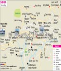
Among the hills, old buildings whisper stories while icy trails climb beyond sight. A long stretch without cars invites slow movement, conversation, pause. Snow-topped mountains appear between gaps, sudden and bright. Among the structures stands Christ Church, built tall with sharp edges, known best for colored glass that catches afternoon light differently each day. A grand building sits perched above the city, shaped by old European designs. Built long ago, it once housed powerful colonial rulers when seasons changed. Decisions that shifted history were made within its walls, whispers echoing through tense meetings. Today, scholars wander where officials once paced, filling rooms with quiet study instead of political debate.
Places of Worship and Faith
Jakhoo Hill holds the oldest shrine here, built high where few go - reaching 2,455 meters above sea level. Standing beyond tree lines, a massive figure of Hanuman rises slowly into view, measuring exactly 108 feet from base to crown. Few structures stretch this tall in all Shimla, making it visible far below through gaps in green cover. Built where the air feels thinner, Bhima Kali Temple stands in Sarahan with quiet strength. Wooden beams lock into stone like a puzzle shaped by time and terrain. This kind of craftsmanship weathers quakes without bowing. Joints fit tight, no nails needed, held by balance alone. Tradition shapes every angle, not just for beauty but survival. Natural Attractions and Adventure Hubs . Kufri and Narkanda sit high where snow turns slopes into ski runs each winter. Thick groves of deodar trees crowd the hillsides, standing dark and still. On clear days, Hatu Peak near Narkanda lifts you above it all - views stretch without end across folded mountain ridges deep inside the Himalayas.
Demographics
Among those living in Shimla District, many have completed schooling and share common traditions, while slowly moving forward in social development. High up in the hills sits Shimla, part of Himachal Pradesh in northern India. Back when census records were last counted in 2011, it held 8,14,010 residents - no small number for one stretch of mountain land. Of those people, 4,25,039 are men, while women make up 3,88,971 of that count. Even though quiet at times, its presence shapes how things run across the region. Life here moves with seasons, yet decisions made within these valleys echo through state affairs. Most folks in Shimla count fewer girls than boys when looking at every thousand men - nine hundred fifteen girls show up instead. That number tells a quiet story about how women fare there compared to men. Over time, each new headcount paints shifts in who lives where. Life patterns change, slowly shaping what the place looks like now.
Shimla district clocks in at 75.26% when it comes to reading and writing skills, hinting at steady learning progress over time. While men show a stronger hold at 89.59%, women land at 77.13%, leaving room between them that measures exactly 12.5 points. Pushing schooling forward stays high on the local government's list, quietly shaping what happens next across neighborhoods.
Administration
High up in the hills, Shimla District runs on a system built for tough terrain. Led by a District Magistrate - also called Deputy Commissioner - it keeps services moving even to far-flung villages. From narrow trails to steep slopes, each decision accounts for how hard travel can be. Remote outposts stay linked through careful planning and local coordination. Mountain weather changes fast; plans adapt just as quickly. Governance here depends less on fixed rules, more on constant movement. Even paperwork shifts with road conditions and snowfall patterns. Seventeen parts make up the region, each running its own revenue work under a system called Tehsils. These units handle local administration while fitting into the larger structure of governance across the area. One follows another not by size but by function, carrying duties tied to land and records. Each operates separately yet connects to form a wider network of oversight and collection. Urban Shimla: Deep inside this structure sits a region made up of 2,705 villages- 2,520 are lived in year-round, while 394 count as empty plots that still bring in tax. Scattered across these settlements are 12 Community Development Blocks along with 363 Gram Panchayats, quietly handling local governance and tracking progress far into the high mountain reaches. Though isolated, such areas remain connected through layered community networks meant to listen, respond, and adapt.
| Official Name | Shimla |
| Location | Himachal Pradesh |
| Area | 5131 sq. km |
| Population | 814010 (2011 census) |
| Language | Hindi, Pahari |
FAQs
Q1: What is the total number of Villages in Shimla District?
Most of Shimla District's 3324 recorded villages show up in both census and land documents.
Q2: What is the Total Population of Shimla District?
Out here, 814,010 people call Shimla District home. When you line up all twelve districts in Himachal Pradesh by size, this one lands in third place on the list. Shimla District Known for Hills Temperate Climate British Colonial Architecture Tourist
Q3: Destinations Like Mall Road, Viceregal Lodge?
Perched high among the Himalayas, Shimla draws eyes worldwide with its frost-tipped ridges and thick woods of pine. Its charm unfolds through old-world buildings left .
Last Updated on : July 10, 2026
