






About
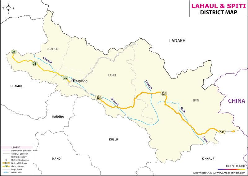
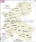
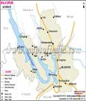
High up in northern Himachal Pradesh lies Lahaul and Spiti, a remote stretch beyond the Himalayas. Though large in size, few people live here. Its open spaces feel silent, almost untouched. To the north stretches Ladakh, and Tibet borders it on the east. Southeast brings you into Kinnaur. Kullu appears below to the south. To the west is Chamba, completing the ring around this isolated terrain. Mountain barriers rise sharply, sealing off the region from easier routes below. Above cloud level, life moves differently. Here, cold winds and old ways shape existence. Its landscape holds sharp differences within itself: empty valleys beside sacred corners.
History & Culture
High above the plains, Lahaul and Spiti unfold not as modern regions but as echoes of a remote past, carved by ice, wind, and time. Though never fully isolated, both valleys hovered at the margins of greater powers - Guge in western Tibet, the kings of Ladakh - never quite absorbed. Separated by harsh landscapes, their paths diverged sharply: southern influences crept into Lahaul through Kullu and Chamba, where Hindu dynasties held quiet sway. Meanwhile, across passes buried under snow each winter, Spiti looked northward, its culture threaded deeply into Tibetan and Ladakhi ways. Distance did more than divide land; it split destinies.
Far from remote, these valleys are linked directly to ancient Silk Road routes, where merchants, monks, and wanderers passed through rugged mountain trails. Not until the 1850s - following conflicts between Britain and the Sikh Empire - did colonial forces move in, aiming to stabilize commerce toward Tibet. By 1960, under India’s administration, both valleys merged into one frontier zone, meant to strengthen access and defense across towering Himalayan terrain.
Among high peaks, existence shapes inner strength and quiet belief. Though Lahaul blends Buddhist traditions with Hindu roots, Spiti holds fast to ancient forms of Tibetan Vajrayana practice. A journey there brings sudden closeness to another world - each remote settlement rises around a sun-bleached monastery (Gompa), silent yet central to how people live.
Warmth shows in how folks greet strangers - open, kind, unhurried. Bhoti or Lahauli pop up now and then, yet Hindi flows easily when visitors arrive. Chubas - thick woolen robes - shield bodies once snow drapes the rooftops. Bright stitching decorates leather boots, laced each morning tightly.ing. Green-striped Himachali caps sit firmly atop heads, come wind or quiet sun.
Under cold skies, time follows old patterns shaped by frost and sun. When snow settles, gatherings pull neighbors into shared moments through winter rites. Robed figures emerge - Buddhist monks draped in bright silks, faces hidden behind bold maskwork. Their steps form a ritual known as the Cham dance, timed to low horn hums paired with drum pulses. Movement tells of past clashes, light against shadow, played out on village ground. With every turn and pause, blessings pass quietly into homes perched above the clouds. Expectation for what comes next grows without words being spoken.
Economy
High up in Lahaul and Spiti, farming adapts to extreme conditions, shaping much of the local economy. Tourism flows in during warmer months, bringing visitors drawn to remote trails and quiet villages. Government-backed initiatives along frontier zones add another layer, supporting infrastructure in these isolated areas.
Government Sector
Year after year, winter halts farming and tourism when thick snow seals off trails and fields. Yet jobs continue - driven not by seasons but by necessity - in a region pressed against China's frontier. Infrastructure tasks never pause, feeding livelihoods even during whiteout storms. Schools employ graduates who might otherwise leave, offering classrooms instead of migration. Government offices, health outposts, and development units absorb much of the area’s skilled workforce. Stability flows less from markets than from mandates tied to security and survival.
Public Sector
Despite harsh conditions, government efforts keep basic systems running throughout the region. Solar projects, handled by official energy agencies, operate alongside compact hydropower units built for freezing climates, lessening reliance on distant power sources. Irrigation networks matter just as much; with nearly no rain in Spiti, publicly financed canals - known locally as Kuhls - carry glacier meltwater across rocky terrain for kilometers, delivering it to remote agricultural fields. These structures support food production where little else would grow.
Services Sector
Years later saw a surge in service-based work across the region, sparked mainly by the completion of the Atal Tunnel under Rohtang Pass. Hidden behind snow for decades, Lahaul now stays connected through every season thanks to that route. Suddenly reachable, towns like Keylong, Jispa, and Kaza began shifting - houses turned into guest homes, local kitchens became eateries, and outdoor equipment started renting out near trails. Instead of relying on distant banks, mountain residents now handle money matters locally due to wider access to digital finance networks. Farmers send payments just as easily as lodge operators book guests - all from villages once cut off each winter.
Though chilly and arid, farming thrives across Lahaul and Spiti. This region focuses on valuable plants suited to crisp mountain air. In Lahaul, top-tier seed potatoes grow alongside hops and potent medicinal herbs known worldwide. Meanwhile, Spiti delivers vibrant green peas and hardy black barley of remarkable standard.
Tourism
High above sea level, tourism in Lahaul and Spiti unfolds as a quiet pilgrimage through rugged landscapes. Motorbike travelers arrive drawn by winding routes carved into cliffs. Scholars of Buddhism find solace near ancient monastic walls weathered by time. Trekkers follow trails where few paths exist, moving between peaks that touch open skies. These roads, among the loftiest passable today, link villages shaped by wind and faith. Old temples stand rooted here, centuries deep, holding stories beyond written records.
Key Monastery
High above the valley floor, rising from a massive volcanic crag at 4,166 meters, sits Key Monastery - the biggest and best-known spiritual hub in Spiti. Though founded in the 1000s, its growth unfolded slowly, adding sun-bleached chambers, tight earthen passageways, and sturdy timber staircases across generations. Inside rests an unmatched array of old thangkas, fragile handwritten texts, alongside aged weaponry passed down through time. Framed by distant river curves below, it remains a quiet refuge where visitors sometimes join resident monks in daily rituals unchanged for hundreds of years.
Chandratal Lake, The Moon Lake
Hidden among the peaks linking Lahaul and Spiti lies Chandratal Lake, a sight so striking it seems imagined. Known as "The Moon Lake" due to its curved outline resembling a slender crescent. At an elevation of 4,300 meters, it draws water from icy glacial runoff. Surrounded entirely by rocky slopes and vast grasslands, where bright alpine blooms emerge each summer. Approaching on foot brings a quiet sense of stumbling upon somewhere untouched.
Out here, the water shows an almost unreal clarity. By daylight, its surface holds a rich sapphire glow - intense, steady. When darkness comes, that same water becomes a perfect stage for the Milky Way, mirroring every curve of light above. Without any electric glare or urban haze nearby, the heavens fill up entirely with stars. Access opens just in summer, limited by rough trails that demand either a shaky ride on unpaved roads or hours on foot through tough terrain. Because of this, the place draws those eager to vanish into silence: people who carry tents, wear worn boots, or simply tilt their heads upward when the sun drops.
Tabo Monastery
Nestled in the arid stretch of the lower Spiti Valley, Tabo Monastery carries a reputation likened to the Ajanta caves, but high in the Himalayan range. Dating back to 996 CE, the site emerged through the efforts of Rinchen Zangpo, a famed scholar and translator of his time. Functioning without interruption since then, it stands as India's most ancient Buddhist monastic ensemble still intact in form. While many strongholds cling to mountain ridges, this one spreads horizontally across the land, shaped from sun-dried bricks held together by earth. Within its dim chambers rest clay figures nearly a millennium old, alongside vibrant paintings on walls - each surface telling fragments of early Indo-Tibetan artistry buried in silence.
Kaza And The High Villages
Perched high in the Himalayas, Kaza anchors Spiti Valley’s trade and travel. From here, journeys unfold toward remote settlements above the tree line. Reaching Kibber takes little time by road; it shelters a reserve where snow leopards move unseen through rocky terrain. Not far away lies Hikkim - its claim to fame is a postal outpost perched at 4,440 meters, drawing visitors eager to send letters from one of Earth's tallest mailing points. Just beyond rests Langza, marked by a towering gold-hued Buddha watching over icy summits. Fossil hunters often walk its slopes, picking up seashell remnants left behind when oceans covered these mountains long ago.
Demographics
Lahaul and Spiti paint a picture of isolation through its people - a close-knit society shaped by high-altitude terrain. Official data from the 2011 Census shows only 31,564 individuals inhabit the region, marking it as India’s most sparsely populated district - two persons per square kilometer on average. Of these inhabitants, 16,588 are men; women number 14,976. For every thousand males, there exist 903 females - one way the numbers tell a story of imbalance. Every single resident lives beyond city limits, scattered among remote villages and monastic settlements. Urban sprawl does not touch this land. Rural life defines everything here.
Among Himalayan communities, Lahaul and Spiti show a literacy level of 76.81%, suggesting education matters deeply there. Looking closer, men reach 85.69% in reading and writing skills - higher than women’s figure, which sits at 66.84%. Though not equal, both numbers point to steady progress over time.
Administration
Deep in the northern reaches, Lahaul and Spiti belong to the Shimla division of Himachal Pradesh. Because the terrain is rugged and distances are long, authority is divided across two centers. Based in Keylong, the Deputy Commissioner runs core operations for most areas. From Kaza, another official - the Additional Deputy Commissioner - oversees daily affairs specific to Spiti Valley. Though linked under one district, each zone manages tasks separately. This setup responds directly to isolation and mountain barriers.
Across steep mountain routes, service access depends on how regions are split up. Two separate subdivisions handle local oversight here. Within those, three tehsils manage daily administration tasks. Each unit operates under a shared regional framework. Structure helps maintain consistent public support despite tough terrain.
Centered around Keylong Tehsil, Lahaul Sub-Division serves as the core hub for governance. Courts, financial operations, and main healthcare services operate here. Since the opening of the Atal Tunnel, access remains open through every season. This route has changed how supplies and travel function across months, once blocked by snow.
Perched far above sea level, Spiti Sub-Division - centered on Kaza Tehsil - oversees isolated frontier villages alongside centuries-old Buddhist monasteries. Rugged terrain defines much of its expanse. Administration here channels funding tailored for life in a harsh, arid mountain zone. Governance blends local tradition with modern infrastructure efforts across scattered settlements.
With this arrangement, vital winter food supplies sit ready alongside medical gear and equipment for clearing roads - just in time to beat the deep snow that cuts valley routes off. Positioning these items early means communities stay supported when travel becomes impossible.
| Facts of Lahaul And Spiti District | |
|---|---|
| Official Name | Lahaul And Spiti |
| Location | Himachal Pradesh |
| Area (km2) | 13833 |
| Population | 31528 |
| Language | Hindi, Bhoti |
FAQs
Q1: How many villages are there in the district altogether?
There are 521 villages in the district.
Q2: How many people live in the Lahaul and Spiti district?
According to the 2011 census, the population of the district is 31528.
Q3: What is the district famous for?
The district is famous for the extreme cold desert, old monasteries, and unexplored mountains. The Chandratal lake is famous all over the world.
Last Updated on : August 18, 2026
