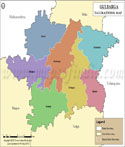
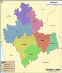
Mandya Tehsil Map |
|
||||||||||

| ||||||||||
|
| *Map highlights the name and location of all the tehsils in Mandya district, Karnataka |
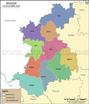
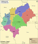
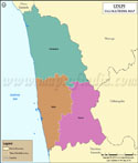
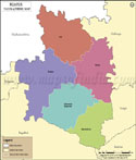
| Major Tehsils of Karnataka |
 |
 |
 |
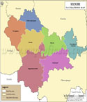 |
| Bangalore Tehsil Map | Belgaum Tehsil Map | Chikmagalur Tehsil Map | Mysore Tehsil Map |
 |
 |
 |
 |
| Gulbarga Tehsil Map | Shimoga Tehsil Map | Udupi Kannad Tehsil Map | Bijapur Tehsil Map |
| other tehsils of Karnataka >> | |||
List of Taluk in Mandya District | ||
|---|---|---|
| Tehsil/Taluka Name | Total (Rural + Urban) Population (2001) in Number | Pin Code |
| Krishnarajpet | 248,245 | 571426 |
| Maddur | 290,783 | 571428 |
| Malavalli | 281,809 | 571430 |
| Mandya | 405,612 | 571401 |
| Nagamangala | 190,770 | 571432 |
| Pandavapura | 175,009 | 571434 |
| Shrirangapattana | 162,984 | 571438 |
Last Updated on : May 11, 2026