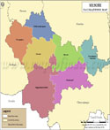
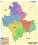
Mysore Tehsil Map |
|
||||||||||

| ||||||||||
|
| *Map highlights the name and location of all the tehsils in Mysore district, Karnataka |
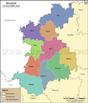
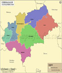
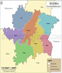
| Major Tehsils of Karnataka |
 |
 |
 |
 |
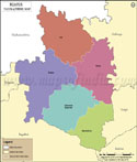
| Bangalore Tehsil Map | Belgaum Tehsil Map | Chikmagalur Tehsil Map | Mysore Tehsil Map |
 |
 |
 |
 |
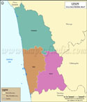
| Gulbarga Tehsil Map | Shimoga Tehsil Map | Udupi Kannad Tehsil Map | Bijapur Tehsil Map |
| other tehsils of Karnataka >> | |||
List of Taluk in Mysore District | ||
|---|---|---|
| Tehsil/Taluka Name | Total (Rural + Urban) Population (2001) in Number | Pin Code |
| Heggadadevankote | 245,930 | 571114 |
| Hunsur | 253,926 | 571105 |
| Krishnarajanagara | 239,199 | 571602 |
| Mysore | 1,038,490 | 570001 |
| Nanjangud | 360,223 | 571301 |
| Piriyapatna | 224,254 | 571107 |
| Tirumakudal - Narsipur | 279,005 | 571124 |
Last Updated on : May 11, 2026