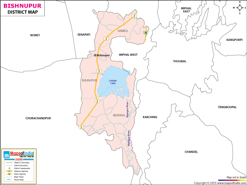
About Bishnupur District
Location
The Bishnupur district is the part of Manipur state. It is situated on the Tiddim Road at a distance of about 27 km from the city of Imphal.
Bishnupur is surrounded by Thoubal district on the east, Imphal West on the north, and Churachandpur on the south. The total area of the Bishnupur district is 496 sq km. It is around 27 km from Imphal, the capital of Manipur. The National Highway 150 connects Imphal with Bishnupur.
Quick Facts
District Headquarters: Bishnupur
Total Area: 530 sq km
Population (2011 Census): 237,399
Literacy Rate: 75.85%
Sex Ratio (per 1000): 999
History of Bishnupur
In ancient times, Bishnupur was known as Lumlangdong. The name Bishnupur was derived from an old temple called "The Vishnu Temple". This is also said that the Vishnu Temple was erected in AD 1793.
Must see places
A tour of Bishnupur will give you a unique experience. Some of the tourist attractions are:
- The Bishnu Temple
- Keibul Lamjao National Park
- Loktak Lake and Sendra Island
- Phubala Ecological Park
The people of Bishnupur have explicit skills in stone carving.
How to reach Bishnupur
The nearest airport is Tulihal Airport at Imphal which is around 32 km from Bishnupur. The nearest rail service is available at a distance of about 236 km at Dimapur station in Nagaland. Also, a rail line is available from Jiribam, Manipur which is 218 km away from Bishnupur. Bus services are there from 8 am to 6 pm from Waheng Leikai in Imphal. To move inside the city, you can find taxis, auto rickshaws, pedal rickshaws, etc.
Hotels in Bishnupur and the best time to visit
Hotels and cottages are available here as per your preference; however, it is advisable to book it in advance during festival season. The Tourist Lodge and Government Rest House are some of the options for the tourists visiting Bishnupur.
Last Updated on : January 14, 2026
