Vellore Tehsil Map


Tehsil Map of Vellore

separator Click here for Customized Maps arrow custom map
Tehsil Map of Vellore ANDHRA PRADESH KARNATAKA Krishnagiri Dharmapuri Dharmapuri Villupuram Kancheepuram Thiruvallur Tiruvannamalai
Print Email Save Buy Now 
*Vellore Tehsil Map highlights the name and location of all the mandals in Vellore district, Tamil Nadu. Disclaimer


  Major Tehsils of Tamil Nadu  
Villupuram Tehsil Map Tirunelveli Tehsil Map Vellore Tehsil Map Coimbatore Tehsil Map
Villupuram Tehsil MapTirunelveli Tehsil MapVellore Tehsil MapCoimbatore Tehsil Map
    
Thanjavur Tehsil Map Madurai Tehsil Map Kancheepuram Tehsil Map Namakkal Tehsil Map
Thanjavur Tehsil MapMadurai Tehsil MapKancheepuram Tehsil MapNamakkal Tehsil Map
  other tehsils of Tamilnadu  >>

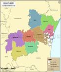
List of Taluks in Vellore District

Taluk/Block NameTotal : Rural+Urban Population (2001) in NumberPin Code
AmburN.A635802
Arakonam459,643631001
Arcot230,673632503
Gudiyatham378,674632602
Katpadi332,363632007
Tirupathur500,455635601
Vaniyambadi551,468635751
Vellore643,645632001
Wallajah380,396N.A


Last Updated on : September 15, 2015