Virudhnagar Tehsil Map


Tehsil Map of Virudhnagar

separator Click here for Customized Maps arrow custom map
Tehsil Map of Virudhnagar Madurai Theni Tirunelveli Thoothukudi Ramanathapuram Sivaganga KERALA
Print Email Save Buy Now 
*Virudhnagar Tehsil Map highlights the name and location of all the mandals in Virudhnagar district, Tamil Nadu. Disclaimer


  Major Tehsils of Tamil Nadu  
Villupuram Tehsil Map Tirunelveli Tehsil Map Vellore Tehsil Map Coimbatore Tehsil Map
Villupuram Tehsil MapTirunelveli Tehsil MapVellore Tehsil MapCoimbatore Tehsil Map
    
Thanjavur Tehsil Map Madurai Tehsil Map Kancheepuram Tehsil Map Namakkal Tehsil Map
Thanjavur Tehsil MapMadurai Tehsil MapKancheepuram Tehsil MapNamakkal Tehsil Map
  other tehsils of Tamilnadu  >>

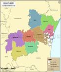
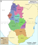
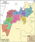
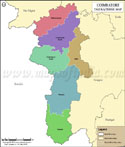
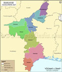
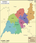
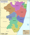
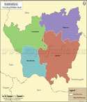
List of Taluks in Virudhunagar District

Taluk/Block NameTotal : Rural+Urban Population (2001) in NumberPin Code
Aruppukkottai223,281626101
Kariapatti90,644626106
Rajapalayam307,959626117
Sattur156,968626203
Sivakasi377,976626123
Srivilliputhur269,317626125
Tiruchuli91,262626129
Virudhunagar233,894626001


Last Updated on : February 26, 2020