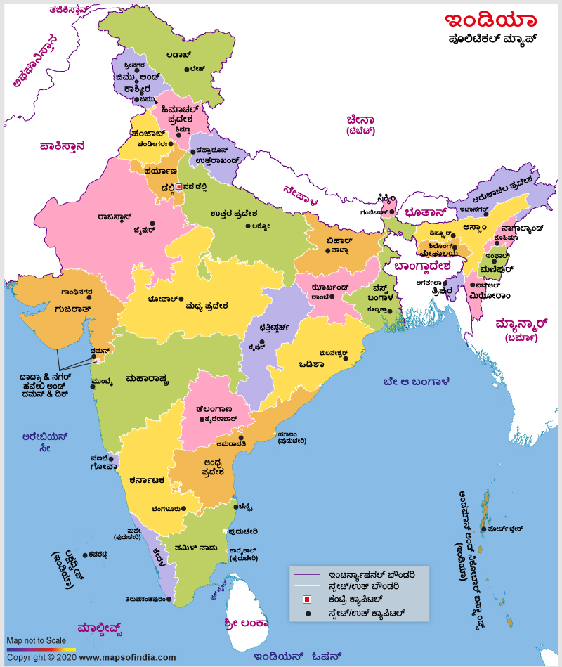
Kannada is the official language of the Indian state of Karnataka. It is one of the scheduled languages of India as well. An India Political Map in the Kannada language helps the Kannada speaking people understand the political subdivisions of India along with their capitals. It is a valuable resource or guide for the travellers who speak or write in the Kannada language.
Touring this country becomes easier for the Kannada knowing people when they carry such a map with them. The outlines of the various states are demarcated in this map, and all the state and union territory capitals have been pointed out vividly as well. When the Kannada speaking people view this map, they will have a clear idea about the names of the states and union territories of India and their capitals. They can also decide their tour plan regarding which places to visit in India with the help of this map. All these maps are user-friendly maps and are available online. Interested travellers can also get an offline version of this map by getting a printout from their PC. This will help them carry the map to their desired locations.
Last Updated on: January 20, 2026
