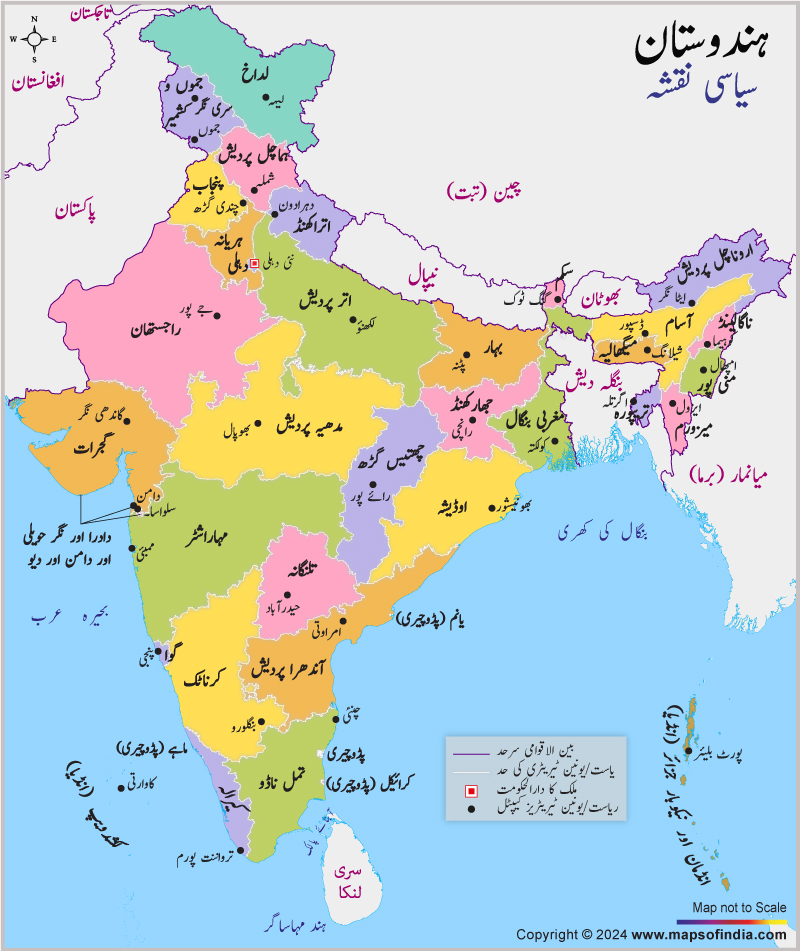
India political map in Urdu is a customized map for people who speak in Urdu. It helps them understand the various political subdivisions of India and their administrative headquarters. Since Urdu is a widely spoken language both in and outside India, this map will help the travelers who speak in the Urdu language.
All the state and union territory boundaries of India have been clearly delineated in this map. Since Urdu is the formal language of the state of Jammu and Kashmir in India and it is spoken and written by a considerable portion of the overall Indian population, this map will rightly guide the Urdu-speaking travelers to find out and visit all the top-rated tourist destinations in India.
India is a traveler's paradise and it is a big country which has different types of tourist attractions in store for the visitors. Therefore, it is always necessary to carry a detailed map with you to know the country properly. An India political map in Urdu is this kind of a map which helps in touring the country and exploring the wonders of the country to the fullest. Getting all the important information about the seventh largest democracy in the world is just a matter of minutes.
Last Updated on : January 20, 2026
