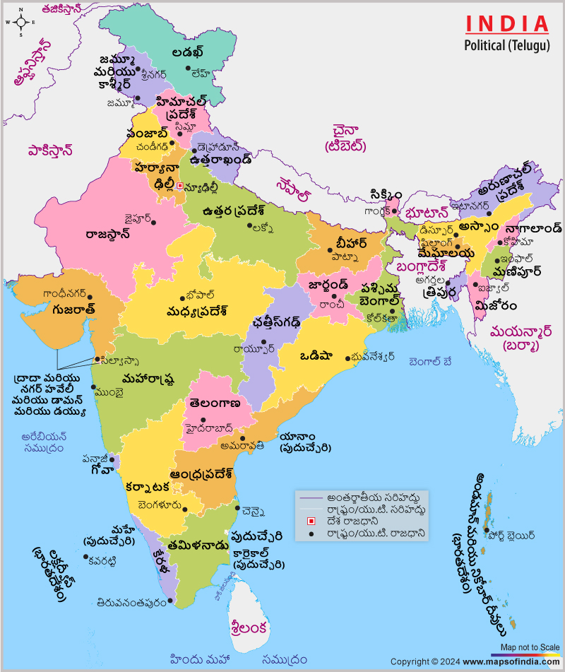
Importance India Political Map in Telugu
The different types of Indian maps are published in almost all the major regional languages. This will help in gaining an easier understanding of the Indian map. For example, a political map of India in the Telugu language is of utmost importance to those people, whose vernacular is Telugu. Apart from knowing about the different states, capitals, seas, oceans, neighbouring countries, this helps them in locating UTs too on a political map of India. Though the north direction of this nation is being marked with "N", which is an English alphabet, all the other information on the political map of India in Telugu version is in Telugu. It is even beneficial for a tourist to carry such a map especially while travelling to the south or southeastern part of the country where the locals of the place will be able to guide him or her through the map.
Last Updated on : March 04, 2024
View India Map in
|
|
