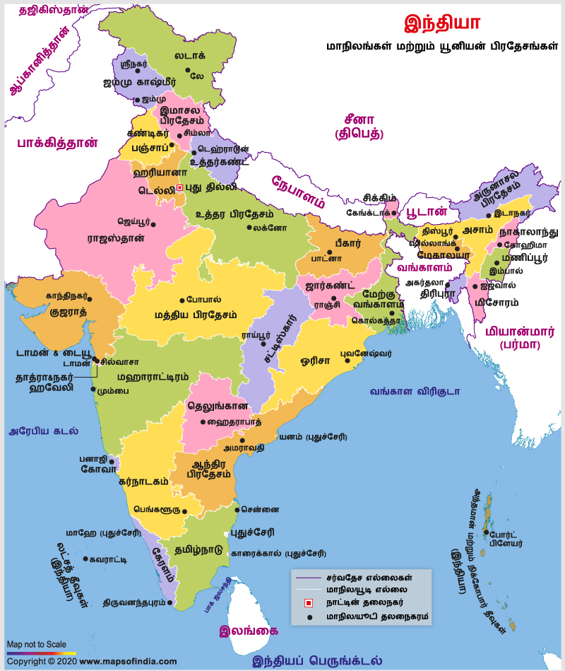
Significance of India Political Map in Tamil
Political maps of the Republic of India are even available in the Tamil language. Such a map is mainly helpful to people, who wants to know their nation in their own mother tongue. It makes them easier to learn about the geographical location of the varied regions of India. With different colors being used for the states or U. T.s, the names of the places are shown in Tamil. The names of the capital cities are even published in that same language, which in turn helps one even learn as well as memorize the names of the state capitals of India. The names of the neighboring water bodies can even be known since, they are even written in Tamil. However, the northward direction of the country is shown in the English language with the letter "N" marked with the symbol of an upward arrow.
Last Updated on : January 20, 2026
View India Map in
