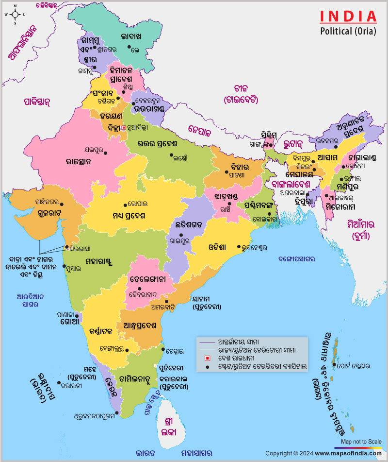
At present, there are 29 states and seven union territories in India. An India political map in Oriya will help the Oriya-speaking people understand these subdivisions and become aware about the states, union territories, and their capitals as well. Oriya is the formal language of the state of Orissa and an important regional language in some other parts of India. Hence, these people will find this map helpful.
Locating the important states and union territories of India together with the capitals becomes an easy task altogether. Since India houses a large number of popular tourist destinations most of which are capitals of different states, this India political map in Oriya language will help the Oriya-speaking travelers explore the country in a simpler way. If you want to take the map along with you while touring India, just get a printout of this map and it will be just a matter of minutes. Oriya speaking people who are keen to know India will find it as a better informational resource.
Last Updated on : January 20, 2026
View India Map in
