The NCR is India's largest and world's second largest urban agglomeration with a population of over 54 million inhabitants.
The concept of the National Capital Region was first mentioned in 1962. The plan was to develop a metropolitan region around Delhi in order to divert the escalating pressure of population from Delhi. This plan was necessary in order to protect Delhi's infrastructure from extreme pressure.
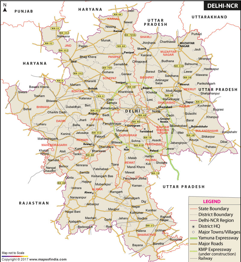
According to the National Capital Region Planning Board Act, 1985, total 23 districts in the adjoining states of Uttar Pradesh, Haryana and Rajasthan as well as the National Capital Territory of Delhi comprise the National Capital Region (NCR) of India.
Participating States and their Districts in NCR
National Capital Territory of Delhi - It covers Delhi and New Delhi.
Haryana - Districts included in the NCR are as follows:
- Bhiwani
- Faridabad
- Gurgaon
- Jhajjar (Jhajjar and Bahadurgarh)
- Mahendragarh
- Panipat
- Rewari
- Rohtak
- Sonipat
- Mewat
- Palwal
- Jind
- Karnal
Uttar Pradesh - Districts included in the NCR are as follows:
- Baghpat
- Bulandshahr
- Gautam Buddha Nagar District (Noida and Greater Noida) es of NCR
- Faridabad-Ballabgarh Complex
- Ghaziabad-Loni-Bulandshahr Complex
- Gurgaon-Manesar Complex
- Noida-Greater Noida Complex
- Sonipat-Bahadurgarh Complex
- Sonipat-Kundli Complex
NCT-Delhi has an area of around 1,483 sq km.
Central NCR (CNCR) has an area of about 2000 sq km.
Following suburbs are included:
A Highway Corridor Zone is proposed. Its approximate area is 300 sq km.
|
||||||
 |
||||||
|
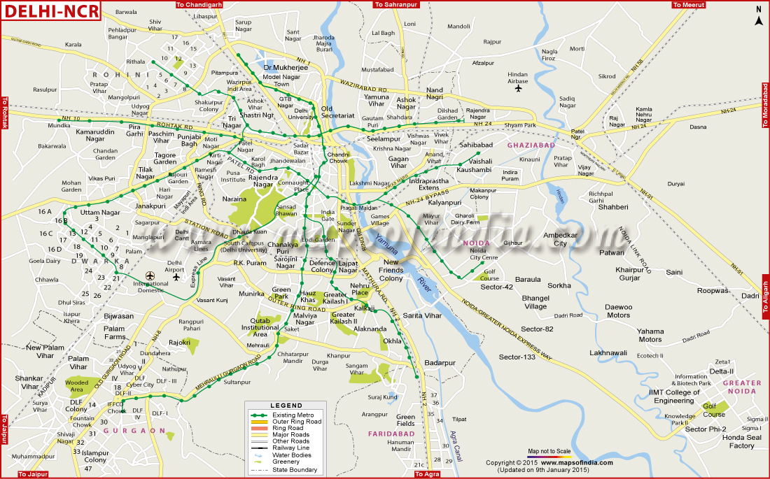
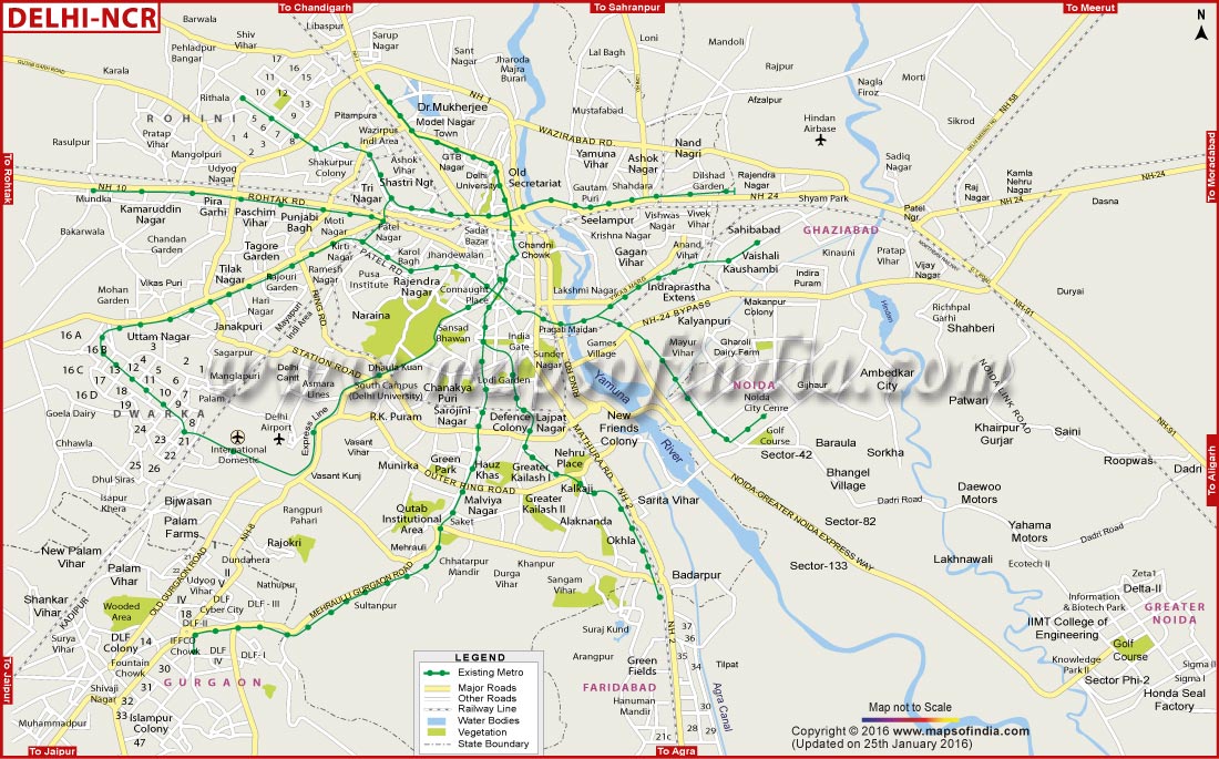
| * The Map showing Delhi NCR Major locations, Roads, Metro lines, etc. | Disclaimer |
UBST100615
WBVDA
Last Updated on : February 19, 2026


