|
|||||||||||
 | |||||||||||
|
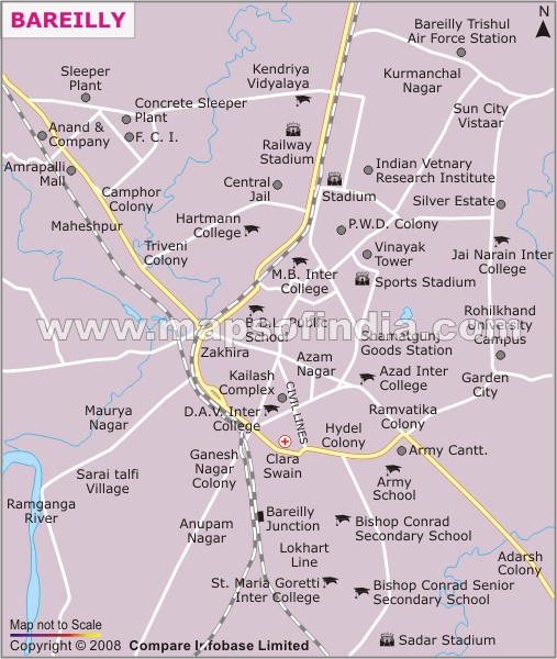
| *Bareilly city Map showing roads, hotels, hospitals and other places of interest. | Disclaimer |
How to reach Bareilly
Bareilly is easily accessible through several modes of transport
By Air
The airport in Bareilly, which is called the Trishul Air Base, belongs to the Indian Air Force. But the airbase is not accessible for the civilians except for the high government officials on official work. The nearest domestic airport in Bareilly is either Pantnagar airport which is approximately 76 km away from the city or Mahendranagar airport which is at a distance of 99 km. New Delhi airport is the nearest international airport which is at a distance of approximately 250 km from the city. From New Delhi, several private carrier services are available which can be taken to reach the Bareilly city.
By Rail
Bareilly is well connected with rail network which connects it to all the major state and cities of India. Bareilly Cantonment Junction is the main railway station of the city. Many super fast and express trains pass through this city and connects it to cities like Delhi, Kolkata, Mumbai, Mathura, Chandigarh etc. There are a few passenger trains as well which connect it to Roza, Farrukhabad. Bareilly-Delhi Express, Triveni Express, Bareilly-Prayag Express are some of the trains which start from the Bareilly railway station.
By Road
Bareilly is well connected to many cities of Uttar Pradesh through a network of National as well as State Highways. Regular buses ply here from major cities such as Jaipur, Ghaziabad, Mathura, Varanasi, Lucknow and New Delhi. Private as well as Uttar Pradesh State Road Transport Corporation buses ply to and from Bareilly. Private taxis or cabs can also be hired to reach the city by road.
WBST14082014
EBAKB191114
Last Updated on : February 19, 2026
| Find Distance from Bareilly to other Indian Cities | |||