


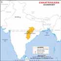
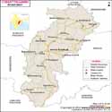
Chhattisgarh, formed on 1 November 2000, is the ninth-largest state in the country, with an area of 135,194 km2 (52,199 sq mi). It is the 17th most populous state in India with a population of 32,186,262 in 2020.
Economy
The economy of this state benefits from its Bhilai Steel Plant, S.E.C.Railway Zone, BALCO Aluminium Plant, S.E.Coal Ltd, and National Thermal Power Corporation Ltd. To add to it all, Chhattisgarh is a mineral-rich state. The service sector consists of trade, transport, communication, banking, insurance, and real estate.
Tourism
This state is also enriched with natural beauty and a pleasant atmosphere. It is surrounded by dense forests, hilly mountains, streams, waterfalls, natural caves, parks, etc. Bastar, called Kashmir of Chhattisgarh, attracts foreign tourists. Mahanadi, one of the largest rivers in India originates from Chhattisgarh.
Hotels in state
The state has several good hotels to offer to tourists. So if you are confused about where to stay in Chhattisgarh, you can choose anyone from Naman Bastar, Muba’s Machaan, Bastar Jungle Resort, Hyatt Raipur, Courtyard by Marriott in Bilaspur. However, choosing the accommodation also depends upon which place you are heading to.
Famous tourists attractions
The state witnesses tourists all through the year. Some of the famous tourist attractions in Chhattisgarh are Bastar, Kailash, and Kutumsar Caves, Mahamaya Temple. Achanakmar Wildlife Sanctuary, Udanti Wildlife Sanctuary, Gomarda Reserve Forest, Maitri Bagh, Chitrakote Falls, Chitradhara Waterfalls, Tirathgarh Waterfalls, Barsoor, Laxman Temple, Uwasaggaharam Parshwa Tirth, Mahant GhasiDas Memorial Museum, Chaiturgarh Fort, Ratanpur Fort, Kanker Palace, and many more to name.
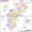
National Highways
The national highways run through the state: NH 6 The route was also known as Asian Highway 46 (AH46), NH 26, and NH 43.
Educational Institutions in Chhattisgarh
- Guru Ghasidas Vishwavidyalaya
- Surguja Vishwavidyalaya
- Chhattisgarh Swami Vivekanand Technical University
- Pandit Ravishankar Shukla University
- Indian Institute of Technology Bhilai
- Indian Institute of Management Raipur
- Hidayatullah National Law University
- Shri Shankaracharya Engineering College, Bhilai
- Government Engineering College, Jagdalpur
Fairs and Festivals in Chhattisgarh
- Bastar Dussehra/Durga Puja
- Bastar Lokotsav
- Madai Festival
- Rajim Kumbh Mela
- Pakhanjore Mela (Nara Narayan Mela)
- Ratanpur Fair
- Shivrinarayan Fair
- Sihawa Fair
- Girodhpuri Fair
- Damakheda Fair
- Sirpur Festival
- Pola
- Nawakhai
- Govardhan Pooja
Best Time to Visit Chhattisgarh
Chhattisgarh experiences a tropical climate, temperature and humidity remain high. Therefore, tourists should pack up their luggage to visit Chhattisgarh and see some absorbing sites, only to avoid the rainy season. If you want to experience the most pleasant weather then plan your trip between September and December.
How to Reach Chhattisgarh
By Air:
The capital of Chhattisgarh, Raipur is linked by air Flights for New Delhi, Mumbai, Kolkata, Nagpur (Maharashtra), and others are available at Swami Vivekananda Airport at Raipur regularly.
By Rail:
The state is well-connected by railways. Raipur and Bilaspur are the two main junctions from where you can catch express and passenger trains. The places where the trains from Chhattisgarh directly connect are Delhi, Amritsar, Cochin, etc.
By Road:
The state is properly connected through highways. The cities where the buses run are Bhopal, Nagpur, Jhansi, Jabalpur, Kolkata, and Bhubaneswar.
Chhattisgarh State Information | |
|---|---|
| Capital | Raipur |
| Date of formation | 01/11/2000 |
| Governor | Shri Ramen Deka |
| Chief Minister | Vishnu Deo Sai |
| Tourist attractions | Bastar, Chitrakote Falls, Kailash and Kotamsar Caves, Mahamaya Temple. |
| Festivals | Pola, Nawakhai, Dussehra, Deepavali, Holi, Govardhan Pooja |
| Major dance and music forms | Panthi, Raut Nacha and Soowa dances; Sohar, Bihav and Pathoni songs |
| Arts and crafts | Iron crafting, lost wax method of metal casting, bhittichitras or murals. |
| Languages | Hindi, Oriya, Marathi, Chhattisgarhi, Gondi, Korku |
| Size | 135,192 km2 (52,198 sq mi) |
| Population (Census 2011) | 32,186,262 |
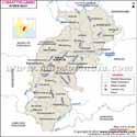
| Rivers | Mahanadi, Indravati, Sone, Hasdeo , and others |
| Forests and wildlife sanctuaries | Kankerghati NP, Indravati NP, Kanger Valley NP |
| State animal | Wild water buffalo |
| State bird | Hill myna |
| State tree | Sal |
| State flower | Sal tree |
| Major crops | Rice, wheat, |
| Factoids | The ancient caves of Kotamsar, Kailash and Dandak in the Kanger forest have stunning limestone formations or stalagmites and stalactites. |
| Approximately 90 languages and dialects are spoken in this state. | |
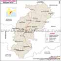
| No. of District | 28 |
Maps in Other Regional Languages
MOI.AB.17.01.17
Last Updated on : March 26, 2026