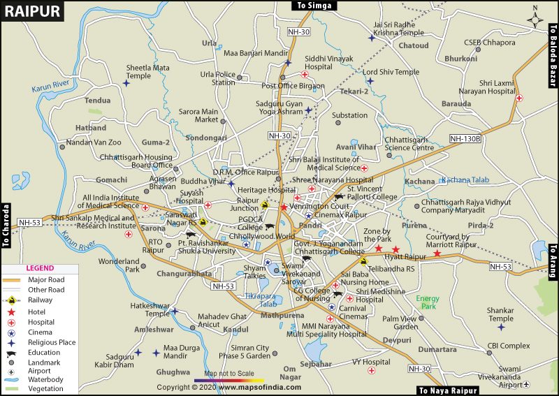
The Raipur Municipal Corporation has a population of 1,010,087 inhabitants and the urban agglomeration has a population of 1,122,555 inhabitants as per the 2011 census. Being an important regional centre, the Raipur city has fascinated people from different parts of Madhya Pradesh and neighboring states. The total population comprises of local ethnic Chhattisgarhis, South Indians, North Indians and a few populace from the North East. The climate of the Raipur is a tropical wet and dry climate, with moderate temperatures throughout the year. The summer months can be extremely hot with dry and hot winds. The city receives rain mostly from late June to early October and winters are mild lasting from November to January.
The infrastructure of the city is well maintained. The National Highways (visible on the raipur city map) which connect the city of Raipur with various other cities are the National Highway Numbers 6, 43 and 200. The government run interstate bus service provides regular transportation to neighbouring cities and states. The Raipur City Bus Limited (RCBL) provides intra-city travel. Apart from these auto-rickshaws, tuk-tuk and taxis are easily available in the city. Raipur is positioned on the Mumbai-Howrah route of the Indian Railways. The main railway station, Raipur Junction, is located at the city center and there are also eight other small railway stations in the city. Swami Vivekananda Airport is located at about 15 km away from the city center. The airport operates around 38 flights daily and connects with major airports across India.
The city of Raipur has many attractions for tourist (visible on the raipur city map), some of the popular ones are Mahant Ghasidas Museum, Guru Tegh Bahadur Museum, Sushilpikangan, Shabari handicrafts emporium and Chhattisgarh Haat, Purkhauti Muktangan Museum, Vivekananda Sarovar, Nandanvan, Rajiv Smriti Van and Urja Park, Mahavir Park, etc.
Last Updated on : November 13, 2025
| Find Distance from Raipur to other Indian Cities | |||
