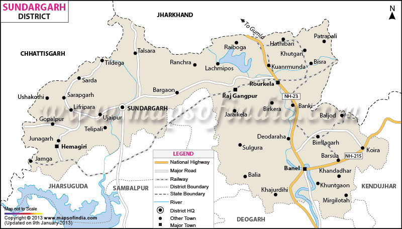
The Sundargarh district occupies a total area of 9,712 sq km. The place is found on the north-western corner of
Odisha.
With a population of 18,29,412, the district has a population density of 188 persons per sq km (2001 census). The literacy rate of Sundargarh is 65.22%.
3,36,000 hectares of land is available for cultivation in the district. Being intersected by Brahmani and other rivers, the district is known to have a flourishing industry of textile and other allied sectors.
The district has a quaint picturesque landscape that attracts quite a number of tourists round the year.
Covered with lush green forest areas and inhabited by colorful tribes, Sundargarh is one of the most beautiful districts of Orissa. Sundargarh district of Orissa is also one of the oldest districts of the state. It was formed on the first day of the year 1948.
The geographical location of the district is between North Latitude 21°36' to 22°32' and East Longitude 83°32' to 85°22'. The Sundargarh District is the second largest district in Orissa an area of 9,712 Square Kilometers. The district is densely populated with a population of 18,29,412.
The Sundargarh District was constituted by the merger of two princely states of Bonai and Gangapur. According to historians, the region was once under the rule of South Kosalas. The Maratha Chief Raghuji Bhonsla handed over the area to the British in the beginning of 19th century.
class="content_heading">Last Updated on : February 19, 2026
