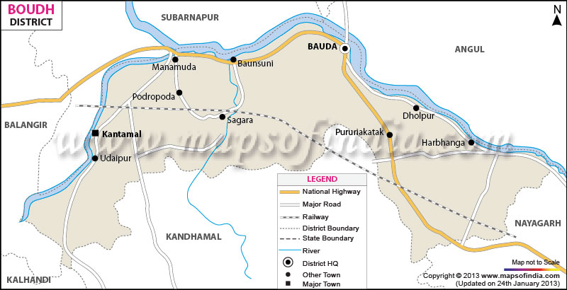
With a total area of 3098 sq km, the district of Baudh accommodates a population of 3, 73, 000 (2001 census). Baudh has a sex ratio of 985 females per 1000 males with 1, 83, 000 literate people.
The 224 km long state highway and well constructed road and railway tracks join Baudh with rest of the districts of
Odisha.
Paddy, wheat and maize are the main crops of Baudh. Fisheries and animal husbandry sectors are the other sources revenue of the district.
Named after the great Lord Buddha, Baudh is renowned for its fascinating Buddha statue, Matengeswar Temple, Jagannath Temple, to name a few.
Bauda district of Orissa bears relics to the rich religious history and cultural legacy of the region of the bygone days. Spread over a total geographical area of 3098 sq. km, Bauda district encompasses a population of 3, 73,000 as per the census data of 2001.
Also known as Boudh, the district of Bauda derived its name from Lord Budhha. The Buddhist religion had flourished in the Bouda or Boudh district of Orissa during the ancient times. Situated in the middle of the state of Orissa, Bauda district is easily accessible by well maintained roads and well laid railway tracks.
Agriculture is the backbone of the economy of the district of Bauda. Most of the local indigenous inhabitants of the district of Bauda depend on the traditional form of raising crops. River Mahanadi and its tributaries flow through the district and make Bauda suitable to grow wheat, paddy and maize. Fisheries and animal husbandry are the other major sources of earning livelihood.
