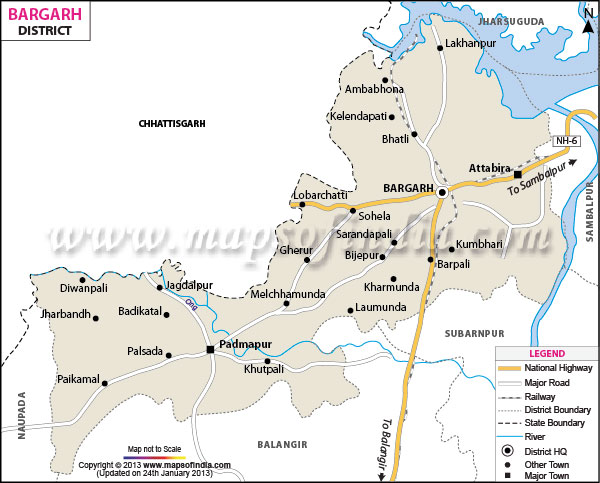
Bargarh, positioned on the westernmost corner of Orissa, has a locational standing of 20
o43'-21
o41' north latitude and 82
o39'-83
o58' east longitude.
Divided into Bargarh Plain, Borasambar and Ambabhona and Lakhanpur, Bargarh occupies an area of 5837 sq km.
The district is densely populated and has a total population of 13.46 million of which males claim 6.81 million while females claim 6.65 million.
Some parts of the region that are under the Hirakund Dam Project are economically sufficient. Rice and pulses are the main agricultural products of the place. However, Sugarcane is the only cash crop of Bargarh. Poultry and dairy are the prime economic activities of the district.
The district has several places of tourist interest. Among them Nrusinghnath, Gandhamardan, Hiuen T'sang, the mighty Mandap and Papaharini are worth of mention.
The Bargarh district of
Odisha was formed on the 1st of April in the year of 1993. One of the notable districts of Orissa, Bargarh is spread over a total geographical area of 5837 sq. km and holds a population of 13.46 millions as per the census data of 2001.
Located in the western part of Orissa, Bargarh district is surrounded by Chhatisagrh on the north, Balangir district on the south, Sambalpur district on the east and Nawapara district on the west.
