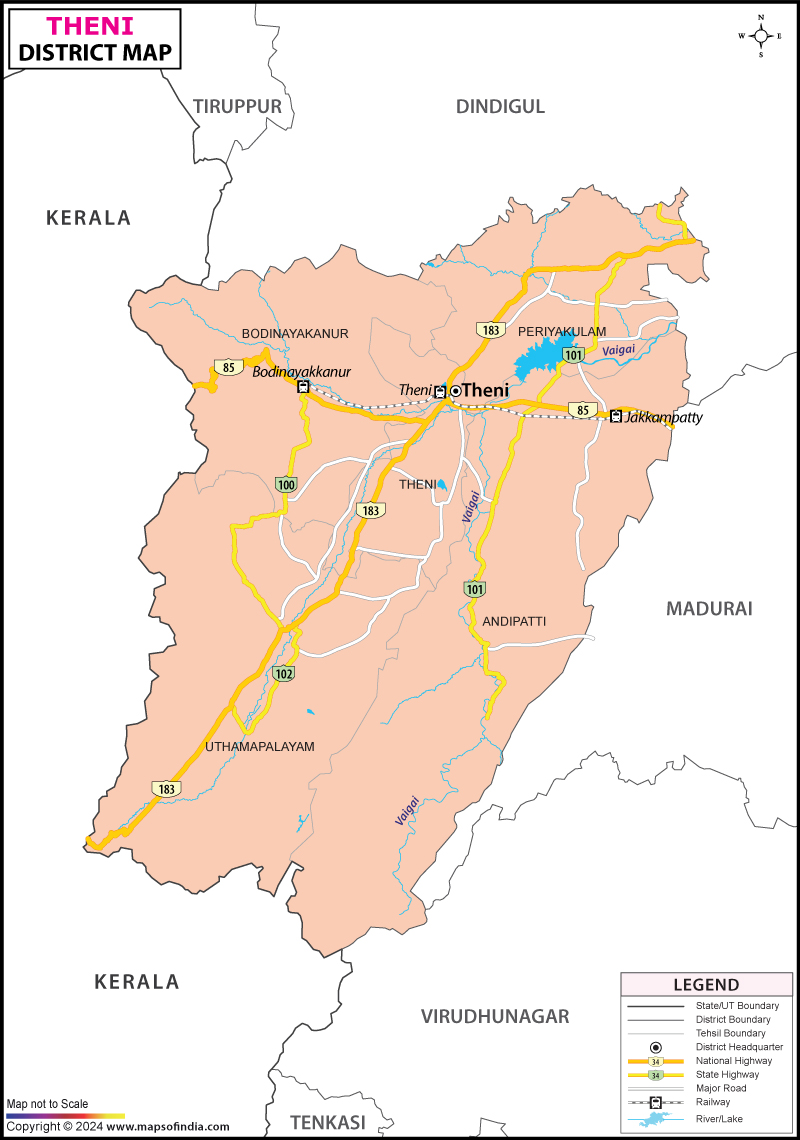
Theni District Map


District Map of Theni

separator Click here for Customized Maps arrow custom map
District Map of Theni
Print Email Save Buy Now 
*The Map showing the National Highway, Major roads, other Roads, District Headquarter, Town, etc in the Theni District, Tamil Nadu Disclaimer


  Major Districts of Tamil Nadu  
Kanchipuram District Map Vellore District Map Salem District Map Tirunelveli District Map
Kanchipuram District MapVellore District MapSalem District MapTirunelveli District Map
    
Erode District Map Tiruvallur District Map Thanjavur District Map Viluppuram District Map
Erode District MapTiruvallur District MapThanjavur District MapViluppuram District Map
  other districts of Tamilnadu  >>

Theni district was formed on 25th July 1996. It covers the geographical area of 3067.2 Sq. km. According to 2001 census the total population of Theni district is 1093950, comprising of 552986 males and 540964 females.

The principal crops of Theni district are paddy, cholam, cumbu, redgram, greengram, blackgram, horsegram, turmeric, sugarcane, mango, bannana, tapiaco, groundnut and gingelly. Sericulture is another occupation of the people of the district.

Popular tourist destinations of the district of Theni are:
  • Meenakshi Amman Temple
  • Tirumalai Nayakkar Mahal
  • Gandhi Museum
  • Mariamman Teppakulam
  • Koodal Azhagar Temple
  • Gowmariamman Temple
  • Saneeswaran Temple
  • Velappar Temple
  • Bathrakaliamman Temple
  • Paramasivan Temple
  • Sivakami Amman Temple
  • Veerappa Ayyanar Temple
  • Suruli Andavar Temple
  • Periya palli vasal, Uthamapalayam.


Last Updated on : February 28, 2024