
List of Taluks in Perambalur District | ||
|---|---|---|
| Taluk/Block Name | Total : Rural+Urban Population (2001) in Number | Pin Code |
| Kunnam | 225,259 | 621708 |
| Perambalur | 131,986 | 621212 |
| Veppanthattai | 136,401 | 621116 |
Last Updated on : February 15, 2020
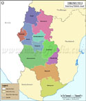
Perambalur Tehsil Map |
|
|||||||||

| |||||||||
|
| *Perambalur Tehsil Map highlights the name and location of all the mandals in Perambalur district, Tamil Nadu. | Disclaimer |
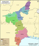
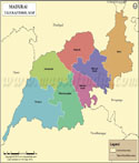
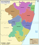
| Major Tehsils of Tamil Nadu |
 |
 |
 |
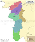 |
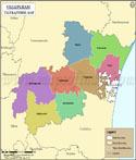
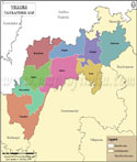
| Villupuram Tehsil Map | Tirunelveli Tehsil Map | Vellore Tehsil Map | Coimbatore Tehsil Map |
 |
 |
 |
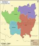 |
| Thanjavur Tehsil Map | Madurai Tehsil Map | Kancheepuram Tehsil Map | Namakkal Tehsil Map |
| other tehsils of Tamilnadu >> | |||
List of Taluks in Perambalur District | ||
|---|---|---|
| Taluk/Block Name | Total : Rural+Urban Population (2001) in Number | Pin Code |
| Kunnam | 225,259 | 621708 |
| Perambalur | 131,986 | 621212 |
| Veppanthattai | 136,401 | 621116 |
|
|