

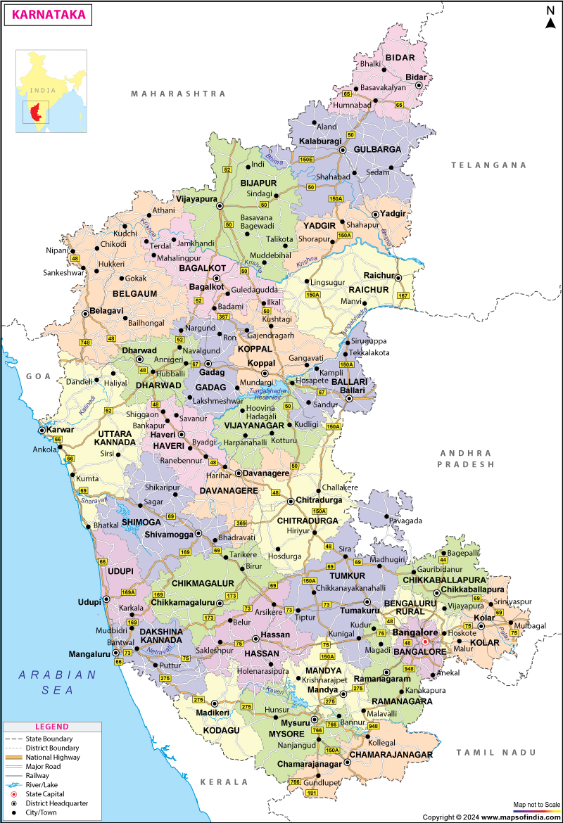




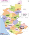
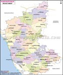
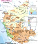
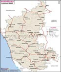
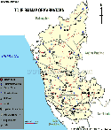
Karnataka is one of India's leading southern states, known for its strong economy, technological innovation, cultural heritage, and ecological diversity. Covering an area of 191,791 sq. km, the state stretches from the Arabian Sea coastline to the Western Ghats and the Deccan Plateau. Its capital, Bengaluru, continues to be India's technology and startup hub while also serving as a centre for education, aerospace, biotechnology, and research. Karnataka is home to UNESCO World Heritage Sites such as Hampi and Pattadakal, major wildlife reserves, coffee plantations, historic temples, and thriving industrial corridors. The Karnataka Map helps users locate districts, cities, highways, rivers, tourist attractions, and important administrative boundaries across the state.
In 1973, the Mysore State was renamed Karnataka. Several dynasties ruled in this region, and thus it has a distinctive culture. The early history of Karnataka states that it was a part of the Maurya Empire, and then it was ruled by the Satvahanas, Pallavas, Kadambas, and many more. Each dynasty has been immortalized in history through its architectural prowess, which can be seen in the form of monuments and temples spread across the state. After the independence of India, it got recognition based on 'Kannada speaking' people.
Karnataka lies in the southwestern region of India. It is the largest state in South India and the seventh-largest in India, formed on 1 November 1956. It shares its borders with the Arabian Sea to the west, Goa to the northwest, Maharashtra to the north, Telangana to the northeast, Andhra Pradesh to the east, Tamil Nadu to the southeast, and Kerala to the south. The unique feature of the state is that its border touches all the four southern Indian sister states.
Karnataka is replete with the automobile, agro, aerospace, textile and garment, biotech, and heavy engineering industries. The state has several special economic zones (SEZs), which is proof of industrial growth like IT, biotechnology, and engineering, food processing, and aerospace. The state is the IT hub of the country.
The economy of the state also depends on agriculture, animal husbandry, mining, quarrying, manufacture, education, etc. It has the highest economic growth rate in India. Gross State Domestic Product (GSDP) of Karnataka is about Rs 18.06 trillion (US$ 258.37 billion) in 2020-21.
Karnataka is a mineral-rich state. The main minerals found are gold, silver, copper, iron-ore, manganese, limestone, dolomite, asbestos, bauxite, chromite, kaolin, and granite rock. More than 90% of the gold produced in India is in the southern part of Karnataka. Kolar Gold Fields (in Kolar District) and Hatti Gold Mines ( in Raichur District) are probably one of the oldest gold mines in the world; besides these, gold reserves have been found in Dharwad and Chitradurga also. Raichur is also known for its silver deposits. Hospet and Bellary are the two districts in the state where a significant amount of Iron ore is excavated. Karnataka also has the largest reserves of Manganese ore in the country.
Karnataka holds the top rank in producing raw silk, coffee, and sandalwood oriented goods. The service sector of the state comprises Consultancies, Real Estate, Academic Institutions, Travel and Tourism, Insurance, and Hotel Industry.
Divisions of Karnataka
A map of Karnataka shows that there are 31 districts in the state, which are grouped under four divisions, and they are as follows: Bangalore Division, Belgaum Division, Gulbarga Division, and Mysore Division.
Bangalore Division
Shimoga, Bangalore Rural, Ramanagara, Chikkaballapura, Chitradurga, Davanagere, Kolar, Bangalore Urban, Tumakuru
Belgaum Division
Bagalkote, Belgaum, Bijapur, Dharwad, Gadag, Haveri, Uttara Kannada
Gulbarga Division
Ballari, Bidar, Gulbarga, Koppala, Raichuru,Yadagiri
Mysore Division
Chamarajanagara, Chikkamagaluru, Dakshina Kannada, Hassan, Kodagu, Mandya, Mysore, Udupi
Districts of Karnataka
Listed below are the 30 districts of Karnataka and their major details:
| District | District Code | Created | Headquarters | Subdivisions | Area | Population (As of 2011) |
|---|---|---|---|---|---|---|
| Bagalkote | BK | 08/15/97 | Bagalkot | Badami, Bagalkot, Hungund, Bilgi, Mudhol, Jamkhandi,Badami, Bagalkote, Bilgi, Ilkal, Hunagunda, Rabkavi Banhatti, Terdal, Guledgudda, Jamkhandi, Mudhol | 6,583 km2 | 1,889,752 |
| Bangaluru Urban | BN | 11/01/1956 | Bengaluru | Anekal, Yelahanka, Bengaluru North, Bengaluru East, Bengaluru South | 2,190 km2 (850 sq mi) | 9,621,551 |
| Bangaluru Rural | BR | 08/15/86 | Bengaluru | Devanahalli, Doddaballapura, Hosakote, Nelamangala | 2,259 km2 (872 square mile) | 990,923 |
| Belagavi | BG | 11/01/1956 | Belagavi | Athni, Bailahongal, Belagavi, Chikodi, Gokak, Hukkeri, Khanapur, Kagawad, Mudalagi, Nippani, Kittur, Raybag, Ramdurg, Saundatti | 13,415 km2 (5,180 square mile) | 4,779,661 |
| Bellari | BL | 11/01/1956 | Ballari | Ballari, Hosapete, Harapanahalli, Kampli, Hoovina Hadagalli, Kudligi, Kottur, Kurugodu, Sanduru, Siruguppa | 4,252 km2 | 14,00,970 |
| Bidar | BD | 11/01/1956 | Bidar | Bidar, Basavakalyan, Bhalki, Aurad | 5,448 km2 (2,103 square mile) | 1,703,300 |
| Vijayapura | BJ | 11/01/1956 | Vijayapura | Vijayapura,Indi, Muddebihal, Babaleshwar, Nidagundi, Tikota, Devara Hippargi, Talikote, Chadchan, Kolhar, Sindgi, Basavana Bagevadi, Almel | 10,494 km2 (4,052 square mile) | 2,177,331 |
| Chamarajanagar | CJ | 08/15/97 | Chamarajanagar | Chamarajanagar, Gundlupet, Kollegal, Hanur, Yelandur | 5,101 km2 (1,970 square mile) | 1,020,791 |
| Chikkaballapura | 09/10/2007 | Chikkaballapura | Bagepalli, Chikkaballapura, Chintamani, Gauribidanur, Gudibanda, Sidlaghatta | 4,524 km2 (1,747 square mile) | 1,255,104 | |
| Chikkamagaluru | CK | 11/01/1956 | Chikkamagaluru | Chikkamagaluru, Kadur, Koppa, Mudigere, Narasimharajapura, Sringeri, Ajjampura, Tarikere | 7,201 km2 (2,780 square mile) | 1,137,961 |
| Chitradurga | CT | 11/01/1956 | Chitradurga | Challakere, Chitradurga, Hiriyur, Holalkere, Hosadurga, Molakalmuru | 8,440 km2 (3,260 square mile) | 1,659,456 |
| Dakshina Kannada | DK | 11/01/1956 | Mangaluru | Bantwal, Beltangadi, Mangalur, Moodabidri, Kadaba, Puttur, Sullia | 4,560 km2 (1,760 square mile) | 2,089,649 |
| Davanagere | DA | 08/15/97 | Davanagere | Channagiri, Davanagere, Harihar, Harpanahalli, Honnali, Jagalur, Nyamati | 5,924 km2 (2,287 square mile) | 1,945,497 |
| Dharwad | DH | 11/01/1956 | Dharwad | Dharwad, Hubballi, Kundgol, Navalgund | 4,260 km2 (1,640 square mile) | 1,847,023 |
| Gadag | GA | 08/24/97 | Gadag | Gadag-Betigeri, Mundargi, Nargund, Gajendragad, Lakshmeshwar, Ron, Shirhatti | 4,656 km2 (1,798 square mile) | 1,064,570 |
| Kalaburagi | GU | 11/01/1956 | Kalaburagi | Afzalpur, Aland, Chincholi, Chittapur | 10,951 km2 (4,228 square mile) | 2,566,326 |
| Hassan | HS | 11/01/1956 | Hassan | Alur, Arkalgud, Arsikere, Belur, Channarayapattana, Hassan, Holenarsipur, Sakleshpur | 6,814 km2 (2,631 square mile) | 1,776,421 |
| Haveri | HV | 08/24/97 | Haveri | Byadgi, Hangal, Haveri, Hirekerur, Ranibennur, Rattihalli, Savanur, Shiggaon | 4,823 km2 (1,862 square mile) | 1,597,668 |
| Kodagu | KD | 11/01/1956 | Madikeri | Madikeri, Somvarpet, Virajpet, Ponnampet | 4,102 km2 (1,584 square mile) | 554,519 |
| Kolar | KL | 11/01/1956 | Kolar | Kolar, Malur, Mulbagal, Srinivaspur | 3,969 km2 (1,532 square mile) | 1,536,401 |
| Koppal | KP | 08/24/97 | Koppal | Gangavathi, Kanakagiri, Kushtagi, Yelburga | 7,189 km2 (2,776 square mile) | 1,389,920 |
| Mandya | MA | 11/01/ 1956) | Mandya | Krishnarajpet, Maddur, Malavalli, Mandya, Nagamangala, Pandavapura, Shrirangapattana | 4,961 km2 (1,915 square mile) | 1,805,769 |
| Mysuru | MY | 11/01/1956 | Mysuru | Heggadadevana, kote, Hunsur, Krishnarajanagara, Mysore, Nanjangud, Piriyapatna, Saraguru, T.Narsipur | 6,854 km2 (2,646 sq mi) | 3,001,127 |
| Raichur | RA | 11/01/1956 | Raichur | Devadurga, Lingsugur, Manvi, Maski, Raichur, Sindhnur, Sirwar | 6,827 km2 (2,636 square mile) | 1,928,812 |
| Ramanagara | RM | 09/10/2007 | Ramanagara | Channapatna, Kanakapura, Ramanagara, Magadi | 3,556 km2 (1,373 square mile) | 1,082,636 |
| Shivamogga | SH | 11/01/1956 | Shivamogga | Bhadravati, Hosanagara, Sagar, Shikaripura, Shivamogga, Sorab, Thirthahalli | 8,477 km2 (3,273 square mile) | 1,752,753 |
| Tumakuru | TU | 11/01/1956 | Tumakuru | Chiknayakanhalli, Gubbi, Huliyar, Koratagere, Kunigal, Madhugiri, Pavagada, Sira, Tiptur, Tumakuru, Turuvekere | 10,597 km2 (4,092 square mile) | 2,678,980 |
| Udupi | UD | 08/25/97 | Udupi | Udupi, Brahmavara, Karkal, Kapu, Kundapura, Hebri, Byndoor | 3,880 km2 (1,500 square mile) | 1,177,361 |
| Uttara Kannada | UK | 11/01/1956 | Karwar | Ankola, Bhatkal, Dandeli, Haliyal, Honnavar, Joida, Karwar, Kumta, Mundgod, Siddapur, Sirsi ,Yellapur | 10,291 km2 (3,973 square mile) | 1,437,169 |
| Yadgir | YD | 12/30/09 | Yadgir | Gurumitkal, Shahapur, Shorapur, Vadagera | 5,273 km2 (2,036 square mile) | 1,174,271 |
| Vijayanagara | VJ | 01/26/2021 | Hosapete | Hosapete, Harapanahalli, Kudligi, Hagaribommanahalli, Kotturu, Kudligi, Vijayanagara | 5,655 km2 | Approx. 13.6 lakh (from old Ballari Census data split) |
As per the the data of 2011 census, the state had a literacy rate of 75.36%, in which 82.47% are males and 68.08% are females. Some of the renowned educational institutions in Karnataka are:
- Bangalore University
- Davangere University
- Karnatak University
- Karnataka State Law University
- University of Agricultural and Horticultural Sciences, Shivamogga
- University of Mysore
- Karnataka Veterinary, Animal and Fisheries Sciences University
Places to Visit in Karnataka
- Bengaluru
- Mysore
- Mangalore
- Hampi
- Coorg
- Bijapur
- Hubli-Dharwad
- Badami
- Goolbarga
- Gokarna
- Jog falls
- Bandipur National Park, to name a few.
Best Time to Visit Karnataka
The best time to visit Karnataka is between November and April. This is the time of the year when the weather remains pleasant.
How to Reach Karnataka
By Air
- It depends which place you are heading to. Some of the airports in this state are Kempegowda International Airport (International), Mangalore International Airport (International), Belgaum Airport, Hassn Airport and many more.By Rail
- Once you decide your destination in this state, you can take information about the railway station accordingly. Some of the railway stations in Karnataka are Bangalore City Junction, Bellari Junction, and so on.By Bus
- There are bus terminals and stands in almost all cities in the state. However, deciding the place to visit will make it easier for the travellers to know more about the bus terminus or stand.Karnataka State Information | |
|---|---|
| Capital | Bengaluru |
| Date of formation | 01/11/56 |
| Governor | Shri Thaawarchand Gehlot |
| Chief Minister | Siddaramaiah |
| Tourist attractions | Mysore City Palace, Chamundi Hill, Stone Chariot in Hampi |
| Festivals | Kar Hunnive, Hampi Utsav |
| Major dance and music forms | Simha Nutrya, Yakshagana |
| Arts and crafts | Bidri; Chitragars' wood chiselling; specialised card game Ganjifa. |
| Languages | Kannada, Tulu, Urdu, Konkani |
| Size | 191,791 sq. km |
| Population (Census 2011) | 61130704 |
| Rivers | Krishna, Tungabhadra, Kabini, and many more |
| Forests and wildlife sanctuaries | Bandipur WS, Nagarhole NP, Mudumalai NP |
| State animal | Asian elephant |
| State bird | Indian roller |
| State flower | Lotus |
| State tree | Sandalwood |
| Major crops | Rice, jowar, coffee |
| Factoids | Another name for Karnataka is Karunadu.in Kannad |
| The central dome of Muhammad Adil Shah's tomb, the Gol Gumbaz of Bijapur, is the second largest in the world. | |
| No. of Districts | 31 |
FAQs
Q1: How many districts are there in Karnataka?
Karnataka has 31 districts, organized into four administrative divisions: Bengaluru, Belagavi, Kalaburagi, and Mysuru. The 31st district, Vijayanagara, was carved out of Ballari in 2020.
Q2: What is the capital of Karnataka?
Bengaluru (formerly Bangalore) is the capital of Karnataka and serves as the state's administrative and technology hub.
Q3: Which is the largest district in Karnataka by area?
Belagavi is the largest district by area, while Bengaluru Urban is the smallest but most densely populated.
Q4: What languages are spoken in Karnataka?
Kannada is the official language. Other widely spoken languages include Tulu, Konkani, Urdu, and English.
Q5: What are the major rivers in Karnataka?
The Kaveri (Cauvery), Krishna, Tungabhadra, and Sharavati are among the state's major rivers.
Q6: What is the best time to visit Karnataka?
October to March is generally considered the best period, thanks to cooler, drier weather across most of the state.
Q7: What are the four divisions of Karnataka shown on the map?
The four administrative divisions of Karnataka are Bengaluru Division, Belagavi Division, Kalaburagi Division, and Mysuru Division.
Last Updated on: July 08, 2026
Road Companions From Bangalore