





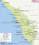
The Keralam (Kerala) Map provides a detailed view of the state's location, districts, cities, rivers, roads, geographical features, and administrative boundaries. Located in southwestern India, Kerala lies along the Arabian Sea and is known for its long coastline, Western Ghats, backwaters, rivers, forests, and diverse landscape.
Kerala shares its boundaries with Karnataka to the north and northeast and Tamil Nadu to the east and southeast, while the Arabian Sea lies to its west. Thiruvananthapuram is the capital of Kerala. The Kerala map helps locate its 14 districts, major cities, important rivers, transportation routes, and other geographical features.
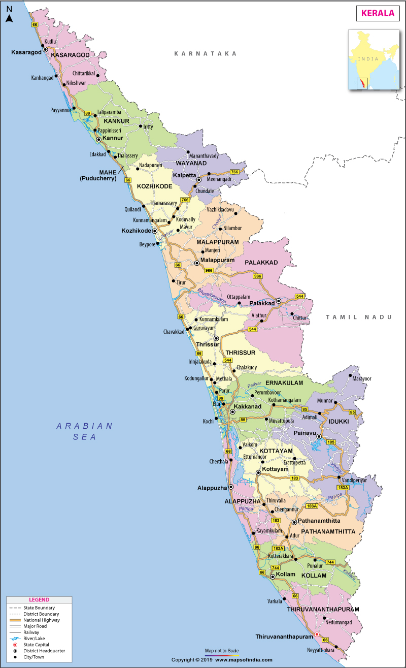
Keralam (Kerala) Map
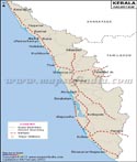
The Keralam (Kerala) map shows the state's elongated north-south shape and its position between the Arabian Sea and the Western Ghats. It helps in understanding the geographical relation of the coastal, central, and eastern parts of Kerala and also helps to identify the administrative divisions of Keralam.
Keralam covers an area of 38,863 sq km. Despite its relatively small area, the state has a varied landscape comprising coastal plains, lowlands, hills, forests, rivers, lakes, backwaters, and mountains.
A detailed Kerala map can be used to locate major cities such as Thiruvananthapuram, Kochi, Kozhikode, Kollam, Thrissur, Kannur, Alappuzha, Kottayam, and Palakkad.
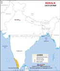
Keralam Location Map
Kerala is located in the southwest of India. The state of Karnataka is adjoining to the north and north-east, while the state of Tamil Nadu is adjoining to the east and south-east. To the west, it is bounded by the Arabian Sea.
The Western Ghats extend along much of Kerala's eastern region and form an important geographical feature of the state. The location of Kerala between the mountains and the sea has influenced its climate, agriculture, settlements, transportation, and economic activities.
Its coastal position has also contributed to Kerala's long history of maritime trade. Coastal towns and ports developed along the Arabian Sea and became important centres for commercial and cultural exchanges.
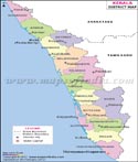
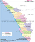
Keralam District Map
Keralam has 14 districts, extending from Kasaragod in the north to Thiruvananthapuram in the south. A district map of Kerala shows the boundaries and locations of these administrative divisions.
The 14 districts of Kerala are: Kasaragod, Kannur, Wayanad, Kozhikode, Malappuram, Palakkad, Thrissur, Ernakulam, Idukki, Kottayam, Alappuzha, Pathanamthitta, Kollam, Thiruvananthapuram.
The districts have different physical characteristics. The coastal districts contain beaches, lagoons, estuaries, and backwaters, while the eastern districts include portions of the Western Ghats, forests, plantations, and mountainous terrain.
Geography of Keralam
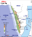
The geography of Kerala can broadly be divided into highlands, midlands, and lowlands.
The highlands are predominantly in the eastern part of Kerala along the Western Ghats. The mountains, valleys, forests, plantations, and several important wildlife areas are all present in this region.
The central part of the state is the midlands, and is characterized by rolling hills, valleys, agricultural land, and high population density.
The coastal strip of the Arabian Sea is called the lowlands. Beaches, lagoons, estuaries, canals, lakes and the extensive backwater network are found in this region.
This tripartite geographical region makes Kerala a diverse geographical landscape.
Western Ghats in Keralam
The Western Ghats are one of the most significant geographical features on the physical map of Kerala. They run throughout the eastern part of the state and feature mountains, forests, valleys, waterfalls, and wildlife habitats.
The highlands also play an important role in plantation agriculture. Several areas of the elevated region of the State grow crops like coffee and rubber.
There are a few rivers that originate in or near the Western Ghats which flow westwards to the Arabian Sea. The mountain range also contributes significantly to the rainfall and climate conditions in Kerala.
Rivers of Keralam
The state of Kerala has a large number of rivers, most of them running from the Western Ghats towards the Arabian Sea.
The Periyar is the longest river in Kerala, and it is one of the most important rivers in Kerala. Another well-known river is the Bharathapuzha, which is also known as the Nila and is also very culturally significant.
The other significant rivers are Pamba, Chaliyar, Chalakudy, Kadalundi, Valapattanam and Achankovil.
A Kerala river map helps show the drainage pattern of the state and the relationship between its rivers, mountains, valleys, and coastal areas.
Keralam Coast and Backwaters
Keralam (Kerala) is located on the Arabian Sea with a long sea coast. Its coastline features sandy beaches, lagoons, estuaries, canals and interconnected waterways.
The coastal districts have an extensive network of lakes, canals, lagoons and rivers known as ‘backwaters' of Kerala.
Vembanad is the biggest lake in Kerala and spreads over the Alappuzha, Kottayam and Ernakulam districts. The lake and waterways that flow through it are significant geographical features of the state.
Major Cities of Keralam
Kerala has several major cities and urban centres distributed across its coastal and inland regions.
Thiruvananthapuram, the state capital, is located in southern Kerala and is an important administrative and urban centre. Kochi, in Ernakulam district, is a major commercial and port city.
Kozhikode is a significant port and trading city in the north of Kerala. Thrissur is a major cultural centre, and Kollam is an important urban centre in southern Kerala.
The other important cities and towns are Kannur, Alappuzha, Kottayam, Palakkad and Malappuram.
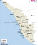
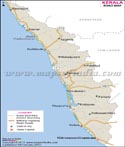
Keralam Road Map
The road map of Kerala depicts the road network linking the districts, cities, towns, neighbouring states and important destinations of Kerala.
The National Highway 66 passes through a large portion of the western side of Kerala and plays a vital role in connecting the north and south regions. The Palakkad area is connected with Kerala and Tamil Nadu by the NH544.
The road network also links the coastal regions with the central and eastern regions of the state, including the hill regions of Kerala.
Forests and Wildlife of Keralam
Forest cover in Kerala is mostly confined to the Western Ghats and hosts a wide variety of flora and fauna.
Some of the important protected areas are Periyar National Park, Wayanad National Park and Silent Valley National Park. These areas are significant for wildlife conservation and biodiversity.
Kerala's forests are particularly important habitats for elephants and numerous species of birds and other wildlife.
Kerala State Information | |
|---|---|
| Capital | Thiruvananthapuram |
| Date of formation | 01/11/56 |
| Governor | Shri Rajendra Vishwanath Arlekar |
| Chief Minister | Shri V. D. Satheesan |
| Recognition | India's first fully digitally literate state (2025) |
| Tourist attractions | Kovalam, Wayanad, Kannur, Thekkady, Kasaragod, Munnar, Kumarakom, Alappuzha |
| Festivals | Onam (August–September), Thrissur Pooram (April–May), Nehru Trophy Boat Race (August), Pulikali (during Onam celebrations) |
| Major dance and music forms | Kathakali, Mohiniyattam; Kalaripayattu (traditional martial art) |
| Arts and crafts | Kalamezhuthu paintings; Kerala temple murals; bell-metal idols, lamps and other traditional metal crafts. |
| Languages | Malayalam |
| Size | 38,863 km2 (15,005 sq mi) |
| Population (Census 2011) | 33,406,061 |
| Rivers | Periyar, Bharathapuzha, Pamba, Chaliyar, Chalakudy and other rivers; Kerala has 44 major rivers, including 41 west-flowing and 3 east-flowing rivers |
| National parks and wildlife sanctuaries | Periyar National Park, Wayanad Wildlife Sanctuary, Silent Valley National Park and other protected areas |
| State animal | Elephant |
| State bird | Great Indian hornbill |
| State flower | Kanikonna or Indian laburnum or amaltas |
| State tree | Coconut |
| Major crops | Coconut, rubber, paddy, pepper, coffee, tea, cardamom, banana and cashew |
| Factoids | Edakkal Caves in Ambukuthimala, Wayanad, contain prehistoric rock engravings and petroglyphs that provide evidence of early human habitation in the region. |
| Believed to be the oldest of all martial art forms, Kalaripayattu gets its name from lalari' or school and 'payattu' or practice. | |
| No. of Districts | 14 |
Thrissur Pooram - Cultural festival of Kerala
Maps in Other Regional Languages
MOI.AB.20.01.17
FAQs
1. Where is Kerala located in India?
Kerala is located in southwestern India, along the Arabian Sea. It shares borders with Karnataka to the north and northeast and Tamil Nadu to the east and southeast. The Western Ghats run along much of its eastern side.
2. How many districts are there in Kerala?
Kerala has 14 districts: Kasaragod, Kannur, Wayanad, Kozhikode, Malappuram, Palakkad, Thrissur, Ernakulam, Idukki, Kottayam, Alappuzha, Pathanamthitta, Kollam, and Thiruvananthapuram.
3. What is the capital of Kerala?
Thiruvananthapuram is the capital of Kerala. It is located in the southern part of the state and is an important administrative and cultural centre.
4. Which states share a border with Kerala?
Kerala shares its mainland borders with Karnataka and Tamil Nadu. The Arabian Sea forms its western boundary. The Union Territory of Puducherry also has the Mahe enclave within Kerala's geographical surroundings.
5. What is the area of Kerala?
Kerala covers an area of 38,863 square kilometres (15,005 square miles). It is a relatively narrow state stretching along India's southwestern coast.
6. What are the major rivers shown on the Kerala map?
The major rivers commonly identified on a Kerala map include the Periyar and Bharathapuzha. Other important rivers include the Pamba, Chaliyar, Chalakudy, Kadalundi, and Valapattanam.
7. What are the major geographical features of Kerala?
The major geographical features of Kerala include the Western Ghats, Arabian Sea coastline, coastal plains, midlands, rivers, lakes, backwaters, forests, and hills. The state's varied terrain ranges from low-lying coastal areas to the mountainous Western Ghats.
Last Updated on : October 14, 2026
Kerala Map
Travel to Kerala
