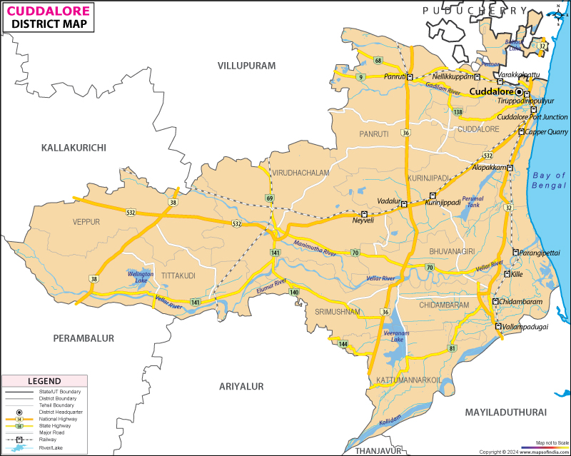
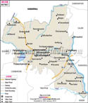
Cuddalore District Map


District Map of Cuddalore

separator Click here for Customized Maps arrow custom map
District Map of Cuddalore
Print Email Save
*The Map showing the National Highway, Major roads, other Roads, District Headquarter, Town, etc in the Cuddalore District, Tamil Nadu Disclaimer


  Major Districts of Tamil Nadu  
Kanchipuram District Map Vellore District Map Salem District Map Tirunelveli District Map
Kanchipuram District MapVellore District MapSalem District MapTirunelveli District Map
    
Erode District Map Tiruvallur District Map Thanjavur District Map Viluppuram District Map
Erode District MapTiruvallur District MapThanjavur District MapViluppuram District Map
  other districts of Tamilnadu  >>

Cuddalore district of Tamil Nadu is spread over 3,678 Sq. km of Tamil Nadu. As per 2001 census, the district has the population of 22,85,395, comprising of 11,50,908 male and 11,34,487 female population.

Major food crops grown in Cuddalore district are paddy, groundnut, sugarcane, cholam, cambu, redgram, tapioca, greengram, blackgram, coriander, banana, maize, varagu, and cashewnut. Some other crops that are grown in the region are gingelly, cotton , groundnut, and coconut.

Popular tourist destuinations of Cuddalore district are :
  • Pichavaram
  • Vadalur
  • Srimushnam
  • Mangrove Forest at Pichavaram
  • Lignite Mines at Neyveli
  • Natrajar Temple at Chidambaram
  • Padaleeswarar Temple at Cuddalore
  • Devanatha Swami Temple at Cuddalore
  • Bhuvaraha Swami Temple at Srimushnam


Last Updated on : February 27, 2024