





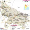
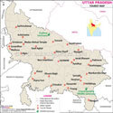
About Uttar Pradesh Map
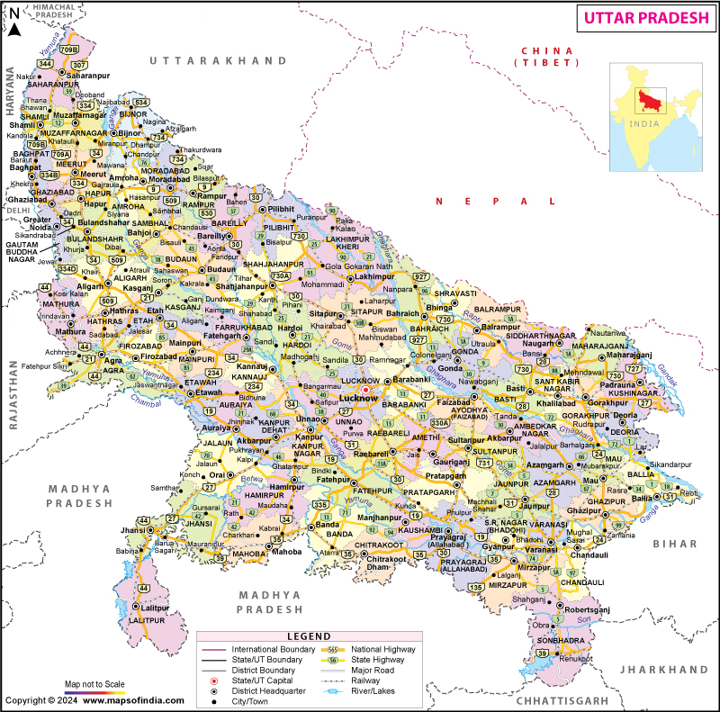
The Uttar Pradesh Map is a valuable geographical resource for Uttar Pradesh in India, which is also the most populous and one of the country's largest states by geographical area. It explains the administration, districts, big cities, transport, rivers and neighboring states. It can be used for various purposes, such as studying, learning, planning trips, conducting research, and as a reference guide. The Uttar Pradesh State Map is particularly useful for understanding the state's administrative structure, transportation network, and geographical layout. Uttar Pradesh is also a strategic state, surrounded by several states of India and also by the bordering country of Nepal, and it is also a major cultural, economic and political centre of India. The UP map serves as a useful reference for understanding the state’s districts, cities, rivers, and important locations in a simple geographical format.
The UP Map identifies 75 districts of the state, the state capital Lucknow, major cities Kanpur, Varanasi, Agra, Prayagraj and Ghaziabad and main highways, rail lines and river lines. The Uttar Pradesh map with Districts helps users easily locate district boundaries, headquarters, and major urban centres across the state. It's especially helpful for students taking competitive tests, researchers interested in regional populations, travellers planning trips, and companies interested in exploring opportunities in the various areas of the state. A precise Map of Uttar Pradesh can also help in comprehending the administrative planning and regional connectivity. A detailed UP state map provides a better view of administrative boundaries, transportation routes, and the overall structure of Uttar Pradesh.
A UP Map is not just an administrative map, but also contains information about the rich cultural and historical background of the State. The Map of Uttar Pradesh can be used to locate the most important destinations of India, like the iconic Taj Mahal among its cities and towns at Agra, the spiritual ghats of Varanasi, and the sacred confluence at Prayagraj. Given the importance of the state in the development of the country, it is highly important to have an accurate and updated Uttar Pradesh Map, which can help one understand the geography of the state, its infrastructure, as well as its importance in the context of the country. The detailed UP Map, whether for educational, travel, research or governance reasons, is an essential tool for exploring the State. The Uttar Pradesh map is widely used by students, travellers, and researchers to explore the geography and regional importance of the state. The UP Map helps users quickly identify districts, major cities, rivers, and transport routes.
Uttar Pradesh
Uttar Pradesh is one of the important states of India in terms of population, history, culture and economy. It is situated in the northern part of India and takes up a significant part of the fertile Indo-Gangetic Plains, and is an ancient hub of religious practice and cultural development as well as politics. The state plays a significant role in the nation's agricultural production and also has a significant share in other industries like textiles, leather, handicrafts, manufacturing and IT.
The State Capital, Lucknow, is famous for its architecture, culture and cuisine. The other major cities are economic, cultural and educational centres: Kanpur, Agra, Varanasi, Prayagraj, Noida and Ghaziabad. Uttar Pradesh's rich heritage, cultural pluralism, and strategic geopolitical position continue to shape its social, political, and economic dynamics and influence the future of India.
A detailed Uttar Pradesh Map is useful for education, travel planning, and regional analysis. The latest UP Map provides a clear overview of important locations across the state.
History
The Uttar Pradesh Map also helps visitors locate important historical cities and heritage sites. Uttar Pradesh has a rich history that is closely linked with the development of Indian civilisation. The region was home to ancient kingdoms such as Kosala and Kashi, while cities like Varanasi emerged as important centres of religion, philosophy, and trade. Sarnath holds special significance as the place where Gautama Buddha delivered his first sermon after attaining enlightenment.
During the Gupta period, the region witnessed remarkable progress in literature, education, science, and art. Later, it became an important part of the Delhi Sultanate and the Mughal Empire, leaving behind iconic monuments such as the Taj Mahal in Agra. Meerut played a key role in the Revolt of 1857, which marked the beginning of India's First War of Independence. After India gained Independence in 1947, the United Provinces was renamed Uttar Pradesh on 24 January 1950, and the state has since remained an influential centre of Indian politics and governance. Using a UP Map makes it easier to explore the state's historical regions.
Culture
The culture of Uttar Pradesh has evolved over centuries through the influence of diverse communities, religions, and traditions. Festivals such as Diwali, Holi, Dussehra, Eid, and Janmashtami are celebrated with great enthusiasm across the state. The Uttar Pradesh Map helps travellers discover famous cultural destinations across the state.
Uttar Pradesh is renowned for its artistic heritage, including Banarasi silk sarees, Moradabad brassware, Firozabad glassware, and Lucknow's famous Chikankari embroidery. The state has also made significant contributions to Indian classical music and dance, particularly Kathak, which flourished in the courts of Lucknow. Its cuisine, especially Awadhi dishes such as kebabs, biryani, kachori, peda, and jalebi, is widely enjoyed across India. A reliable UP Map is useful for planning visits to festivals and heritage centres.
Language
Hindi is the principal official language of Uttar Pradesh, while Urdu also has official-language status. English is widely used in higher education, business and official communication. Awadhi, Bhojpuri, Braj and Bundeli are among the major regional speech varieties and linguistic traditions found across the state. The dialects have a rich literary tradition and are still important in maintaining local cultural identities. The Uttar Pradesh Map is frequently used by students studying regional geography.
Urdu also holds an important position in the language heritage of the state, especially in Lucknow, which became the hub of Urdu literature and poetry. English is widely used in higher education, business and government communication. The presence of several languages in Uttar Pradesh is a testament to its rich cultural heritage and history. The UP Map provides a simple way to understand the state's administrative divisions.
Geography
The Uttar Pradesh Map clearly represents rivers, plains, forests, and major settlements. Uttar Pradesh covers an area of about 240,928 square kilometres and forms a major part of the fertile Indo-Gangetic Plain. The state is traversed by important rivers, including the Ganga, Yamuna, Ghaghara, Gomti, Rapti, and Chambal, which support agriculture, irrigation, and human settlements. The Uttar Pradesh State Map provides a clear representation of the state's rivers, plains, forests, agricultural regions, and major urban centres.
The climate is predominantly subtropical, with hot summers, a southwest monsoon from June to September, and cool winters. Fertile alluvial soil and extensive irrigation make Uttar Pradesh one of India's leading producers of wheat, rice, sugarcane, and pulses. The state also includes important ecological areas such as Dudhwa National Park, while rapidly growing urban centres like Noida, Ghaziabad, and Lucknow coexist with its predominantly rural landscape.
Uttar Pradesh District Map
The Uttar Pradesh Map provides a complete district-wise geographical reference. The Uttar Pradesh District Map shows all 75 districts along with their boundaries, headquarters, and administrative divisions across regions such as Western Uttar Pradesh, Awadh, Bundelkhand, Purvanchal, and Rohilkhand. It is widely used for education, administration, research, regional planning, and competitive exam preparation. An updated Uttar Pradesh Map with districts provides accurate information for understanding the state's administrative structure and regional distribution. The UP Map is widely used for district-level planning and research.
Uttar Pradesh Road Map
The Uttar Pradesh Road Map shows major national highways, state highways, expressways and important road connections across the state. The UP Road Map gives the details of all the major roads and highways of UP and their routes and lengths. Uttar Pradesh has one of the largest and most dense road transportation systems in India, which supports trade, tourism, agriculture, and economic development. A modern Uttar Pradesh Map helps users understand expressways and highway connectivity.
The map shows important district roads, national highways, State highways and expressways. Significant connectivity has been facilitated through the key infrastructure initiatives of Yamuna Expressway, Agra-Lucknow Expressway, Purvanchal Expressway, Bundelkhand Expressway and Ganga Expressway. The systems of expressways have shortened traffic transit times and heightened flows of transportation between cities and villages.
This UP road map is particularly beneficial for route planning, logistics firms, the planning of freight transport, and businesses assessing transportation networks. It can also create an awareness among the users about the strategic role of Uttar Pradesh as a major transit zone between the Northern, eastern and central parts of India. Hence, the UP Map supports efficient route planning across the state.
Uttar Pradesh Railway Map
Uttar Pradesh has an extensive railway network connecting major cities and important industrial, commercial and pilgrimage centres across the state. The state acts as an important railway centre of India to link different parts of India with a network of railway lines for both passenger and goods. The Uttar Pradesh Map highlights important railway corridors connecting major cities. Rails are a key component of industry, tourism, and everyday mobility.
The map prominently mentions different railway junctions of major cities like Lucknow, Kanpur, Prayagraj, Varanasi, Agra, Gorakhpur, Jhansi and Bareilly. The junctions are also important as they link Uttar Pradesh to major metro cities and neighbouring states. The map also shows significant railway lines, divisions and routes, which are used for goods and people transport.
The railway map is useful for learning about and understanding the transportation infrastructure and regional connectivity within the state. The UP Map is useful for understanding the state's railway infrastructure.
Uttar Pradesh Political Map
The Uttar Pradesh Political Map displays the state's administrative divisions, district boundaries, divisional headquarters, district headquarters, and major cities. It is widely used for education, governance, elections, public administration, and regional planning. An updated Uttar Pradesh Map helps users understand the state's administrative structure, political boundaries, and the relationship between different districts and neighbouring states.
Uttar Pradesh Physical Map
The Uttar Pradesh Physical Map highlights the state's natural features, including rivers, plains, forests, wetlands, and protected areas. Most of the state lies within the fertile Gangetic Plain, while major rivers such as the Ganga, Yamuna, Ghaghara, Gomti, Rapti, and Chambal shape its landscape and support agriculture and settlements. The Uttar Pradesh Map provides valuable insights into the state's physical features.
The map also identifies important ecological regions, including Dudhwa National Park, and the northern part of the state includes the Terai region adjoining the Himalayan foothills. It is a valuable resource for students, researchers, geographers, and travellers seeking to understand the state's physical geography and natural environment. The UP Map is an excellent resource for students, researchers, and travellers.
| UP State Information | |
|---|---|
| Capital | Lucknow |
| Date of formation | 24. Jan. 1950 (Renamed as Uttar Pradesh) |
| Governor | Anandiben Patel |
| Chief Minister | Yogi Adityanath |
| Tourist attractions | Taj Mahal, Varanasi Ghats, Triveni Sangam, Ayodhya, Sarnath, Mathura-Vrindavan |
| Festivals | Karva Chauth, Annakoot, Shitala Ashtami, Eid |
| Major dance and music forms | Kathak, Lucknow and Benares Gharanas of music |
| Arts and crafts | Chikankari, Banarasi brocade, brassware, glassware, carpets and Sanjhi art |
| Languages | Hindi, Urdu, English |
| Size | 240,928 sq. km |
| Population | 199,812,341 (Census 2011) |
| Rivers | Ganga, Yamuna, Gomti, Ghaghra, Ramganga, Betwa |
| Forests and wildlife sanctuaries | Dudhwa NP |
| State animal | Swamp Deer |
| State bird | Sarus crane |
| State flower | Palash |
| State tree | Ashok |
| Major crops | Wheat, rice, pulses, Sugar Cane |
| Factoids | Sarnath: The Dhamek Stupa is an important Buddhist monument associated with Sarnath, where Buddha delivered his first sermon. |
| Taj Mahal: The Taj Mahal was commissioned by Mughal emperor Shah Jahan in memory of Mumtaz Mahal. | |
| No. of District | 75 |
Divisions of UP
| Prayagraj Division | Faizabad Division | Mirzapur Division |
| Agra Division | Basti Division | Kanpur Division |
| Bareilly Division | Jhansi Division | Saharanpur Division |
| Aligarh Division | Devipatan Division | Meerut Division |
| Chitrakoot Division | Lucknow Division | Varanasi Division |
| Azamgarh Division | Gorakhpur Division | Moradabad Division. |
Districts of UP
Given below are the names of the 75 districts of the state:
| Agra | Basti | Maharajganj | Ghaziabad |
| Firozabad | Sant Kabir Nagar | Jalaun | Hapur |
| Mainpuri | Siddharthnagar | Jhansi | Meerut |
| Mathura | Banda | Lalitpur | Mirzapur |
| Aligarh | Chitrakoot | Auraiya | Sant Ravidas Nagar |
| Etah | Hamirpur | Etawah | Sonbhadra |
| Hathras | Mahoba | Farrukhabad | Amroha |
| Kasganj | Bahraich | Kannauj | Bijnor |
| Prayagraj | Balarampur | Kanpur Dehat | Moradabad |
| Fatehpur | Gonda | Kanpur Nagar | Rampur |
| Kaushambi | Shravasti | Hardoi | Sambhal |
| Pratapgarh | Ambedkar Nagar | Lakhimpur Kheri | Muzaffarnagar |
| Azamgarh | Amethi | Lucknow | Shamli |
| Ballia | Barabanki | Raebareli | Saharanpur |
| Mau | Faizabad | Sitapur | Chandauli |
| Badaun | Sultanpur | Unnao | Ghazipur |
| Bareilly | Deoria | Bagpat | Jaunpur |
| Pilibhit | Gorakhpur | Bulandshahr | Varanasi |
| Shahjahanpur | Kushinagar | Gautam Buddha Nagar |
FAQs
Q1: What are the major tourist attractions visible on a Map of Uttar Pradesh?
Some major attractions include the Taj Mahal in Agra, the ghats of Varanasi, Ayodhya, Mathura, Vrindavan, Sarnath, and Prayagraj.
Q2: What is a Kumbh Mela and where does it take place in Uttar Pradesh?
Prayagraj hosts the Kumbh Mela periodically at the confluence of the Ganga, Yamuna and the traditionally revered Saraswati.
Q3: Which states share a border with Uttar Pradesh?
Uttar Pradesh shares borders with Uttarakhand, Himachal Pradesh, Haryana, Delhi, Rajasthan, Madhya Pradesh, Chhattisgarh, Jharkhand, Bihar, and also shares an international border with Nepal.
Q4: What is the total area of Uttar Pradesh?
Uttar Pradesh covers an area of approximately 240,928 square kilometers, making it one of the largest states in India by area.
Q5: How many divisions are there in Uttar Pradesh?
Uttar Pradesh is divided into 18 administrative divisions, each comprising multiple districts.
Q6: Which is the largest district in Uttar Pradesh by area?
Lakhimpur Kheri is the largest district in Uttar Pradesh by area.
Q7: Which is the smallest district in Uttar Pradesh by area?
Hapur is the smallest district in Uttar Pradesh by area.
Click to View Large Map of Uttar Pradesh
Last Updated on: October 05, 2026