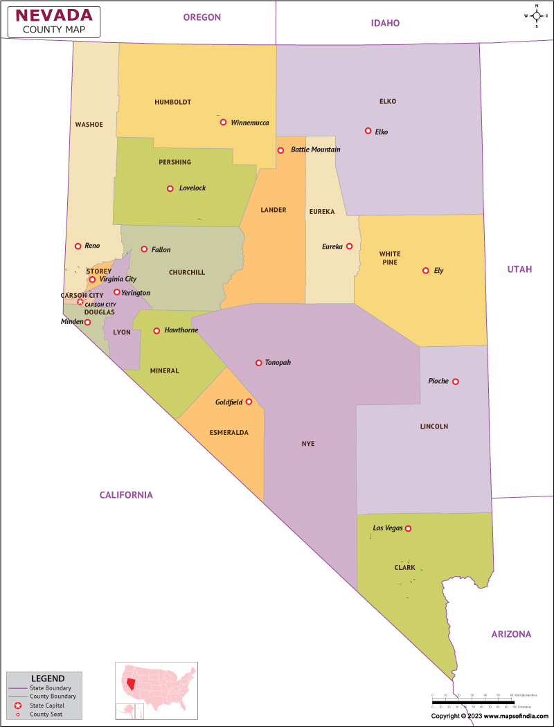
The arid state flourished with mountains, semi arid grasslands and sandy alkali deserts, Nevada, was admitted to the union in the year 1864, as the 36th State of the Union. A good chunk of the Nevadan population resides in the urban areas with half of them living in Las Vegas alone. The Nevada State Museum stands as a historical emphasis to the mining industry and mineral collections of the State. The resort industries of Las Vegas and Reno has attracted substantial population over the years making the place a leading land of metropolis activities.
History
The mountainous land of Nevada inhabited people from the Native American Tribes including Shoshone, the Paiute, the Washoe, and the Mohave. These tribes resided in small villages and coexisted peacefully before the arrival of European settlers. The Spanish were the first Europeans to arrive on the land in the 1700s. The Mexican-American War overthrew the Spanish and Mexican claim to the land. As part of the Treaty of Guadalupe Hidalgo, Nevada became part of the United States in 1848. The state became its own territory in the year 1861 and admitted to the Union in 1864. Mormons are considered to be one of the first permanent settlers of the land in 1851. The California Gold Rush attracted many visitors to California, eventually making it an excellent tourist spot even in the present years. In the hopes of recovering from the Great Depression, Nevada legalized gambling in 1931. With time the industry boomed to an impressive extent. Today, the casinos of Las Vegas are tourist magnets and form a major industry of the state.
Culture
The state of Nevada offers to you much more than the scintillating charm of drinks and debauchery. The City of Sin is indubitably the most attractive part of the State. However, small towns like Ely and Elko are known to embrace gambling in a much western style. The state also has a good number of retiree populations residing mostly in Las Vegas. The demographic structure of the state includes a good mix of senior citizens, blue-collar casino workers, grizzled cowboys, party-mongers, etc. The rural areas of the state have a much more amicable ambience and welcoming to visitors. The gorgeous state of Nevada elegantly flaunts one of its cities' saying, "What happens in Vegas, stays in Vegas".
Language
English is the most spoken language of the state. Spanish falls second, with Asian and Pacific Island languages also widely used in the state.
Geography
The most mountainous and driest state of the United States shares its boundaries with Oregon and Idaho in the north and with California and Arizona in the south. Utah and Arizona reside in their east and California in the west. The state's land can be divided into three parts, categorized, the Columbia Plateau, the Sierra Nevada mountain range, and the rest is covered with Basin and Range region.
FAQs
Q1: Where does the state derive its name from?
Nevada’s name comes from the Spanish word nieve, which roughly means “snow-capped" referring to the Sierra Nevada mountain range.
Q2: Why is it nicknamed the Silver State?
It is named so as a nod to a major silver deposit that attracted settlers and strengthened the area’s economy.
Q3: What are some underground treasures of the state?
They include gold, silver, copper, and some of the world’s best black opals.
Q4: What are some of the popular figures from Nevada?
Tennis pro Andre Agassi and Patricia Ryan Nixon, former first lady of the United States are some of the gems of the State.
Last Updated on: July 20, 2023
