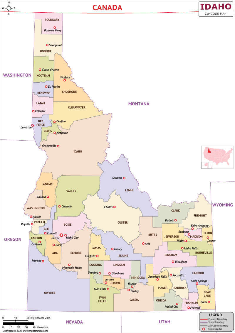
The state of Idaho can be found in the Western United States Pacific Northwest region. Despite having the seventh-least amount of people per square mile of any of the 50 states in the United States and the fourteenth-largest state by land area, Idaho has about 1.8 million residents. Manufacturing, agriculture, mining, forestry, and tourism are key sectors of the state's economy. Idaho is home to the largest Department of Energy facility in the nation, the Idaho National Laboratory, as well as several science and technology companies that either have their headquarters or have factories there.
Boise is the largest and the state's capital city. The county seat of Ada County is located in Boise, which is also the capital and most populous city of Idaho in the United States. Located on the Boise River in southwest Idaho, it is 110 miles north of the Nevada border and 41 miles east of the Oregon border. At 2,704 feet above sea level, the downtown area is situated.
History
One of the last places in the lower 48 US states to be explored by people of European descent was Idaho. On August 12, 1805, at Lemhi Pass, the Lewis and Clark expedition arrived in what is now Idaho. The area that included Idaho was disputed for many years between the United States and Great Britain. Through the Oregon Treaty with Britain, the region was admitted to the Union in 1846. It became part of the Oregon Territory in 1848 only.
Culture
The cultural landscape of Idaho is diverse. Given that it was one of the last states in America to be colonized by Europeans, it doesn't appear to have any particular dominant heritage. The southern part of the state has a sizable farming community where large farms grow wheat, potatoes, and barley. Since all of the major cities are concentrated in the south, this predominantly white state has the greatest ethnic diversity there. At historical sites, museums, and distinctive events all over the state, Idaho's rich culture and history are prominently displayed.
Language
In Idaho, the English language combines Northern and North Midland characteristics, with specific Northern pronunciations designating the panhandle. Apache, Cherokee, Choctaw, Dakota, Keres, Pima, and Yupik are among the languages spoken at home by a significant number of people. Many Native Americans who had previously resided in the northern reaches of the Great Basin and the Rocky Mountains now call this area home.
Geography
Idaho is a Rocky Mountain state with a wealth of wildlife and beautiful scenery. Rapids, large lakes, steep canyons, and snow-capped mountain ranges can all be found in the state. The Snake River's waters flow through the deepest gorge in the US, Hells Canyon. Shoshone Falls plunges from cliffs at a higher elevation than Niagara Falls. Idaho has two time zones, with the border between them roughly located halfway between Canada and Nevada.
| Official name | Idaho |
| Capital | Boise |
| Population | 19 Lakhs |
| Area | 216,632 km² |
| Currency | US Dollar |
| Religion | Baptist Family |
| Language | English |
| Major cities | Boise, Moscow, Idaho Falls |
FAQs
Q1: What is the official language of Idaho?
English is the official language of Idaho.
Q2: What is the capital of Idaho?
Boise is the capital of Idaho.
Q3: What is the currency of Idaho?
American Dollar is the currency of Idaho.
Q4: What is the climate in Idaho?
With an average daily high temperature of only 15 degrees, Idaho is one of the coldest places in the United States of America.
Last Updated on: June 27, 2023
