
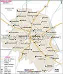
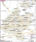
With a poplution of approximately 6 lakhs, Gulbarga District has an agrarian economy supplemented by a handful of cement, textile, leather and chemical industries.
Tourism is a significant revenue-generating sector in Gulbarga. The district's tour de force includes:
- Gulbarga Fort
- Khandar Khan's mosque
- Hirapur mosque
- Sharana Basaveshwara Temple
- Khaja Bandenawaj
- Ganagapur
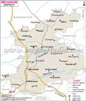
- From Nagpur - 640 KM
- From Mumbai - 564 KM
- From Bangalore - 663 KM
- From Hyderabad - 214 KM
- From Delhi - 1691 KM
- From Chennai - 778 KM
Last Updated on : May 11, 2026