






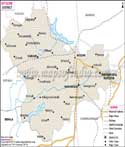
About
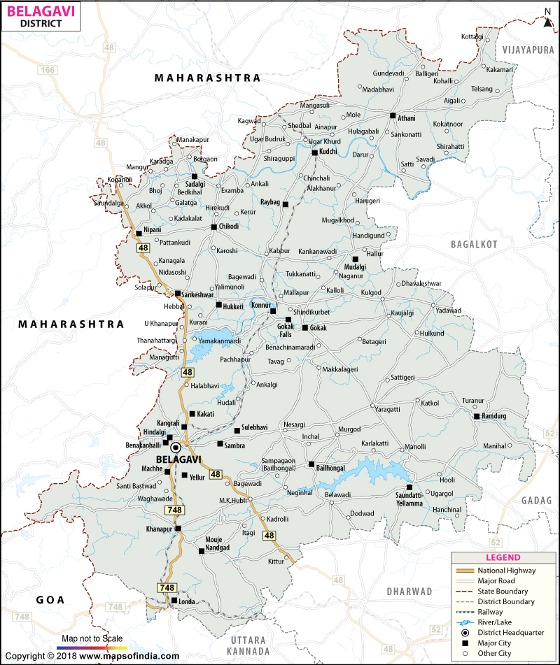
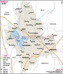
Belagavi or Belgaum is one of the wealthiest and densest Districts of Karnataka and is in the north west part of the State adjoining Maharashtra and Goa. The name of the district is to honour its head city, Belagavi, which is reputed to have been named after "Venugrama" or "bamboo village" from which bamboo was once grown around the village. It is also the second state legislature building of Karnataka – Suvarna Vidhana Soudha – built to ensure administrative parity for the region with Bengaluru. Belagavi is an inter-state and inter-district border district adjoining the Dharwad, Gadag, Bagalkot, Kolhapur (Maharashtra) and Sangli (Maharashtra) districts and also adjoining Goan and is a truly border district in terms of language, culture and trade. Belagavi's special characteristics of having leafy forests of the Western Ghats, black soil fertility and a history of contribution to the freedom movement from Rani Chennamma of Kittur and historic forts make it one of the few special districts in Karnataka.
History & Culture
Belagavi's written history started with the Ratta dynasty who ruled around 12th century and constructed the Belagavi Fort, which was fortified and modified by the Vijayanagara empire, the Bijapur Sultanate, the Marathas and the British who utilized it as a cantonment town. Before the influence of the Rattas, the entire area was under the sway of the Chalukyas of Badami and the Kadambas of Banavasi whose second capital at Halasi (currently Khanapur taluk) is also a significant historical site with ancient temples built during the Kadamba rulers' period. The freedom movement of the district, in which Rani Chennamma of Kittur, an erstwhile princely state in the district, raised an armed revolt against the British East India Company in 1824, a long while before the 1857 uprising, is one of the most popular events. The Kittur Fort and museum today commemorate her as one of the first women freedom fighters in Indian history.
Belagavi also has symbolic political significance because of the Suvarna Vidhana Soudha set up in the wake of a number of demands connected to the Belagavi border issue between Karnataka and Maharashtra State as well as the venue of Indian National Congress session in 1924 presided by Mahatma Gandhi. The district is also a cultural crossroads as Kannada, Marathi, Konkani and Urdu are spoken in patches throughout the district. The district's religious life is based on the cornerstones of several religious sites like Yellamma Devi temple at Saundatti, one of the most visited Shakti pilgrimage centres in north Karnataka visited by huge crowds during annual jatra, Military Mahadeva temple and Kapileshwara temple in Belagavi city, associated with the sacred and revered Jyotirlinga. The district is also known for its handloom and food culture, such as the unique kunda (sweet) prepared from milk and its rich religious diversity, including the important shrine and churches like St. Mary's Church.
Economy
The economy of Belagavi is diversified and agriculture, industry and service sector activities are strong. The district has been benefiting from its administrative status as it is the winter home of the state legislature of Karnataka, and has been the recipient of much government investment, infrastructure and jobs. In addition to the offices of the Zilla Panchayat, the revenue departments and the district hospital, there are a number of jobs in the public sector like the Airmen Training School of the Indian Air Force at Sambra, the Army Commando School and a School of Jungle Warfare. The main activity in Public Sector in Belagavi is production of sugar- the district has become one of the most important districts for sugarcane cultivation and sugar processing in Karnataka with large number of sugar cooperative and private sugar mills and has also developed large number of cotton, cast-iron and foundry industries around Belagavi city which is known for its cast-iron and foundry industries which produces components for the country.
Agriculture is one of the major economic activities and the plains of the district are irrigated using water from the Krishna, Malaprabha and Ghataprabha rivers and reservoirs such as Hidkal dam, Malaprabha dam etc. and sugarcane, cotton, tobacco and foodgrains are extensively cultivated. The city of Belagavi, with the support of Visvesvaraya Technological University, several medical institutions and engineering institutions, has become a hub of education and healthcare excellence in the region, as far as the Services Sector is concerned. Tourism, trade and transport services are also important as the district is considered a commercial gateway between Karnataka and Maharashtra and Belagavi City is a major commercial and logistics hub on the rail lines as well as the National Highway corridor with the Belagavi Airport playing an important role between the district and other major cities in India.
Tourism
In the taluks of Belagavi district there are numerous historical, religious and natural places spread out across the district. Belagavi Fort, a century-old fortress, is the main and historical landmark of the city of Belagavi, with shrines dedicated to Durga and Ganapati and Kamal Basadi Jain temple, Safa Masjid inside the fort. The Military Mahadeva Temple and Kapileshwara Temple, which are significant places on the Jyotirlinga pilgrimage circuit, are very popular amongst the devotees especially during the Maheshwari day. The valour of Rani Chennamma is honored at Kittur Fort and the museum, which is located a bit further from the city, is one of the most visited historical places in the district. Gokak Falls is another highlight of nature and adventure, the Ghataprabha river plunging over a horseshoe-shaped sandstone fall of approximately 52 metres - and it was here that one of the earliest hydropower generation plants in India was set up in 1887. Godchinamalaki and nearby Vajrapoha falls on the Markandeya river are other scenic detours. The Sada Falls trek attracts adventure lovers with its trekking into thick forests and rocky areas, the Kavala Caves with its stunts and activities, and the Bhimgad Wildlife and Dhupdal Dam bird sanctuaries are also worth a visit to enjoy wildlife and bird watching.
The Yellamma Devi Temple at Saundatti, one of the most important Shakti pilgrimage centres of the region, is the major centre of religious tourism and attracts huge numbers of visitors during its annual fair; the ancient religious town of Halasi in Khanapur taluk, which was the second capital of the Kadamba dynasty, is also a major centre of religious tourism. Other sites of interest are the Suvarna Vidhana Soudha, the Sangolli Rayanna Rock Garden and the beautiful green and biodiversity of Jamboti in the Western Ghats.
Demographics
As per the 2011 census the population of the district is 47,79,661 out of which the number of males is 24,23,063 and females is 23,56,598. The same census also denotes that the literacy rate of the district is 73.28% and the female percentage in this statistics is 64.58%, whereas male literacy is 82.2 %. This shows that the gender ratio is not so great as there are around 966 females per 1000 males. Apart from this the population density is approximately 316 persons per sq. km.
The female-to-male difference in the literary rates has however improved as per the more recent labour force surveys which show that the district literacy rate for 2023–24 is closer to 81 per cent. The district has a population of approximately 12.1 per cent STs and 6.2 per cent of STs. The district lies at the linguistic junction of three linguistic regions and hence Kannada is the main language with considerable density of Marathi, Konkani and Urdu speakers being found in the border talukas adjoining Maharashtra and Goa, respectively and in the Urdu-speaking minority group. The district is mostly Hindu with a significant Muslim community, and some Jains, Christians and Sikhs.
Administration
Belgaum district has a large size and population with more than one Lok Sabha seat and a higher number of Vidhan Sabha seats as it has tremendous political influence in Karnataka under the Deputy Commissioner of the Zilla Panchayat system. The district was generally divided into ten taluks but in the recent years it was bifurcated into fourteen taluks for better administration and to bring revenue offices near to the people of the district, which includes Belagavi, Khanapur, Bailhongal, Saundatti, Ramdurg, Gokak, Hukkeri, Sampgaon, Chikodi, Athani, Raybag, Kagwad, Kittur and Nippani taluks of the district revenue sub-divisions. The district is also divided into three revenue sub-divisions to oversee the administrative process and each taluk is also broken up into hoblis and gram panchayats to carry out village-level governance. Belgaum is the largest district in terms of population and administration as it has almost 1275 revenue villages along with more than 30 towns and municipal areas. The huge network of taluks/hoblis /panchayats provides an efficient administration of essential services, welfare programmes and rural development schemes in the different landscape of the district from the plains bordering Maharashtra to the taluks of Western Ghats with forest cover.
| Facts of Belgavi District | |
|---|---|
| Official Name | Belgavi |
| Location | Karnataka |
| Area (km2) | 13433 |
| Population | 4779661 |
| Language | Kannada |
FAQs
Q1: How many villages are there in Belgaum district?
There are 1275 revenue villages.
Q2: What is the population of Belgaum district?
The population of the district is 47,79,661.
Q3: Where is Belgaum district famous?
The Belagavi Fort, Kittur Fort, Gokak Falls, Suvarna Vidhana Soudha, and Yellamma Devi temple at Saundatti are famous attractions of Belagavi.
Q4: What were the reasons for Belgaum to be renamed as Belagavi?
The state government officially changed the names of the city and the district to Belagavi and along with a few other Kannada cities respectively, to give a boost to Kannada names for different important places.
Q5: What is the literacy rate of Belgaum district?
According to the census 2011, the overall literacy rate of Belgaum district is 73.48%.
Q6: How many Taluks are there in Belgaum district?
The district was earlier subdivided into 10 taluks, but in recent years it has been reorganized into 14 taluks.
Q7: What is the link between Belgaum and Rani Chennamma?
Rani Chennamma was an armed freedom fighter against the British East India Company in 1824 with her base at Kittur within Belgaum district and was one of the earliest women freedom fighters in India.
Q8: Which languages are spoken here?
Kannada, Marathi, Konkani and Urdu are the languages spoken here.
Belgaum Distance Chart
Last Updated on : August 03, 2026
