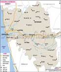
Uttara Kannada is one of the biggest districts of Karnataka. It is located in the western part of the state.
Uttara Kannada is divided into four sub-divisions namely Karwar, Sirsi, Kumta and Bhatkal.
The district has a population of 1,353,644 according to the census of 2001.
The total area of the district is 10.25 lakh hectares.
Uttara Kannada District Map |
|
||||||||||

| ||||||||||
|
| *District Map of Uttara Kannada highlights national highway, major roads, railways, rivers, etc. |
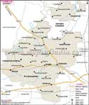
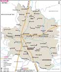
| Major Districts of Karnataka |
 |
 |
 |
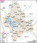 |
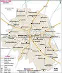
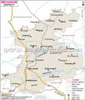
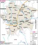
| Bangalore District Map | Belgaum District Map | Gulbarga District Map | Shimoga District Map |
 |
 |
 |
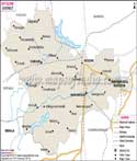 |
| Tumkur District Map | Bijapur District Map | Dakshin Kannad District Map | Mysore District Map |
| other districts of Karnataka >> | |||
Last Updated on : May 11, 2026