





| Adilabad District Fact Sheet | |
|---|---|
| District | Adilabad |
| Headquarters | Adilabad |
| Population (2011) | 2737738 |
| Area (/km2) | 16105 |
| Denisty ((/km2)) | 170 |
| Literacy | 0.6155 |
| Forest Area under the control of Forest Department (Area in Hectares) | 6,89,517 |
| Languages Official | Telugu |
| Temple | Gnana Saraswati Temple, Basar |
| Mandals | Adilabad, Asifabad,Bazarhathnoor, Bejjur, Bela, Bellampalle, Bhainsa, Bheemini,Boath, Chennur, Dahegaon, Dandepally, Dilwarpur, Gudihathnoor, Ichoda, Indervelly, Jainad, Jainoor, Jaipur, Jannaram, Kaddam, Kagaznagar, Kasipet, Kerameri, Khanapur, Kotapally, Kouthala, Kubeer, Kuntala, Laxmanchanda, Lokeshwaram, Luxettipet, Mamda, Mancherial, Mandamarri, Mudhole, Narnoor, Nennel, Neredigonda, Nirmal, Rebbena, Sarangapur, Sirpur(T), Sirpur(U), Talamadugu, Tamsi, Tandur, Tanoor, Tiryani, Utnoor, Vemanpally, Wankidi |
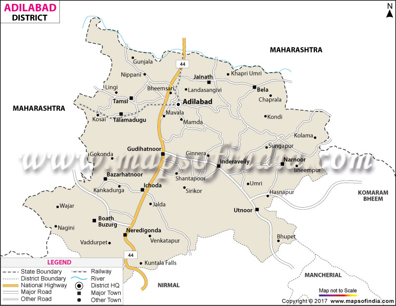
Adilabad District Map (Telangana) |
|
||||||||||
 | ||||||||||
|
| *Adilabad District Map highlights the National Highway, Major Roads, District Headquarter, etc in Adilabad. |
| Districts of Telangana |
 |
 |
 |
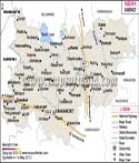 |
| Adilabad District Map | Nalgonda District Map | Mahbubnagar District Map | Medak District Map |
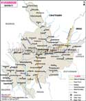 |
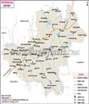 |
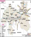 |
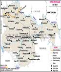 |
| Khammam District Map | Warangal District Map | Rangareddi District Map | Karimnagar District Map |
 |
 |
||
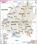
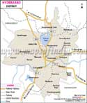
| Nizamabad District Map | Hyderabad District Map | ||
About
Surrounded by emerald forests, ancient river valleys and rugged Deccan, Adilabad is a colourful corner of the northernmost state in the land of Telangana. The Adilabad district map is transformed to a map of the gateway district—a territory between the Deccan Plateau and Central India, surrounded comfortably by the districts in Maharashtra such as Nanded, Yavatmal and Chandrapur. However, long before the Middle Ages, sultans took over the canvassed terrain, the rhythm drummed and bounced by indigenous civilisations, setting off centuries of cultural evolution.
The district covers a geographical area of about 4,153 km², serving as a biological and cultural oasis in the state. The dense teak forests and xeric deciduous forest cover the landscape, forming a cooler microclimate as high up in the forest uplands. It is bordered by a mighty river Penganga and its knitted tributaries, Kadam and Saathnala, running through the heartland. The Adilabad district map shows that the district is located on the important national transportation routes and is a vital point of connection between Northern India and Southern India. It's the territory known for its unspoiled waterfalls, wide expanse of cotton fields and ancient traditional roots from its aboriginal tribes. An Adilabad district map holds particular significance when viewed in the context of agriculture and forests, revealing that human living and nature conservation areas often fall along the same lines.
History & Culture
The area dates back much longer than its current status as a district. The district's own tourism records indicate that Pandavula Gutta caves are one of the more archaeological spots in Telangana with evidence of human settlements dating back to the Paleolithic era. Later the district was under Kakatiya rule and the temple complex in Ghanpur, locally known as "Kota Gullu", was constructed during the reign of Kakatiya king Ganapati Deva, which is a testimony of the architectural aspirations of those days.
The district's name itself is a testament to Acharya Kothapalli Jayashankar, who was a scholar and a proponent for the creation of the state of Telangana. It is one among a few districts in the state named after a modern political and intellectual figure instead of a place or ruling dynasty. Culturally, the district has a strong Telugu identity – Bathukamma and Bonalu are observed all over the district and Maha Shivaratri, at Kaleshwaram, is attended by large numbers of people who attend for Abhishekam and Rudrabhishekam ceremonies in the old Shiva temple of Kaleshwaram. The presence of the densely forested belts around the district has also led to tribal customs and traditions continuing to have an influence on the culture of the district, with communities in the most remote mandals showing a clear tribal influence in their cultural activities, even with the more mainstream Hindu festivals.
History sleeps here not only in textbooks, but it calls out in volume here to forest valleys and stone old monuments. The history of the area goes back to the remote antiquity, when it was inhabited by the Mauryas, Satavahanas, Vakatakas and Chalukyas of Badami. The Rashtrakutas and Kakatiyas later dominated, and in the medieval period took the place of the suzerainty of the Bahmani Sultans, Bijapur Sultanate and finally the Asaf Jahi Dynasty of the Nizams of Hyderabad. However, what is really the History of this district is the history of its aboriginal communities, the Raj Gonds, Pardhans, Kolams and Lambadas. It is on this very ground that the legendary tribal leader Komaram Bheem started to vigorously fight in the 1930s, inspiring and raising the slogan "Jal, Jangal, Zameen" (Water, Forest, Land) which symbolised indigenous rights.
In the cultural sense, the district is characterised by a curious cross-over identity which sets it apart from the rest of southern India. The locals also have a blend of Telugu and Marathi culture, as well as a unique Adivasi culture, due to its geographical location being very close to Maharashtra, which can be seen while checking the Borderlines with Maharashtra in the Adilabad district map. During Diwali, which is the Hindu festival celebrating the triumph of good over evil, the cultural scene resumes with the performance of the sacred Raj Gond dances Dandari and Ghusadi.
The annual Nagoba Jatara, organised at Keslapur, one of the world's largest tribal congregations in India, is another great cultural landmark. In this poignant ritual, the Mesram group of the Gond tribe across state boundaries provides purification rituals for the Snake God Nagoba, enticing hundreds of thousands of pilgrims. On the other hand, the classical Hindu traditions continue to be preserved with folk traditions at ancient temples such as Jainath Temple. Oral History of the Pardhan bards who sing epic genealogies with homemade string instruments such as the Banam continues the spiritual values and victories of the area through the generations.
Economy
The economy of the region lies in a perfect balance of traditional agriculture, forest resource exploitation, a burgeoning industry and an evolving public administrative system. The extensive green stretches shown on the Adilabad district map are related to the fertile black cotton soil that has given the district the distinction of being known as the ‘White Gold Belt' in Telangana for the state.
Government Sector
The Government Sector plays a significant role as an administrative hub of the North of Telangana, and is a huge source of income and economic stability. The Integrated Tribal Development Agency (ITDA) at Utnoor has a transformative role as it both provides funding and implements welfare programmes, works on preservation programmes for indigenous arts, and carries out special agricultural development programmes. Besides, administrative offices like those of the Forest Department which deal with large tracts of forests, the public works department, social welfare, revenue, education, etc., utilise a considerable amount of educated local labour.
Public Sector
Industrial infrastructure, energy distribution, and exploitation of natural resources are controlled by the public sector. Mineral rich deposits of limestone, manganese ore and clay occur in the region and activities in mining and quarrying are well organised under government auspices. To cater to the huge annual production of these raw materials, such as raw cotton, soya bean, and pulses, there are procurement hubs and warehousing set ups by public sector agencies like the Food Corporation of India (FCI) and Cotton Corporation of India (CCI). In addition, there are extensive power line systems in the district owned by the State power distribution utility.
Services Sector
Services are the fastest-growing sector upon which the recent economic engine has been powered due to the fast paced urban adjoining of Adilabad town and the highways. The district town acts as a top-notch commercial centre of the surrounding rural areas and adjoining mandals in neighbouring Maharashtra. This segment is mainly supported by retail commerce, wholesale agriculture markets (APMC), banks, transport and logistics, and border private health facilities. The study tracks transport routes on the Adilabad district map and their presence right through the region which has led to an ‘economy of the roadside' in the district and inter-state transport trade.
Tourism
The district showcases its raw natural beauty continuously, a paradise of eco-tourism, history, wildlife photography and soul seeking avenues—unspeakable nature at its prime.
Kuntala waterfalls are the tallest among the waterfalls in Telangana, as it falls from a height of nearly 147 feet. Kuntala Falls is formed by the Kadem (Kadam) River as it cascades over rocky cliffs. Local lore says it got its name from Queen Shakuntala, who is supposed to have lived in these verdant forests and bathed in these clean waters.
The Sri Laxmi Narasimha Swamy Temple in the Jainath village is a wonderful specimen of medieval stone sculpture art which gives a testimony of the classical style of art. The temple was constructed during the time of Chalukyan cultural influences and is adorned with intricate carvings on the stone pillars and detailed sculptures of Hindu gods and goddesses, along with ancient Prakrit inscriptions. In October and November, the light from the sun falls exactly on the deity's feet.
The Saathnala dam project provides tranquil water among low-lying green hills and rolling meadows for people who follow water bodies on the Adilabad district map. It provides a vital link to nearby farm villages for irrigation and acts also as a desirable picnic ground, with boating and birdwatching facilities for the visiting families and wintering migrants.
Demographics
Demographic survey analysis shows a very unique population structure consisting of multiple ethnic groups, such as urban people, agricultural rural inhabitants and tribal groups living in the rural area.
Official statistical profile data indicate that the total population is about 708,972, as per the Census 2011. On the whole, there is an average population density of approximately 171 persons per km², which is significantly lower than the state average, because the physical terrain is substantially covered by vast forest reserves. The district has one of the highest numbers of Adivasi population, with 31.6% of the total population in this category from ST.
The district's overall literacy rate stands at around 63.49%, indicating a positive trend in improvement due to specific educational infrastructure development initiatives and tribal welfare programmes. The study shows that the literacy of males is around 70.81%, while the literacy of females is around 51.31%. The state government has established residential schools in rural areas and it is continuing to make strident efforts to close these educational gaps.
Telugu is the main official administrative language in public administration and education, whereas Gondi, Kolami and Lambadi are widely spoken in the tribal settlements. Historical and geographical relationships are evident on an Adilabad district map, and Marathi is fluently spoken by people along the northern boundary of the state, as is Urdu in urban areas as well as Hindi.
Administration
The administration of a territory with dense forest, decentralised tribal villages and growing cities needs a hierarchical system with decentralisation. Adilabad town is the centre of the region with the administrative head office.
On an administrative division layout of the Adilabad district map, it shows that the district is divided into two major Revenue Divisions, namely, Adilabad Revenue Division and Utnoor Revenue Division. These divisions consist of 18 Tehsils (also called as Mandals) which serve as very important units for land revenue, law and order, disaster management and distribution of social relief. These mandals include Adilabad Urban, Adilabad Rural, Mavala, Gudihathnoor, Bazarhathnoor, Bela, Bheempur, Jainath, Talamadugu, Tamasi, Utnoor, Indervelly, Narnoor, Gadiguda, Sirikonda, Ichoda, Neradigonda, and Hasnapur.
The District has about 508 revenue villages, and the development of grassroots democratic governance and localised development is in the hands of local Gram Panchayats. A detailed map for Adilabad was created, showing the various rural settlements and Gudems and the visual picture of the link between them and the mandal headquarters via the growing all-weather road network. This structural connectivity enables the efficient provision of public services, healthcare centres, government schools and agricultural extension services to the forest communities.
FAQs
Q1: What is the district population?
It has 708,972 residents.
Q2: How many villages are there?
There are 508 villages.
Q3: What is the literacy rate?
The rate is 63.49%.
Q4: What makes the district famous?
It boasts waterfalls and cotton.
Q5: What languages do people speak?
Locals speak Telugu and Gondi.
Q6: Which waterfall is the highest?
Kuntala is the highest fall.
Q7: What does an Adilabad district map show?
An Adilabad district map shows 18 tehsils.
Last Updated on : September 01, 2026
