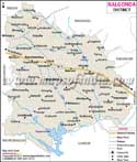
| Nalgonda District Fact Sheet | |
|---|---|
| District | Nalgonda |
| Headquarters | Nalgonda |
| Population (2011) | 3483648 |
| Area ((/km2)) | 14240 |
| Denisty ((/km2)) | 245 |
| Literacy | 0.6505 |
| Forest Area under the control of Forest Department (Area in Hectares) | 83073 |
| Temple | Yadagirigutta Lakshminarasimha Swamy Temple Pangal |
| Languages Official | Telugu, Urdu |
| Mandals | Bommala Ramaram, Yadagirigutta, Tirumalagiri, Atmakur (S), Mothkur, Bhongir, Choutuppal, Narketpally, Kethepally, Mothey, Penpahad, Nalgonda, Marriguda, Nidamanoor, Garidepally, Mellachervu, Neredcherla, Peddavoora, Nampally, Gundlapay, Turkapally, Alair, Thungathurthy, Jajireddigudem, Atmakur (M), Bibinagar, Ramannapeta, Kattangur, Suryapet, Nadigudem, Vemulapally, Munugode, Chandur, Tripuraram, Chilkur, Huzurnagar, Damercherla, P.A.Pally, Chintapally, Chandampet, Rajapet, Gundala, Noothankal, Saligowraram, Valigonda, Pochampally, Chityal, Nakrekal, Chivemla, Munagala, Thipparthy, Narayanapur, Kanagal, Miryalaguda, Kodad, Mattampally, Anumula, Gurrampode, Devarakonda |
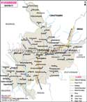
Nalgonda District Map (Telangana) |
|
||||||||||
 | ||||||||||
|
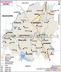
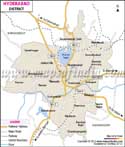
| *Nalgonda District Map highlights the National Highway, Major Roads, District Headquarter, etc in Nalgonda. |
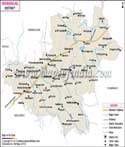
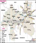
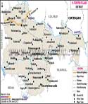
| Districts of Telangana |
 |
 |
 |
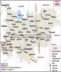 |
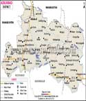
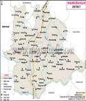
| Adilabad District Map | Nalgonda District Map | Mahbubnagar District Map | Medak District Map |
 |
 |
 |
 |
| Khammam District Map | Warangal District Map | Rangareddi District Map | Karimnagar District Map |
 |
 |
||
| Nizamabad District Map | Hyderabad District Map | ||
Last Updated on : May 11, 2026