





| Khammam District Fact Sheet | |
|---|---|
| District | Khammam |
| Headquarters | Khammam |
| Population (2011) | 2798214 |
| Area ((/km2)) | 16029 |
| Denisty ((/km2)) | 175 |
| Literacy | 0.6546 |
| Forest Area under the control of Forest Department (Area in Hectares) | 7,59,438 |
| Temple | Bhadrachalam Temple Jamalapuram, Stambhadri temple Parnasala |
| Languages Official | Telugu |
| Mandals | Aswapuram, Aswaraopeta, Bayyaram, Bhadrachalam, Bonakal, Burgampadu, Chandrugonda, Chintakani, Chintoor, Cherla, Dammapeta, Dummugudem, Enkoor, Julurpadu, Garla, Gundala, Kalluru, Kamepalli, Khammam (Urban), Khammam (Rural), Kusumanchi, Konijerla, Kothagudem, Kukkunoor, Kunavaram, Madhira, Manuguru, Mudigonda, Mulakalapalli, Nelakondapalli, Paloncha, Penuballi, Pinapaka, Sathupalli, Singareni, Tallada, Tekulapalli, Tirumalayapalem, Vararamachandrapuram (V.R.Puram), Velerupadu, Vemsoor, Venkatapuram, Wazedu, Wyra, Yellandu, Yerrupalem |
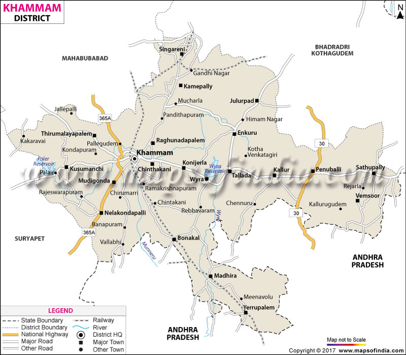
Khammam District Map (Telangana) |
|
||||||||||
 | ||||||||||
|
| *Khammam District Map highlights the National Highway, Major Roads, District Headquarter, etc in Khammam. |
| Districts of Telangana |
 |
 |
 |
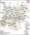 |
| Adilabad District Map | Nalgonda District Map | Mahbubnagar District Map | Medak District Map |
 |
 |
 |
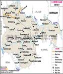 |
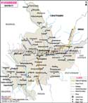
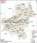
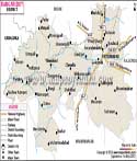
| Khammam District Map | Warangal District Map | Rangareddi District Map | Karimnagar District Map |
 |
 |
||
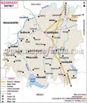
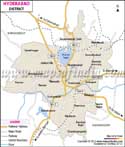
| Nizamabad District Map | Hyderabad District Map | ||
About
The Khammam district is located in the eastern part of Telangana and it is a small island in the middle of the state between the heartland and the adjoining districts of Chhattisgarh in the west and Andhra Pradesh in the east. Khammam is named after its headquarters town, Khammam itself which is believed to be the origin of "Kammamet" or "Khammam Mettu", associated with the old fort situated on a hill, which dominates over the town even today. After the Telangana district reorganisation in 2016, Khammam district was restructured to become a compact administrative district with the eastern tracts with high forest cover being set up as a new district of Bhadradri Kothagudem. What's left is a district of some 4,361 square kilometres of fertile agriculture combined with a few strips of hills and a distinct regional identity.
Suryapet and Mahabubabad districts are in the west, Bhadradri Kothagudem is in the east and NTR district and Eluru district in Andhra Pradesh are in the south and the east respectively with which Khammam is bounded. Khammam is a land of trade and culture since all these districts are adjacent to each other. In the heart of the urban area lies the unique rocky hill which is topped with an old fort in the district headquarters town of Khammam, which has now become almost a landmark of the district. Although agriculture is at the heart of Khammam's economic activity and identity, it is also a place of rich history in the Backward Regions Grant Fund, diverse communities and a key pass to some of the important pilgrim and heritage sites of Telangana just beyond its borders.
History & Culture
The history of Khammam is over a thousand years old, with the area under Kakatiya rule as evidenced by the hill fort at Khammam town which was built or strengthened during the Kakatiya rule before additions by the successive rulers such as the Qutb Shahis and Nizams. However, the modern district is much younger in its history, having been set up on 1 October 1953 from the erstwhile Warangal district with the taluks of Khammam, Madhira, Yellandu, Burgampadu and Palwancha. Undivided Khammam was one of the districts with the highest landmass in the country for a long period, until it was divided into current Khammam and the new Bhadradri Kothagudem district in 2016, which is more forested.
Geographically, Khammam is culturally complex, compounded with multiple layers of identity. Telugu language was the dominant language, but its location at the borders of the tribal areas also ensured a significant number of Koya and other tribal communities who have their own customs, dances and seasonal festivals which are still an integral part of the district even though on a smaller scale.
Hindu festivals such as Sankranti, Bathukamma and Dasara are celebrated widely and more often have classical Telugu customs combined with more localised rural ones associated with the agricultural calendar. The district was also officially identified as one of the most backward districts in India in a national programme in 2006, which influenced funding and policy-related attention to the district over the decades since then and to which residents refer when they talk about progress since then.
It is a matter of pride for the people that the fifth Chief Minister of undivided Andhra Pradesh, Jalagam Vengal Rao, was born in this district. Thus the cultural diversity of this place makes it a unique district in the Telangana state and gives it a unique value for the people who live here in harmony despite the existing diversities between them.
Economy
The economy of Khammam is still very much based on agriculture, but also has significant elements of the government and public sector and services sectors that complement the overall picture.
In terms of government jobs, the town of Khammam is a district headquarters city and has all the government departments, including the district collectorate, revenue department, welfare department and other offices, which are regular sources of employment. As the district also has a long history of funding backward regions for development, many government initiatives related to agriculture, irrigation, and rural development have contributed disproportionately to the district's local livelihoods over the last few decades.
Historically, the district relied on public sector investment in irrigation infrastructure and as a consequence, its economy is supported by the public sector. The vast network of public sector banks, cooperative credit institutions and agricultural marketing federations serves the farming community, the backbone of the district.
Services Sector: Khammam town is an important hub for regional trade and services activity and has a large number of educational institutions, private hospitals and retail businesses. Education-Services has been introduced in the district economy by engineering and medical colleges located in and around the district headquarters, which attract students from all over the region. There remains a significant informal services economy that revolves around transport, storage and marketing of agricultural goods, with agricultural trade remaining the driver of informal services, especially in chillies, cotton, paddy and other cash crops.
Tourism
The district of Khammam is not as high on the tourist radar as some of Telangana's larger districts, but it has a few real one-of-a-kind attractions.
It is located at Khammam Fort which was built in the Kakatiya era on a rocky hillock in the middle of the town of Khammam, and provides panoramic views of the town and also remnants of old fortification walls and gateways.
The area of Nelakondapalli is also known for its ancient Buddhist heritage, the Erradibba Stupa over 2000 years old, which pre-dates the more famous Hindu and Islamic layers in the district.
The scenic Wyra Reservoir is also an ideal place for a quiet getaway, with its serene waters and lush vegetation, especially in the post-monsoon season.
In addition to these special locations, the town of Khammam, its vibrant and colourful markets and the ancient fort that overlooks the town's streets, provide a small, strollable experience to the district's complex history.
The well-connected road and rail networks that run through Khammam make it a popular stopover for tourists traveling to larger pilgrimage sites such as Bhadrachalam, across the district boundary.
Rural areas of the district, especially those around its irrigation tanks and canal system, are also attractive to people interested in agrarian tourism, experiencing first-hand the lifestyle of life in the rural landscape, which only comes alive when irrigated crops like chilli and cotton are being harvested, when the countryside becomes quite colourful.
Demographics
Based on the 2011 Census Khammam has a population of 14,01,639 and the literacy rate of the district is 65.95% with the male literacy rate being 73.69% and the female literacy rate being 58.31% clearly showing how there is disparity in the gender literacy and therefore urging the need for a more inclusive education sector which brings females on equal grounds with the males. Despite the reorganisation in 2016 the district has an agricultural profile with around 22.60% of the population living in urban areas while 77.40% living in rural mandals. The district's population is quite diverse with almost 20% of the population belonging to the Scheduled Castes, 14% to the Scheduled Tribes and this therefore makes it important for the state government to make welfare schemes for the vulnerable sections of the society.
The majority of the population speaks Telugu, which is the dominant language in the district, followed by Hindi and Koya which are used by a meaningful minority population, especially in the areas of historical tribal settlement. The religious population of the district is largely Hindu and the Muslims are in smaller numbers, mainly in and around Khammam town.
The statistics together suggest a district in the process of establishing its new identity following the reorganisation: smaller, more compact, but still with a significant rural presence and a farming population with a strong local identity. Compared to the more metropolitan districts nearer Hyderabad, Khammam has a more pronounced sex ratio and meaningful tribal and SC strength, which shows that Khammam has remained a rural and agrarian area, influencing its politics and the seasonal nature of its economy.
Administration
The district of Khammam is divided into two revenue divisions namely Khammam and Kalluru and they have 21 revenue mandals along with village-level governance that is handled by 427 Gram Panchayats, under the direction of 20 Mandal Praja Parishads and a single Zilla Praja Parishad. The district has 379 revenue villages with varying distribution across the mandals of the district and the urban mandal is the most populated one with several more rural mandals still having an agricultural character.
The district collector's office is located in the town of Khammam and that looks after the revenue administration and coordination among the mandals and the urban civic functions are carried out in Khammam district by the Khammam Municipal Corporation and other smaller corporations of the towns. The administrative unit of the district is therefore capable of managing the affairs of the place along with giving equal importance to innovation and working for the people’s good.
| Facts of Khammam District | |
|---|---|
| Official Name | Khammam |
| Location | Telangana |
| Area (km2) | 4361 |
| Population | 14,01,639 |
| Language | Telugu |
FAQs
Q1: How many villages are there in Khammam district?
379 revenue villages under 21 mandals.
Q2: What is the population of the district?
14,01,639 is the population of the district.
Q3: What is the district famous for?
The fort perched on the hilltop, the agricultural economy which depends on chillies and cotton and heritage sites such as the Erradibba Buddhist stupa and the Mukkanteswaralayam temple.
Q4: What is the literacy rate of the district?
As per the 2011 Census the literacy rate for the district is 65.95%.
Q5: What is the language spoken in Khammam district?
Telugu, Hindi and Koya.
Q6: How many mandals and revenue divisions are there?
There are 21 revenue mandals under 2 revenue divisions.
Q7: What is the year when Khammam district came into existence?
The town of Khammam was established in 1953.
Q8: Why is Khammam Fort important?
It is one of the well-known historical monuments of the district and was constructed on a rocky hill in the center of Khammam during the Kakatiya period.
Q9: Which is the main industry in Khammam district?
Agriculture and trade-related services.
Last Updated on : September 01, 2026
