





West Bengal: An Overview
In terms of population, West Bengal ranks as the fourth most populated state in India with an estimated population of 102,552,787 in 2024.
Districts of West Bengal
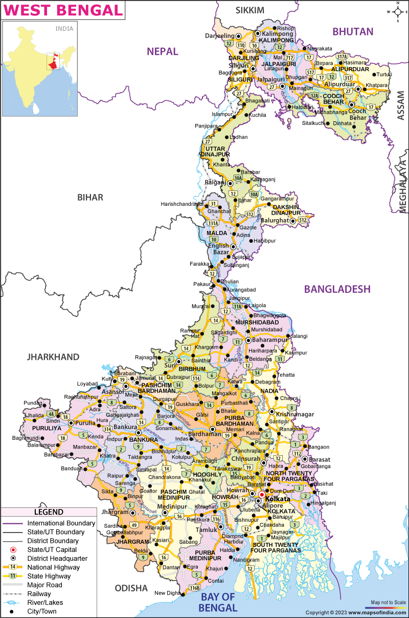
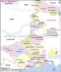
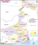
As of 1 November 2023, West Bengal is divided into 23 districts:
Alipurduar, Bankura, Birbhum, Purba Bardhaman, Cooch Behar, Dakshin Dinajpur, Darjeeling, Hooghly, Howrah, Jalpaiguri, Jhargram, Kalimpong, Kolkata, Malda, Murshidabad, Nadia, North 24 Parganas, Paschim Bardhaman, Paschim Medinipur, Purba Medinipur, Purulia, South 24 Parganas, and Uttar Dinajpur.
Divisions of West Bengal
There are five administrative divisions in the state: Presidency, Jalpaiguri, Malda, Medinipur and Burdwan.
Area of West Bengal
The state covers a total area of 34,267 m2 or 88,752 km².
Population of West Bengal
According to the 2011 census, the population of the state is 91,276,115. The estimated population in 2024 is 102,552,787.
Tourist Attractions in West Bengal
The state is known for the Sundarbans, a UNESCO World Heritage Site. Major cities include Kolkata, Siliguri, Asansol, Durgapur, Kharagpur, Darjeeling and Malda.
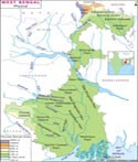
The state has diverse geographical features, including the Himalayan Mountain Range in the north, the Gangetic Plain in the south, and the Sundarbans delta in the southwest.
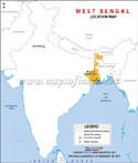
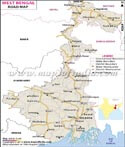
West Bengal shares borders with the Indian states of Jharkhand, Odisha, Sikkim, Bihar, and Assam. It also borders Bangladesh to the east, and Nepal and Bhutan to the north.
Economy
West Bengal has a diversified economy, with agriculture, manufacturing, mining, and services contributing significantly to its GDP. It is the sixth-largest contributor to India's GDP.
Education in West Bengal
The state has a strong education system, with several renowned universities and institutes, including the University of Calcutta, Jadavpur University, Indian Statistical Institute, and Visva-Bharati University.
Government of West Bengal
The current Governor of West Bengal is C.V. Ananda Bose, appointed by the President of India. The Chief Minister is Smt. Mamata Banerjee, representing the Trinamool Congress party. The Legislative Assembly has 294 seats.
Geography of West Bengal
The state has diverse geographical features which include towering summits of the Himalayan Mountain Range, flat terrain, rivers, and sea. The state shares its boundaries with the Himalayas in the north and the Bay of Bengal to the south. To the west, it is bordered by the states of Jharkhand and Bihar. To the east, it is bordered by Bangladesh. To the northeast, it is bordered by Assam, Sikkim and Bhutan. The territory of Nepal lies to the northwest. The state of Odisha is situated to the southwest of the state.
Landforms
The state is made up of the following varieties of landforms:
- Darjeeling Himalayan hill region
- Terai region
- North Bengal plains
- Rarh region
- Coastal plain
- Sunderbans
- Western plateau and high lands
- Ganges delta
Agro-climatic regions
The state can be divided into the following agro-climatic regions:
- The shoreline alluvial areas in the south
- The Teesta and Terai alluvial areas of North Bengal
- The mountainous areas in the north
- The Vindhya alluvial area in the middle
- The red, laterectic, and severely rolling areas to the west
- The Gangetic alluvial area in the west.
West Bengal State Information | |
|---|---|
| Capital | Kolkata |
| Date of formation | 26/01/50 |
| Governor | C. V. Ananda Bose |
| Chief Minister | Mamata Banerjee |
| Tourist attractions | Victoria Memorial, Vidyasagar Setu, Shantiniketan, Darjeeling |
| Festivals | Durga Puja, Rabindra Jayanti |
| Major dance and music forms | Jatra theatre; Baul; Rabindrasangeet |
| Arts and crafts | Terracotta Bankura horses; Kalighat style of painting; hand-woven Baluchari Silk textiles |
| Languages | Bengali, Hindi, Urdu |
| Size | 88,752 sq. km |
| Population (Census 2011) | 91276115 |
| Rivers | Hooghly, Teesta, Torsa, Subarnarekha, Joldhara |
| Forests and wildlife sanctuaries | Sunderbans Tiger Reserve, Jaldapara WS |
| State animal | Fishing cat |
| State bird | White-throated kingfisher |
| State flower | Shephali |
| State tree | Devil tree or chatian |
| Major crops | Rice, maize, oil seeds, sugarcane |
| Factoids | Bengali literature developed early thanks to the cultural awakening brought about by the Brahmo Samaj. |
| Rabindranath Tagore, the first Asian to win the Nobel Prize for Literature, was from Bengal. | |
| No. of District | 23 |
FAQs
Q1: How many districts are there in West Bengal?
West Bengal has 23 districts, each with its own administrative headquarters and unique geographical features.
Q2: Which countries share an international border with West Bengal?
West Bengal shares international borders with Bangladesh, Nepal, and Bhutan, making it an important gateway to northeastern India.
Q3: What is the capital of West Bengal?
Kolkata is the capital of West Bengal and serves as the state's cultural, commercial, and administrative center.
Q4: Which are the major rivers shown on the West Bengal map?
Major rivers include the Ganga (Hooghly), Teesta, Damodar, Mahananda, Subarnarekha, and Torsa.
Q5: Which states border West Bengal?
West Bengal shares borders with Sikkim, Assam, Bihar, Jharkhand, and Odisha, along with international borders with Bangladesh, Nepal, and Bhutan.
Q6: Which is the largest district in West Bengal by area?
South 24 Parganas is the largest district in West Bengal by area and is home to a significant portion of the Sundarbans.
Q7: Which geographical regions can be identified on the West Bengal map?
The map highlights the Himalayan region in the north, the Terai and Dooars, the Gangetic plains, the Rarh region, and the coastal Sundarbans in the south.
Last Updated on : July 17, 2026
West Bengal Route Maps
Famous Personalities of West Bengal
