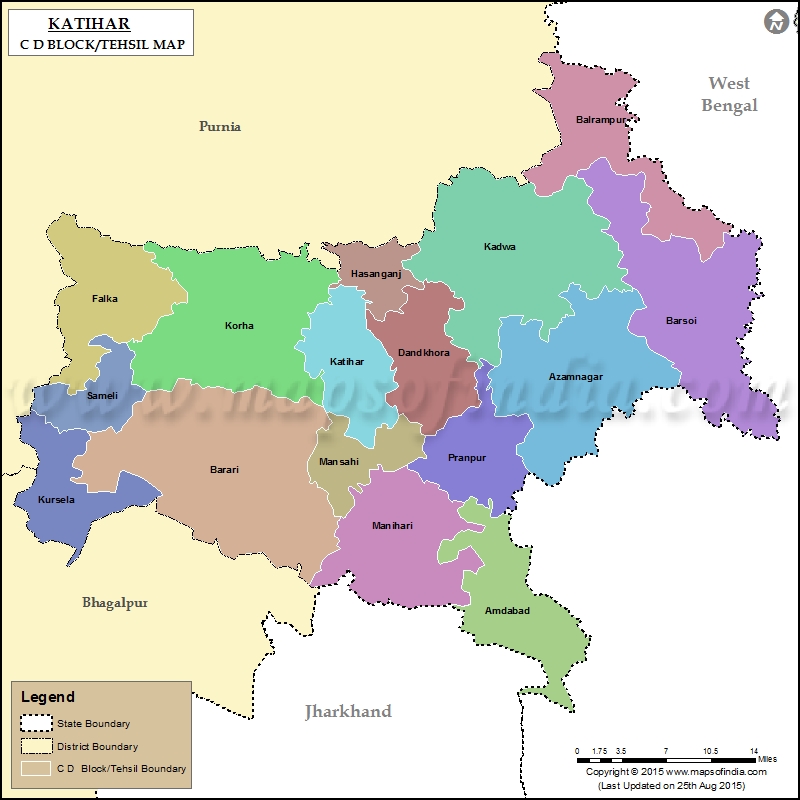
List of Taluka/C.D. Block in Katihar District
| Tehsil/C.D Block Name | Total : Rural+Urban Population (2001) | Total : Rural+Urban Population (2011) | Pin Code |
|---|---|---|---|
| Amdabad | 132,107 | 166,457 | N.A |
| Azamnagar | 247,002 | 315,633 | 855113 |
| Balrampur | 122,541 | 158,819 | 854317 |
| Barari | 220,955 | 285,211 | N.A |
| Barsoi | 262,402 | 343,717 | 855102 |
| Dandkhora | 54,172 | 68,038 | 855114 |
| Falka | 121,588 | 155,867 | 854114 |
| Hasanganj | 42,886 | 55,950 | N.A |
| Kadwa | 268,917 | 346,431 | 855114 |
| Katihar | 264,716 | 321,516 | 854105 |
| Korha | 210,656 | 282,105 | 854108 |
| Kursela | 52,997 | 64,053 | N.A |
| Manihari | 149,250 | 191,206 | 854113 |
| Mansahi | 62,581 | 84,249 | 854103 |
| Paranpur | 112,607 | 144,126 | 854116 |
| Sameli | 67,261 | 84,771 | 854101 |
Last Updated on : January 14, 2026
