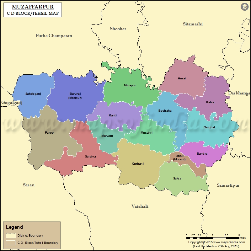
List of Taluka/C.D. Block in Muzaffarpur District
| Tehsil/C.D Block Name | Total : Rural+Urban Population (2001) | Total : Rural+Urban Population (2011) | Pin Code |
|---|---|---|---|
| Aurai | 232,729 | 289,775 | 843312 |
| Bandra | 107,266 | 123,500 | 843115 |
| Baruraj (Motipur) | 306,007 | 404,700 | 843132 |
| Bochaha | 184,662 | 242,984 | 843103 |
| Dholi (Moraul) | 74,670 | 90,460 | 843105 |
| Gaighat | 203,065 | 259,897 | 847107 |
| Kanti | 213,223 | 269,764 | 843109 |
| Katra | 191,410 | 246,249 | 843321 |
| Kurhani | 344,755 | 435,307 | 844120 |
| Marwan | 124,227 | 164,370 | 843113 |
| Minapur | 259,356 | 339,767 | 843128 |
| Musahri | 555,902 | 679,786 | N.A |
| Paroo | 274,563 | 357,911 | 843112 |
| Sahebganj | 183,118 | 241,093 | 843125 |
| Sakra | 242,815 | 306,247 | 843102 |
| Saraiya | 248,946 | 326,800 | 843119 |
Last Updated on : January 14, 2026
